Romans Battery - Constitution Island
|
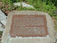
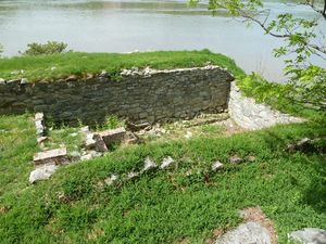
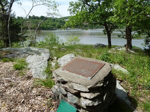
Romans Battery - Constitution Island (1775-1783) - A Patriot Revolutionary War battery first established in 1778 on Constitution Island in Putnam County, New York. The battery was destroyed by the British in 1777 and partially rebuilt in 1878. Named for engineer Bernard Romans. The battery was abandoned in 1783 at the end of the war.
History of Romans' Battery Part of Fortress West Point. First established in October 1775 by engineer Bernard Romans and completed by Captain William Smith on 1 Mar 1776. The original battery was 200-feet long and probably mounted thirteen 6-pounders and one 9-pounder. A 12-foot by 18-foot brick powder magazine was located at the southwest corner. The battery was described (and criticized) by Lord William Alexander Stirling in 1776: "the ...battery is a straight line constructed by Mr. Romans, at very great expense; it has fifteen embrasures, which face the river at a right angle, and can only annoy a ship in going past: the embrasures are within twelve feet of each other; the merlons on the outside are but about two feet in the face, and about seven feet deep, made up of square timbers covered with plank, and they look very neat ... Upon the whole, Mr. Romans has displayed his genius at a very great expense and to very little publick advantage." The battery including the magazine was destroyed by the British during their 20 day occupation in October 1777. Rebuilt in 1778 after the British withdrew and the Great Chain was placed across the Hudson. The battery was abandoned in 1783 at the end of the war.
Current StatusOn Constitution Island, United States Military Academy reservation which is an active military installation and access may be restricted. Tours are offered in the summer months.
See Also:
Sources:
Links: Visited: 21 May 2012
| ||||||


