Devil's Slide Military Reservation
|
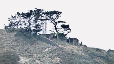
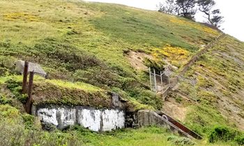
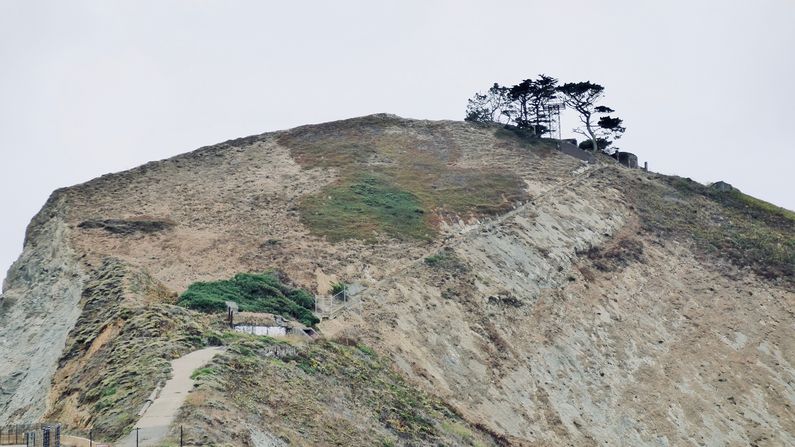
Devil's Slide Military Reservation (1940-1983) - A U.S. Army Military Reservation established before 1940 in San Mateo County, California. Used during World War II to house three Coast Artillery base-end optical fire control stations and one Coast Artillery fire control radar site (SCR-296A). Transferred to the U.S. Navy in 1959. Disposed of in 1983. HistoryThis site housed three Coast Artillery base-end optical fire control stations (BES) and one Coast Artillery fire control radar site (SCR-296A) during World War II for Coast Artillery gun batteries, Battery 244, Battery 129, Battery Townsley and Battery Davis. 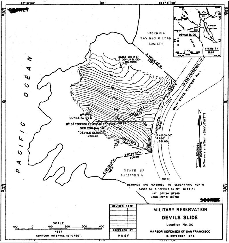 Battery Townsley/Battery Davis BES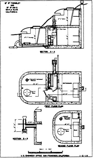 The BES for Battery Townsley and Battery Davis were combined into one structure but with two levels. The Battery Townsley BES was on the first floor while the Battery Davis BES was on the second floor. Each level contained mountings for two observation instruments, the first was an M1 Class 5 Depression Position Finder (DPE) and the second was a Model 1910 azimuth instrument. The BES was accepted for service on 14 Nov 1941 at a cost of $15,329.36.
Battery 129 BES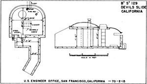 The BES for Battery 129 was built as a single station and contained mountings for two observation instruments, the first was a Depression Position Finder (DPE) and the second was an azimuth instrument. The BES was accepted for service on 16 Nov 1943 at a cost of $7,716.87. Battery 129 was completed and transferred for use on 7 May 1944 but never armed. The gun tubes actually arrived but the gun carriages were never furnished and the Battery was never operational.
Radar Transmitter Building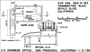 The radar transmitter building has a single large 26.5 by 15' reinforced concrete room that housed the radar equipment and the operators as well as the radar maintenance personnel. On top of the radar building is a raised platform where the 12'-10.5" diameter circular radar antenna housing was placed. This housing looked like a water tank and was meant to disguise the rotating antenna. See Devil's Slide WWII Radar Site.
Common Power House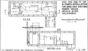 The radar equipment required 16.3kW of 120/240 AC, 1 phase, 60 cycle power furnished by commercial power backed up by an on-site generator. One 25 KVA generator was furnished and installed by the Signal Corps for the radar in a combined power building along with with a small 3 KVA generator provided to power the base-end station structures. The Power House building has two rooms, a small room with internal dimensions of 6' by 8' by 8' tall that has an upward shaft for air and exhaust. This room is connected by a single door to a larger room, 8' wide by 23' long and also 8' tall. This room housed the two generators and the switchgear. At the end of this larger room is a single entrance door and ramp with tapered side walls. See Devil's Slide WWII Radar Site.
Facilities deactivated at the end of the war in 1945. The reservation was ransferred to the U.S. Navy in 1959 and disposed of in 1983. Current StatusPrivate ownership supervised by Montara State Park unit, near Montera, San Mateo County, California.
See Also: Sources: Links: Visited: 27 Apr 2019, 6 Sep 2017
|
