|
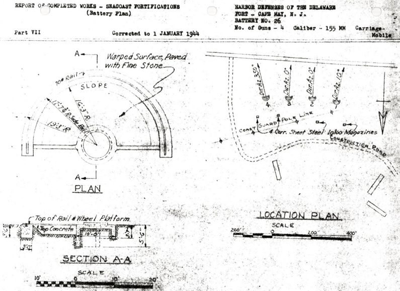
Battery 25 (1942-1944) - Battery 25 was a reinforced concrete, World War II 155mm coastal gun battery on Cape May Military Reservation, Cape May County, New Jersey. Battery construction started 31 Dec 1941, was completed 15 Jun 1942 and transferred to the Coast Artillery for use 14 Apr 1944 at a cost of $ 21,100.00. Deactivated in 1946.
Part of the Harbor Defense of the Delaware.
Originally built as a World War II concrete coastal gun battery with four 155mm M1918MI guns mounted on M1917 mobile carriages emplaced on concrete Panama Mounts. Four igloo magazines constructed of corrugated sheet metal were placed behind the gun positions. The guns were emplaced in 1942 and removed in February 1944.
Battery 25 Armament (edit list)
Empl
No
|
Caliber
Type
|
Barrel
Length
|
Model
|
Serial
No
|
Manufacturer
|
Carriage
|
Service
Dates
|
Notes
|
| 1
|
155mm Rifle
|
233"
|
M1918MI
|
|
866
|
Watertown
|
Mobile, M1917, #1264, Pateaux
|
1942-1946
|
|
| 2
|
155mm Rifle
|
233"
|
M1918MI
|
|
308
|
Bullar
|
Mobile, M1917, #1307, Pateaux
|
1942-1946
|
|
| 3
|
155mm Rifle
|
233"
|
M1918MI
|
|
945
|
Watervliet
|
Mobile, M1917, #1381, Pateaux
|
1942-1946
|
|
| 4
|
155mm Rifle
|
233"
|
M1918MI
|
|
881
|
Watervliet
|
Mobile, M1917, #1280, Pateaux
|
1942-1946
|
|
| Source: RCW Form 1, 1 Jan 1945, Coast Defense Study Group, Berhow, Mark A. ed, American Seacoast Defenses: A Reference Guide, 2nd Edition, CDSG Press, McLean, VA, 2004, ISBN 0-9748167-0-1, pages 190-191, 208
|
Current Status
Part of Cape May Point State Park. No remains visible.
|
|
Location: Cape May Point State Park, Cape May County, New Jersey
Maps & Images
Lat: 38.93137 Long: -74.95552
- Multi Maps from ACME
- Maps from Bing
- Maps from Google
- Elevation: 21.65'
|
See Also:
Sources:
- U.S.Army, Supplement to the Harbor Defense Project of The Delaware, (HDDEL-AN-45), 1 Jul 1945, CDSG
Links:
Visited: 17 Aug 2010
|
