Wildcat Military Reservation
|
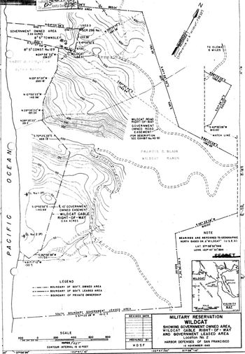
Wildcat Military Reservation (1940-1946) - A 201 acre U.S. Army Military Reservation established in 1940 during World War II near Olema in Marin County, California. Abandoned as a military reservation circa 1946.
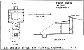
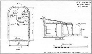
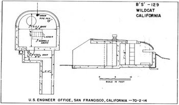
World War IIPart of the Harbor Defense of San Francisco.  The reservation was first established in 1940 during World War II as a 3.69 acre (plus road and cable easements) U.S. Army Military Reservation six miles southwest of Olema in Marin County, California. Initially used as the site of two reinforced concrete fire control stations, one for Battery Townsley (B/7-S/7) at Fort Cronkhite and one for Battery 129 at Fort Barry (B/7-S/7). The reservation was later expanded to 201 acres (including easements) to accommodate the addition of two searchlight positions, a SCR-296A Radar Site and support facilities. Two access roads were established, one northeast to Olema and one south to Bolinas. A telephone cable easement southward to a fire control switchboard at Bolinas Military Reservation provided the primary communications path. Antiaircraft protection was provided by two .50 Cal. Browning M2 machine gun positions, one about 250' south of the radar site and one about 300' northeast of the radar site. 
Post WarAt the end of the war, the equipment was removed. The leased Tract 7 parcel of land was then returned to the owners on 15 Jul 1947. On 26 Jul 1950, 8.344 acres were quitclaimed to Grace H. Kelham. On 31 May 1951, 77.556 acres were transferred to the Department of the Navy who deleted that transfer on 28 Nov 1952. On 30 Jun 1953, Tract 6 was returned to the owners. The remaining 3.69-acre parcel (Tract 4A) was quitclaimed to Grace Hamilton Kelham on 16 Aug 1961 without stipulation.
Current StatusPart of Point Reyes National Seashore in Marin County, California. Several hiking trails cross the former reservation and the Wildcat Camp is located on the site of the reservation. No visible remains of the Military reservation facilities. Public access via hiking and biking trails. No direct automobile access.
See Also:
Sources:
Links:
Visited: No
| ||||||||||||||||||||||||||||||||||||||||||||||||||||||||||||||||||||||||||||||||||||

