Tonopah Air Force Station
|
Tonopah Air Force Station (1957-1970) - A Cold War Air Force Radar Station first established in 1957 on Brock Mountain near Tonopah in Nye County, Nevada. Named Tonopah Air Force Station after the location. The site was moved in 1961 from Brock Mountain to Beacon Hill north of Tonopah and established as a SAGE System radar site. Initially assigned a Permanent ID of SM-164, later a Sage ID of Z-164. Abandoned as U.S. Air Force Station in 1970. HistoryEstablished in 1956 as a split site with the radar on Brock Mountain and the squadron area next to the town of Tonopah, at the foot of the peak. The site became operational on 8 Feb 1957 as Tonopah Air Force Station manned by the 866th AC&W Squadron. The station initially had both a manual Ground-Control Intercept (GCI) and early warning mission. The early warning mission involved tracking and identifying all aircraft entering their airspace while the GCI mission involved guiding Air Force interceptors to any identified enemy aircraft. Controllers at the station vectored fighter aircraft at the correct course and speed to intercept enemy aircraft using voice commands via ground-to-air radio. The January-June 1958 NORAD/CONAD History listed the site as operational with one MPS-7 (a mobile FPS-3) search radar and one FPS-6A height-finder radar. At the same time, a second site had been selected on Beacon Hill for a more permanent SAGE System radar site and contracts were let for the site and the infrastructure required. On 31 Mar 1961, the final inspection took place on the new Beacon Hill facilities. In June 1961 the site was moved from Brock Mountain to Beacon Hill north of Tonopah. At the new location, the 866th operated a pair of FPS-6 height-finders and an FPS-7C Frequency Diversity (FD) search radar as part of the SAGE System. SAGE System TransitionThe transition of the manual GCI system to the automated SAGE system began with the installation of the FST-2 coordinate data transmitter and search radar upgrades. The FST-2 equipment digitized the radar returns and transmitted the digital returns to the SAGE direction center. Under the SAGE System, interceptor aircraft were directed to their targets by the direction center computers and controllers, greatly reducing the need for local controllers and equipment at every radar station. The FST-2 was a very large digital system using vacuum tube technology. Over 6900 vacuum tubes were used in each FST-2 requiring 21 air-conditioned cabinets, 40 tons of air conditioning, 43.5 kva of prime power, and usually a large new addition to the operations building. The FST-2B modification added two more cabinets but with newer solid-state (transistor) technology to process coded responses from aircraft transponders. SAGE System Operation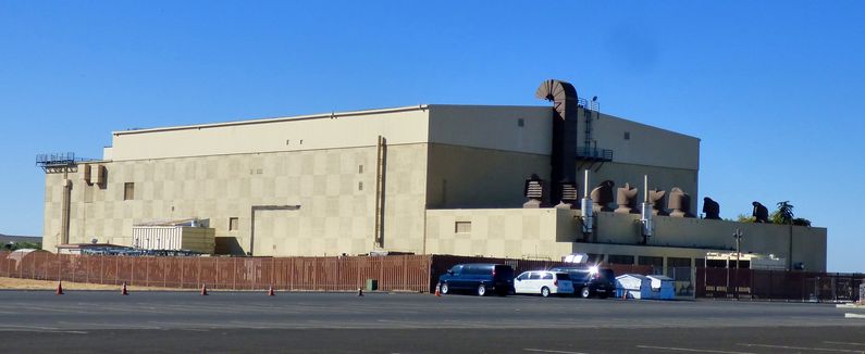
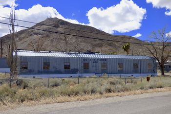
The site began operation as a SAGE site in June 1961 initially feeding the Stead SAGE Direction Center DC-16. On 1 Apr 1966 Tonopah was connected to the Adair SAGE Direction Center DC-13. When the Adair direction center closed down in 1969, Tonopah was connected to the Luke SAGE Direction Center DC-21 on 15 Sep 1969 and remained connected to Luke until it closed. In 1963 the two FPS-6 height-finder radars were converted to FPS-90 radar sets. One of the FPS-90 radars was removed in 1969. ClosureTonopah AFS and the 866th were deactivated on 1 Jul 1970. The Beacon Hill site was turned over to the FAA for use in the Air Traffic Control system. The GATR site continued in operation. Tonopah FAA Radar SiteThe Beacon Hill site was turned over to the FAA for use in the Air Traffic Control system as a Beacon Only Site (BOS). Mode S Beacon System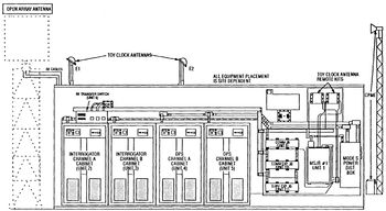 The Tonopah FAA Radar Site was selected in the 1990s to become one of 21 long-range radar sites to have a Mode S radar beacon system installed. The Mode S system allowed operation in the existing beacon modes but added features to improve beacon operation by allowing aircraft identification with a single interrogation and two-way digital communication between controllers and pilots. Besides the 21 long-range sites, there were other short-range radars to be upgraded for a total of 137 sites on the implementation list. Tonopah was #103 on the list, scheduled to receive the Mode S equipment on 30 Nov 1994. Installation required interfacing with the radar system, addition of a beacon antenna on top of the search radar antenna, a new larger radome, interfacing with the Common Digitizer (CD-2) if installed, additional communication lines and equipment. The radar site data is now available to the USAF/NORAD Battle Control System-Fixed (BCS-F) operations centers (EADS & WADS) as well as the FAA Salt Lake City ARTCC (ZLC) and adjacent ARTCCs. Other federal agencies have access to the data under the Homeland Security umbrella. Physical PlantThe physical plant of the Air Force Station was divided into two main sites located on nearby peaks, a cantonment area, a housing area, and a radio site. The first main site was envisioned as a temporary location housing a manual operations building, mobile radar equipment, and backup generators. The second main site was to be a SAGE System site, completed with a SAGE operations building, a fixed FPS-7 radar tower, and two fixed FPS-6 height-finder towers. The cantonment area and the housing area were located below the main sites at the edge of the town of Tonopah. The Cantonment area housed the enlisted barracks, the bachelor officer's quarters, the orderly room, the dining hall, the motor pool, and other support buildings. The cantonment area was formally occupied on 1 Feb 1956. Apart from the cantonment area was a small 18-unit housing area for married personnel. The housing area was originally slated for 27 units but that was later reduced to 18 units, 6 units for officers, and 12 units for airmen. The housing was begun in June 1958 and completed later that year. A separate Ground to Air Transmitter/Receiver (GATR) radio site was located north of the second location and housed the radio equipment for directing aircraft intercepts. On 25 May 1960, the GATR site became the first facility accepted for service at the Beacon Hill location.
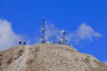
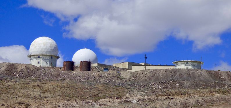
Note: Reported dates may overlap and may be incorrect or reflect periods of intermittent temporary command. Current StatusSite #1 on Brock Mountain is now the site of a commercial transmitter site. Site # 2 on Beacon Hill houses an FAA secondary radar (IFF/SIF) in the old search-radar tower. It is unclear what is housed in the newer radome. The Cantonment area and the housing area are in civilian hands and have been repurposed for civilian use. Part of the GATR Site became the site of a Soviet-era BARLOCK radar that was used during the U.S. Air Force Red Flag exercises to simulate battlefield conditions. That radar is no longer located at the GATR site but the outline of the tower can still be seen.
See Also:
Sources:
Fortification ID:
Visited: 3 Apr 2017
|
