Mishaum Point Military Reservation
|
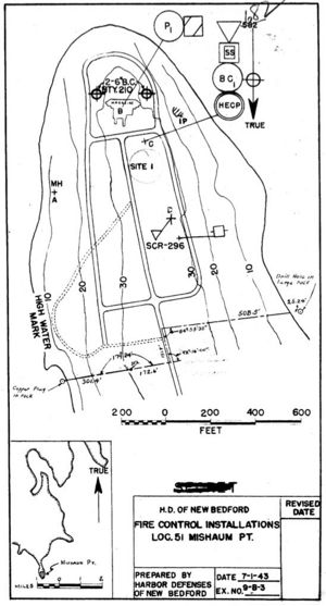
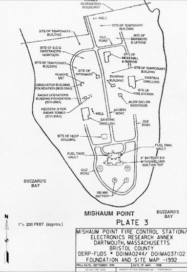
Mishaum Point Military Reservation (1943-1947) - A World War II Coastal Military Reservation first established in 1943 on Mishaum Point in Bristol County, Massachusetts. Abandoned in 1947. World War II (1941-1945)Part of the Harbor Defense of New Bedford. This 26.84 acre military reservation on Mishaum Point was purchased by the U.S. Government on 26 Mar 1943 for placement of Battery 210 and supporting equipment. Fire control elements were also placed on the reservation in the form of a Harbor Entrance Command Post (HECP) and two fire control radar sets. Battery 155 - Mishaum Point with twof 155mm GPF guns on Panama mounts was emplaced while Battery 210 was under construction and four 37mm guns provided additional firepower at the water's edge. Battery 210 was completed in 1945 and the 155mm guns were withdrawn. The post had several support buildings including two barracks, a mess hall and NCO/Officer quarters that later became the caretaker's quarters. One Army sergeant was stationed at the post as the caretaker from the end of the war until the site was turned over to the Navy on 9 Aug 1951. The Navy transferred the site to the Air Force on 29 Jul 1958 and it was used as the Mishaum Point Electronics Research Annex. The site was declared surplus 19 Apr 1963 and sold to a private party on 18 Nov 1964.
Current StatusPrivate property on Mishaum Point in Bristol County, Massachusetts. The Battery 210 structure is covered by a private house and grounds. No period guns or mounts.
Sources:
Visited: No
| ||||||||||||||||||||||||||||||||

