Lower Fort Garry
|
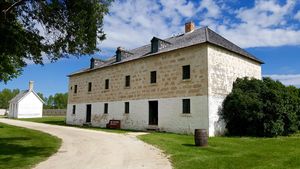
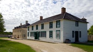
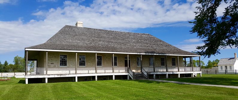
Lower Fort Garry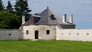 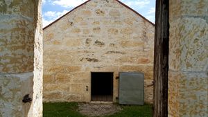 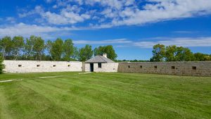 Lower Fort Garry is a stone‑built HBC trading post fort established in 1830 on the Red River about 20 miles north of Winnipeg. An 1826 flood had damaged the forts at Winnipeg and led to the Governor of Ruperts Land, George Simpson, to start construction of the stone fort on a better site. The first major building completed was the Governor's own residence known as the "Big House". The Governor had recently married his eighteen-year-old cousin, Frances Simpson and they briefly took up residence at the Big House 1832. Frances was unhappy and by 1833 she had returned to England. Besides the central Big House residence, there were three other multi-story stone buildings constructed over the years including a limestone trading store (1831), a retail store (1873) and a large warehouse. A smaller stone building (1852) housed the unmarried male workers. A stone wall surrounds the compound and the major buildings. At each corner of the wall was a circular bastion, each with a structure inside. This wall was extended and expanded during the 1840s Oregon Crisis when the fort was garrisoned by a detachment of British troops. The stone wall provided gun loopholes all along the perimeter. Only two entrances break the wall to the post, the main gate was located on the east side, providing direct access to the river. The only other gate was located on the west side. The British troops garrisoned here in 1846-1848 not only expanded the wall but also added the circular bastions at the corners. The fort was also garrisoned by the Canadian Militia from 1870-1871 during the Red River Rebellion which was led by Louis Riel, political leader of the Métis people. The first of the numbered Canadian Indian treaties, the "Stone Fort Treaty" (Treaty No. 1) was signed here on 3 Aug 1871 by the Canadian government and the Ojibway and Swampy Cree people. The newly organized North West Mounted Police trained at Fort Lower Fort Garry during the winter of 1873-1874 and later assembled at Fort Dufferin to the south before their march into western Canada. From 1913 to 1951 the fort, still under the ownership of the HBC, was leased to the Motor Country Club. In 1951 the Hudson’s Bay Company donated the fort and adjoining lands to Parks Canada. The Motor Club continued to lease the property until 1962.
Current Status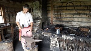 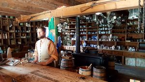 Absolutely must see fort! This is the oldest stone-walled fur post remaining in Manitoba. Parks Canada has restored and interpreted much of the fort to the 1850-1860 period. Under restoration at the time of our visit (July 2016) were the outer walls and the Big House. The restoration work is slated to be completed next year (2017). The fort is staffed by knowledgable and skilled interpreters of the 1850s experience, including a skilled blacksmith who can turn out nails in a flash and a store clerk who can sell you anything. A large visitor's center provides access. Admission fee.
See Also: Sources:
Links:
Visited: 27 Jul 2016
| ||||||
