Highlands Air Force Station
|
Highlands Air Force Station (1948-1966) - A Cold War Air Force Radar Station first established in 1948 near Middletown Township, Monmouth County, New Jersey. Named Highlands Air Force Station after the location on 1 Dec 1953. Initially assigned a Permanent ID of P-09 and later a Sage ID of Z-09. Abandoned in 1966. Also the site of Highlands NIKE Army Air Defense Command Post (AADCP) NY-55DC. History of Highlands Air Force Station Established in 1948 and became operational that year as Highlands Air Force Station manned by the 646th AC&W Squadron. The station initially had both a Ground-Control Intercept (GCI) and early warning mission. The early warning mission involved tracking and identifying all aircraft entering their airspace while the GCI mission involved guiding Air Force interceptors to any identified enemy aircraft. Controllers at the station vectored fighter aircraft at the correct course and speed to intercept enemy aircraft using voice commands via ground-to-air radio. Initial equipment included two CPS-6 radar sets.
GPA-37 Analog Flight Control System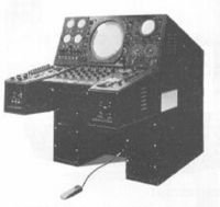 In 1957 Highlands AFS received the first operational GPA-37 Analog Flight Control System as a prelude to the SAGE System becoming operational. The GPA-37 was capable of directly controlling supersonic aircraft (F-106) and supersonic air breathing missiles (BOMARC) using time division data link (TDDL) to the airborne guidance systems. The GPA-37 was also capable of interfacing with the NIKE missile system. In preparation for the SAGE System an FPS-6 height-finder radar was installed and the site was slated to receive the first FPS-7C search radar but that installation was delayed until September 1959.
SAGE TransitionThe transition of the manual GCI system to the automated SAGE system began with the installation of the FST-2 coordinate data transmitter and search radar upgrades. The FST-2 equipment digitized the radar returns and transmitted the digital returns to the SAGE direction center. Under the SAGE System, interceptor aircraft were directed to their targets by the direction center computers and controllers, greatly reducing the need for local controllers and equipment at every radar station. The FST-2 was a very large digital system using vacuum tube technology. Over 6900 vacuum tubes were used in each FST-2 requiring 21 air-conditioned cabinets, 40 tons of air conditioning, 43.5 kva of prime power, and usually a large new addition to the operations building. The FST-2B modification added two more cabinets but with newer solid-state (transistor) technology to process coded responses from aircraft transponders. 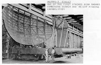 The site began operation as a SAGE site in July 1958 initially feeding the McGuire SAGE Direction Center DC-01. The search radar was upgraded to an FPS-7C in September 1959 and an FPS-6B height-finder radar was added in 1960. By 1963 the site was operating an FPS-7C search radar, an FPS-90 height-finder and an FPS-26A height-finder. This was the configuration when the Air Force Station closed in 1966.
U.S. Army Air Defense Command Post (AADCP)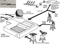 The U.S. Army Air Defense Command Post (AADCP) designated NY-55DC at Highlands directed the Nike units in the New York Defense Area, replacing the manual operations center at Fort Wadsworth on Staten Island. The AADCP was built on the Highlands Air Force Station adjacent to the operations building and included the Missile Master building (aka nuclear bunker), four radar towers, a diesel power plant and electrical switch building. Initial Army equipment included the FSG-1 Missile Master System and one each FPS-6 and FPS-90 height-finders. Construction began 10 Jul 1958 and the Missile Master was accepted in May 1960 and operated through 30 Nov 1966. The FSG-1 Missile Master was replaced with the TSQ-51 Missile Mentor System in 1966 and that system was purportedly replaced by a GSG-5 BIRDIE system by 1 Jul 1972. AADCP operations ended in April 1974 with the closure of the region's remaining Nike fire units.
The Highlands Army Air Defense Site was decommissioned on 31 Oct 1974 and the Highlands Missile Master building was demolished in 1995. Texas Tower 4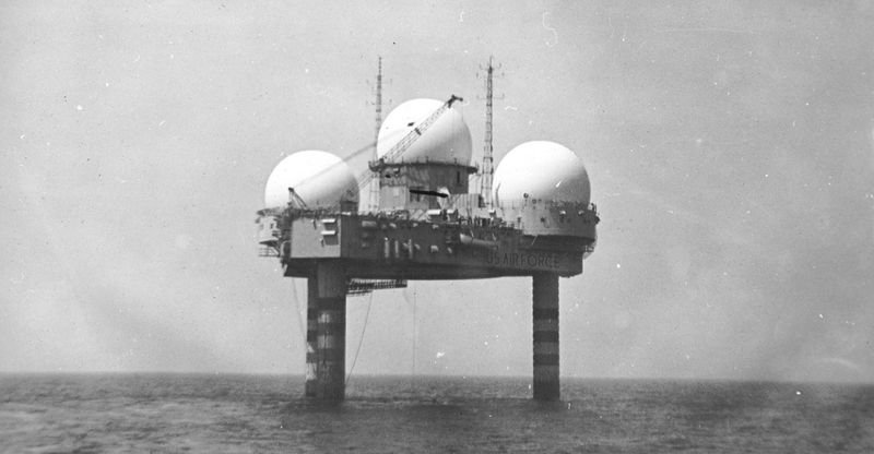 Texas Tower 4 was a radar platform operated as a sub-unit of the Highlands AFS by personnel assigned to the 646th. The tower became operational in April 1959 and went SAGE System operational in April 1960. The tower was located about 80 miles out in the Atlantic Ocean and connected to Highlands AFS by a multi-channel tropospheric (tropo) scatter radio system (FRC-56). The Tropo system terminated at Highlands AFS with the antennas and equipment located on the old World War II 16" gun battery Battery 116 site. The antennas were placed on the top of gun emplacement #2 and the equipment building located in the back near the central rear entrance. Texas Tower 4 was damaged by Hurricane Donna in September 1960 and was structurally unsound when a winter storm on 15 Jan 1961 collapsed it into the ocean. All 28 men of the reduced crew on board were lost and only two bodies were ever recovered. The loss of Texas Tower 4 caused the other two towers to be closed in 1963 and caused Palermo Air Force Station to be reactivated.
Gap FillersHighlands AFS was responsible for the maintenance of one remote unattended gap-filler radar site. The unattended gap filler sites were placed in locations where the main search radar lacked coverage. These sites were equipped with short range FPS-14 or FPS-18 search radars and FST-1 Coordinate Data transmitters that sent digitized radar target data to a SAGE direction center and to the main radar site. Both the radar set and the FST-1 were dual channel to increase site up time. Maintenance teams were dispatched for regularly scheduled maintenance or when fault indicators on the FSW-1 remote monitoring equipment suggested the site had problems. The FSW-1 also allowed remote operation of specific functions such as channel changes for the radar and for the FST-1, it also allowed remote operation of the diesel generators at the gap filler site. The Highlands AFS gap-filler radar was located at Gibbsboro, New Jersey. The gap-filler site was deactivated in December 1960 at Gibbsboro as the construction of the new Gibbsboro Air Force Station began.
ClosureHighlands AFS and the 646th were deactivated on 1 Jul 1966 and the site was turned over to the U.S. Army and became Highlands Army Air Defense Site. Finally closed in 1974.
Current StatusAbandoned in Middletown Township, Monmouth County, New Jersey.
See Also:
Sources:
Visited: 13 Aug 2010 |