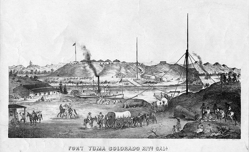
Fort Yuma
| More information at Warlike, Wikidata, Wikipedia
Fort Yuma (1850-1883) - First established as Camp Independence (1) in 1850 during the California Gold Rush near the Colorado river bottoms below the mouth of the Gila River in Imperial County, California. Protected the southern emigrant route to California. Moved in March 1851 to the former site of Camp Calhoun and named Camp Yuma. Renamed Fort Yuma in 1852. Permanently abandoned in 1883.
HistoryFirst established to protected the southern emigrant route to California and to control the Yuma Indians. One estimate of emigrant traffic at the Colorado River crossing in 1851 had 60,000 emigrants crossing. The post was established by Bvt. Major Samuel P. Heintzelman, 2nd U.S. Infantry, in 1850 as the government exerted control over the new California territory acquired as a result of the Mexican-American War. The post was moved to higher ground in March 1851 to the former site of Camp Calhoun and named Camp Yuma, it was renamed Fort Yuma in 1852. Difficulties in supplying the post caused its temporary abandonment in 1851, it was re-garrisoned in 1852 after a battle with the Yuma Indians. 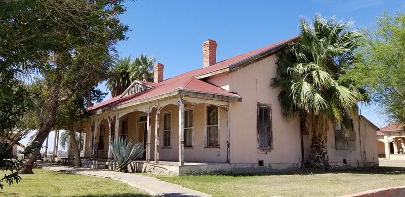   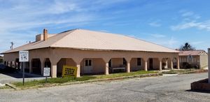 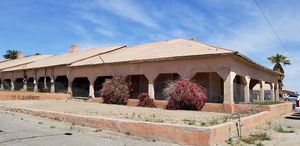 Colonel Joseph K.F. Mansfield inspected the post 4-7 Jun 1854 and found it with an available force of 5 officers and 106 enlisted men including the commander, Maj. Heintzelman. He found the quarters to be made of willows and worthless. Subsequent plans were drawn up and approved for good temporary quarters for two companies. Two supply routes were now in place, one by small steamer up from the mouth of the Colorado River and one by a land route from the New San Diego Depot. Both routes were expensive in terms of cost and time. Col. Mansfield noted that it seldom rained and that sand storms could shut out the rays of the sun. In a final note, he recorded the subsequent departure of Maj Heintzelman and the arrival of his replacement, Bvt. Major George H. Thomas, and elements of the 3rd U.S. Artillery. Fort Yuma became known as the hottest post in the U.S. Army with 110+ degree temperatures in the summertime. The post was also dangerous, as evidenced by a large graveyard. The post became a stop on the Butterfield Overland Mail Route (1857-1861) and the El Paso-Fort Yuma Stage Line.
U.S. Civil War (1861-1865)In 1861, at the beginning of the U.S. Civil War, California Volunteers (Union) replaced the regular troops who were ordered back east. The new garrison was ordered to examine every person who tried to pass the post. Rumors of possible attacks from Confederate forces and sympathizers caused the garrison to build a series of earthworks and trenches to help defend the fort against attack. The attacks never came and Fort Yuma became a supply and personnel depot and established Yuma Quartermaster Depot in 1863, on the other side of the river. After the war, a small garrison provided security for the supply depot and occasionally fought hostile Indians. 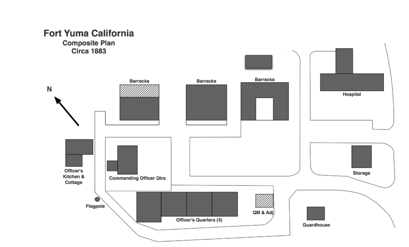 ClosureThe Southern Pacific Railroad reached Yuma in 1877. The Yuma Quartermaster Depot was abandoned in 1880 and Fort Yuma was abandoned on 16 May 1883, the reservation was transferred to the Interior Department and the Quechan Tribe on 22 Jul 1884. Current Status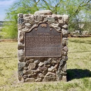 While significant numbers of historic structures remain at Fort Yuma the site is currently being used as tribal government complex by the Quechan Tribe. There are law enforcement activities and purely administrative functions in some of the buildings while other buildings appear unoccupied and abandoned. There are no interpretive signs or historic plaques to identify the buildings and explain their history. There is one historic marker that identifies the site but it is located at the back of the post next to an empty flagpole. A very small gift shop is located near the flagpole. There is supposed to be a small Indian museum in the area but it could not be located. There are some small road signs that point the way to the fort from I-8 but if you follow the signs you will probably go right past it. If you pass the Paradise Casino you have gone too far and you need to turn back and go up the hill. Best to use a GPS to find your way. On arrival, you will need to find a place to park, we chose the large lot just below the Commanding Officer's Quarters. We checked in at one of the administrative offices and we were told that we were free to look around.
See Also:
Sources:
Links: Visited: 1 Apr 2019 | |||||||
