Fort John Custis

From FortWiki
Jump to: navigation, search

Fort John Custis ((1940-1981) - Established in 1940 as Fort Winslow (1) to complement Fort Story in protecting the entrance to Chesapeake Bay. Renamed Fort John Custis in G.O. 49, 1 Oct 1942, after Captain John Parke Custis, USA. The Fort closed in 1948 and was occupied by Fort Custis Lashup Radar Site from 1950 to 1952 and by Cape Charles Air Force Station from 1952 to 1981. Also known as Fort Custis.

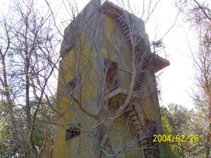
Fort John Custis Group Station Tower by Airstrip

World War II (1941-1945)

Part of the Harbor Defense of Chesapeake Bay.
Fort John Custis World War II Battery (edit list)
Battery
Click on Battery links below
No. Caliber Type Mount Service Years Battery Cost Notes
Battery 122
Battery Winslow
2 16" Casemated
Barbette (CBC)
1941-1943-1943-1948 $ 1,531,866 Navy Gun
(16" 1940 Program)
Battery 123 2 16" Casemated
Barbette (CBC)
Not Built $ ? Navy Gun
(16" 1940 Program)
Battery 228 2 6" Shielded Barbette (SBC) 1942-1943-1943-NA $ 230,398 Buried
Battery 227 2 6" Shielded Barbette (SBC) 1942-1943-1943-1965 $ 271,352 Guns to
Battery 234,
Fort Pickens
Battery AMTB 20 - Fishermans Island 2 3" Pedestal Mount 1942-1942-1944-1944 $ 16,465 Guns from
Battery Lee (2),
Fort Wool (1)
Battery AMTB 24 - Fishermans Island 2 90mm Fixed AMTB 1942-1943-1944-1946 $ 6,937
Battery 155 - Fishermans Island 4 155mm Mobile
Panama Mounts
1942-194? $ ?
Source: CDSG
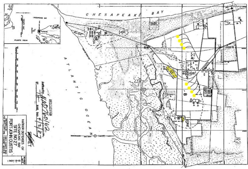
Fort John Custis Plan 1945
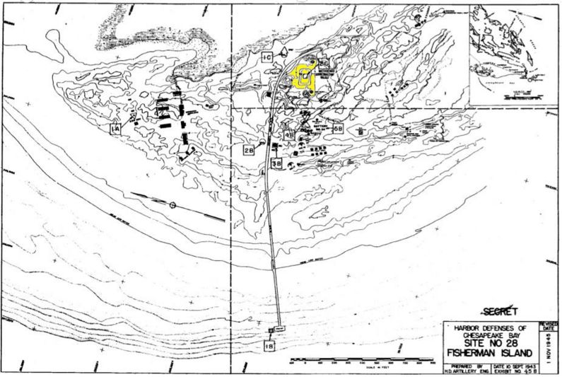
Fisherman's Island Plan 1945


Cold War (1947-1991)

The U.S. Air Force operated the Fort Custis Lashup Radar Site with an ID of L-15 here on 1 Jan 1951 manned by the 771st AC&W Squadron. The Lashup site was renamed Cape Charles Air Force Station 1 Dec 1953. As a permanent site the designation changed to P-56 and when the site joined the SAGE System the designation changed to Z-56. Closed 1 Jun 1981 and became the property of the US Fish & Wildlife Service in 1984.

Current Status

The Fort property is now the Eastern Shore of Virginia National Wildlife Refuge.


Location: Located on the tip of Cape Charles, Virginia at the entrance to Chesapeake Bay.

Maps & Images

Lat: 37.133543 Long: -75.956375

Sources:

  • Roberts, Robert B., Encyclopedia of Historic Forts: The Military, Pioneer, and Trading Posts of the United States, Macmillan, New York, 1988, 10th printing, ISBN 0-02-926880-X, page 812
  • U.S.Army, Supplement to the Harbor Defense Project of Chesapeake Bay, (HDCB-AP-45), 1 Nov 1945, CDSG

Links:

Visited: 26 Jul 2010


Personal tools
Namespaces

Variants
Actions
content
Toolbox