Clear Air Force Station
|
Clear Air Force Station (1959-present) - A Cold War BMEWS System Air Force Radar Station, first established in 1959 near Anderson in Denali Borough, Alaska. Active military installation.
Missions
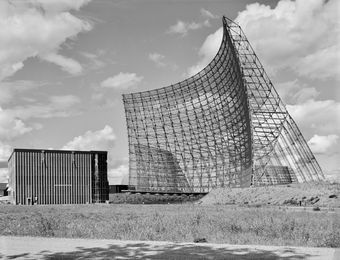
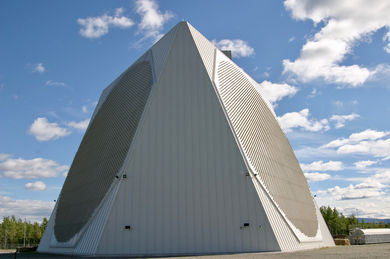
HistoryBMEWS Site II, Clear AFS, Alaska was established in 1959 and achieved initial operational capability on 30 Sep 1961. It became fully operational on 31 Dec 1961 manned by Detachment 2, 71st Missile Warning Wing. Initial equipment included three FPS-50 SLBM detection radar sets. One FPS-92 tracking radar was added in 1966. The tracking radar was housed in a 140-foot protective radome atop building 102. Power and heating for the remote site were provided by a large coal-fired power plant. Coal was brought to the site by rail. The three FPS-50 search radar sets were replaced by one FPS-115 Pave Paws Solid State Phased-Array Radar (SSPAR) (now a FPS-123) in 2001. The FPS-115 PAVE PAWS radar was relocated from Eldorado Air Force Station in Texas. On 15 Dec 2000, the BMEWS FPS-50 radars were deactivated, and the FPS-115 SSPARS began 24-hour operations. Initial Operational Capability was declared on 31 Jan 2001. The radar is housed in a 10 story building with three outward facing walls, two of which contained 5,354 solid state array elements each, providing 240-degree coverage for some 3450 miles at elevations from 3 to 85 degrees above the horizon. The radar system has been upgraded over the years to a FPS-123 and then to the current FPS-132, Upgraded Early Warning Radar (UEWR). On 21 May 2004, the 213th Space Warning Squadron of the Alaska Air National Guard (AANG) took over the operation of Clear AFS. The transfer to the National Guard improved personnel stability by closing the revolving door of active duty personnel that were rotated every year. Over 100 Alaska guardsmen are assigned to the 213th SWS to perform the daily missile warning and space surveillance mission while there may be only 10-15 active duty personnel assigned to the 13th Space Warning Squadron on site. There are also some 35 Defense Department civilians, and more than 150 contractors supporting the mission. Personnel numbers fluctuate with mission and equipment changes. Current Status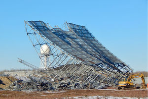 Demolition of the old FPS-50 antennas and structures began on 18 Oct 2016 and was expected to be completed by mid-November 2016. The FPS-50s were deactivated on 15 Dec 2000 but have remained in place since that time. The site is being cleared to make way for the Long Range Discrimination Radar(LRDR) alongside Clear’s new and improved FPS-132 UEWR system.
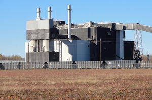 The 1960s-era coal-fired power plant at Clear AFS was decommissioned in January 2016. Clear AFS is now connected to the local power grid and draws its power from a more efficient system, reducing monthly energy consumption by 82 percent.
FutureThe Clear AFS is the chosen site for a Long Range Discrimination Radar (LRDR) system to improve targeting for a Ballistic Missile Defense (BMD). On 26 Oct 2015 Lockheed Martin was awarded a nine-year $784 million contract to develop, build and test the Long Range Discrimination Radar (LRDR). The radar system will support a layered ballistic missile defense strategy to protect the U.S. homeland from ballistic missile attacks. The system is slated for operational testing at Clear AFS by 2020.
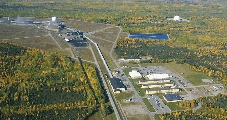
Physical PlantClear AFS is divided into four major areas, the composite area, camp area, SSPARS site, and the old technical site area.
See Also: Sources:
Visited: No
| |||||||||||||||||||
