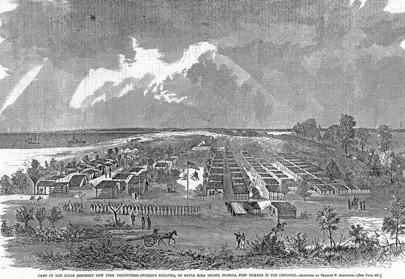
Camp Brown (1)
|
Camp Brown (1) (1861-1861) - A U.S. Army post established in 1861 during the U.S. Civil War by Colonel William Wilson, 6th New York Volunteer Infantry, on Santa Rosa Island in Escambia County, Florida. Named for Colonel Harvey Brown, commander of Fort Pickens. Abandoned in 1861.
HistoryThe 6th New York Volunteer Infantry (Billy Wilson's Zouaves) arrived on Santa Rosa Island on 26 Jun 1861 to reinforce the regular garrison at Fort Pickens. The 6th New York had been formed in New York City and sailed by steamer to the Island to help thwart an expected Confederate attack on the Island and Fort Pickens. The regiment landed in the surf and prepared a camp on a narrow neck of the Island to block any planned landside attack. The camp was built as an ordinary army camp with the company streets running east and west and the color line on the east side, running north and south. The garrison initially consisted of ten companies, A-K. The garrison was depleted when two companies (B & E) were sent to Fort Jefferson, one company sent to Fort Taylor (2) in Key West (A), one company sent to Battery Cameron (I) and one company sent to Battery Lincoln (3) (G). The Camp came under direct attack from about 1500 Confederate troops sent by Confederate General Braxton Bragg to take the Fort Pickens on 9 Oct 1861 in the Battle of Santa Rosa. The Camp was overrun by the Confederate troops and burned to the ground. The 6th New York was forced to fall back toward Fort Pickens but they managed to set a line and hold it with help from the regulars in the Fort. The attack was repelled. On 2 Dec 1861 Camp Brown was ordered abandoned and the 6th New York took up new positions closer to the fort. In May 1862 the 6th New York occupied Pensacola after it was abandoned by the Confederates. Current StatusArcheological remains only on Santa Rosa Island, Escambia County, Florida.
See Also: Sources:
Links: Visited: Area 5-6 Jan 2018
| ||||||
