Camp Adair
|
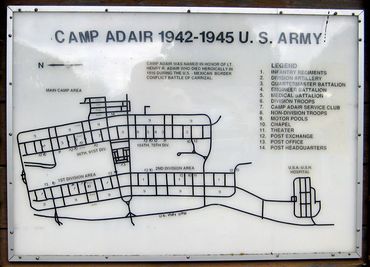
Camp Adair (1942-1946) - Established in 1942 and formally dedicated 4 Sep 1943 on 50,000 acres in Benton and Polk Counties, Oregon, and was deactivated on 23 May 1946. Camp Adair was named after Lt. Henry Rodney Adair, a West Point Graduate (Cullum 4309), who was killed on 21 Jun 1916 during Gen. Pershing's incursion into Mexico. In the 1960s the camp became the site of Adair Air Force Station and an incomplete Camp Adair BOMARC Missile Launch Site. The Air Force Station closed in 1969.
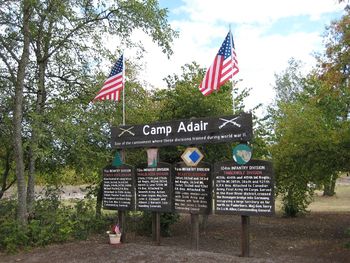
World War II (1941-1945)Camp Adair was built as a training center during World War II and was occupied by four divisions of combat infantry troops, the 91st U.S. Infantry Division (Powder River), the 96th U.S. Infantry Division (Deadeye), the 104th U.S. Infantry Division (Timberwolf), and the 70th U.S. Infantry Division (Trailblazer). As these divisions were shipped out the U.S. Army turned the base hospital over to the U.S. Navy to handle casualties from the Pacific Theater. The hospital was enlarged to take care of 3,600 convalescents. The camp also served as a prisoner of war camp between Aug 1944 and Apr 1946 for Italian and German prisoners. Another group that was located at Camp Adair was the 9th Signal Corp. The civilian leader of this group was Robert E "Zeke" Walton who was charged with training and directing the Signal Corp Photographers. I have posted some of his photographs and some of his memorabilia can be viewed at the Linn County Museum in Albany, Oregon. After the war ended and the camp closed, Zeke returned to Roseburg where he and a partner (Sid Frederickson) opened the Photo Lab and Studio. Cold War (1947–1991)In 1957 portions of Camp Adair became Adair Air Force Station which housed the 26th Air Division SAGE Support Facility and the Adair SAGE Direction Center DC-13. A Bomarc System Missile Launch Facility was begun but was canceled before it was completed. In 1969 the Air Force Station was declared surplus property and disposed of. That property now forms the basis of the Adair Village community. Many of the buildings from the Air Force Station remain today and the large SAGE blockhouse dominates the village. Current StatusOnly a few buildings and foundations remain to mark the main site of Camp Adair. A sign on US Highway 99W commemorates the divisions that trained there. Each Division also has a memorial located near the public viewing area 0.5 miles east of 99W on Camp Adair Road. The 50,000-acre site that made up the camp is owned by state and local governments and individuals.
See Also: Sources:
Links: Fortification ID:
Visited: 16 Aug 2015, 23 Sep 2007 Picture Gallery
| |||||||


