Battery Davis (3)
|
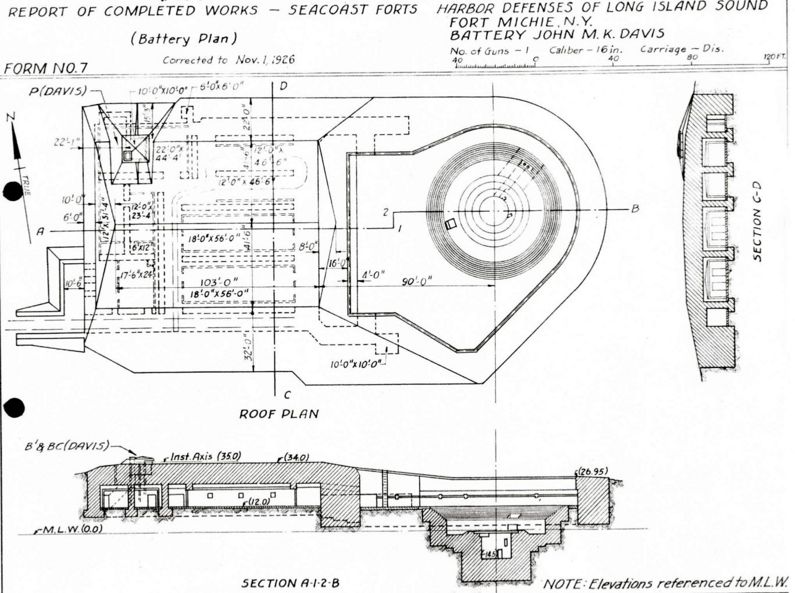
Battery Davis (3) (1923-1944) - Battery Davis (3) was a reinforced concrete, Endicott Period 16 inch coastal gun battery on Fort Michie, Suffolk County, New York. The battery was named after MG John Moore Kelso Davis, veteran of the U.S. Civil War, who died 20 May 1920 in Hartford, Connecticut. Battery construction started in October 1919, was completed in June 1922 and transferred to the Coast Artillery for use 17 May 1923 at a cost of $ 723,286.49. Deactivated in 1944. World War IPart of the Harbor Defense of Long Island Sound. Originally built as a World War I concrete coastal gun battery with one 16" M1919 guns mounted on an M1917 Disappearing carriage. This was a single story battery with the gun and the magazine on the same level. The carriage was equipped with retracting, traversing and elevating electric motors. This was an open battery, not casemated, with a one-of-a-kind disappearing carriage. Within the battery was a plotting room with the BC station directly above it, connected by stairs and a voice tube. Electrical power was furnished from an emplacement power plant with three 25KW gasoline driven motor generator sets and interconnected with three other emplacement power plants. Also internal to the battery was a mining casemate.

World War IISalvage of gun and carriage directed 2 Feb 1944. The 16" gun was transferred back to Watervliet 31 Mar 1944. Current StatusNo period guns or mounts in place.
Sources:
Links: Visited: No
| ||||||||||||||||||||||||||||||||