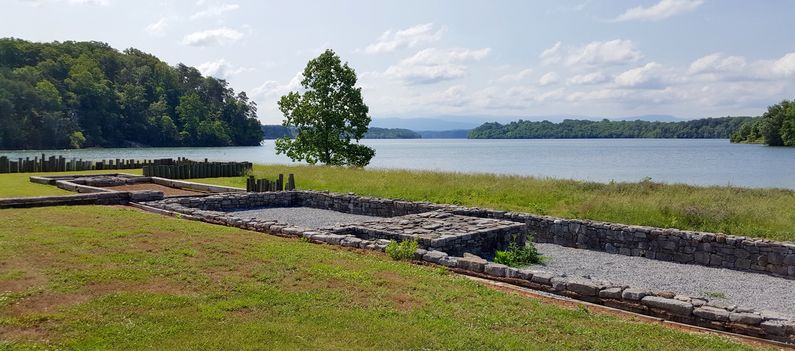
Tellico Blockhouse
|
Tellico Blockhouse (1793-1807) - Initially established as a militia post in 1793 by Governor William Blount near present day Vonore, Monroe County, Tennessee. Built as a result of the Treaty of Holston (1791) to provide an interface with the Overhill Cherokee Indians and later to become a part of the Indian factory system. Federalized in 1794 and garrisoned by U.S. Army troops. Probably named after the nearby Tellco Plain. Abandoned in 1807 but used sporadically until 1811.
History of Tellico BlockhouseEstablished in 1793 as a result of the Treaty of Holston (1791) to provide a check against white settlement of Cherokee lands and to keep the peace between both cultures. The post was situated 12 miles inside Cherokee country on high ground overlooking the Cherokee village of Tuskegee between Nine Mile Creek and the Little Tennessee River. The remains of the post are now at the edge of the lake created by dams along the Little Tennessee River and directly across the river from the site of Fort Loudon. The Telco Blockhouse became a Federal post as a result of a 1794 Congressional Act creating Federal frontier posts and a part of the Federal system of Indian factories in 1796 as a result of a 19 May 1796 Congressional Act Establishing trading Houses with the Indian Tribes. The Factory system was designed to teach the local tribes western methods of agriculture and trades. The blockhouse was then garrisoned by a small detachment of U.S. Army troops under Captain Edward Bulter, it also served as a trading post, Indian agency and was the scene of several treaty signings. The post evolved over time with the change in functions and while it may have been just a blockhouse in the beginning it came to be a large palisaded compound containing several large buildings and at least two structures that might fit the definition of a blockhouse by themselves. The sketch and the model of the Tellico Blockhouse at the Fort Loudoun Visitor Center indicate that this was much more than a small outpost. By 1807 the Cherokee population in the Tennessee Valley had dwindled and the U.S. Army relocated the garrison to the Hiwassee River. A few soldiers remained at the blockhouse through December 1811 but as an outpost, not a primary fortification. Current StatusA part of the Fort Loudoun State Historic Site. Marker and extensive stabilized ruins that outline most of the major structures. Located just across the lake from Fort Loudoun. The visitor center at Fort Loudoun has information and a model of what the blockhouse looked like.
See Also: Sources:
Links:
Visited: 22 May 2016
| ||||||
