Point Montara WWII Radar Site
|
Point Montara WWII Radar Site (1943-1947) - A World War II U.S. Army Signal Corps Radar Site established in 1943. Used to provide early warning and direction of intercepts of approaching enemy aircraft. Located near the community of Montara in San Mateo County, California. Deactivated in 1947. Also known as Station J-80, Montara Tactical Position and as a part of Camp Montara.
HistoryThis radar site was established in 1943 during World War II as a part of a chain of some 65 radar stations along the West Coast of the United States and Canada. These secret radar sites were built to provide early warning and interception of approaching enemy aircraft and ships but also served to assist friendly aircraft that were lost or had in-flight emergencies. This radar network was in addition to a network of search and fire control radars established at each of the West Coast harbor defenses. This chain of West Coast radar stations was established in response to the June 1942 Japanese invasion and capture of the U.S. Aleutian Islands of Attu and Kiska. The islands were both recaptured by U.S. forces and declared secured by 24 Aug 1943. The radar chain was constructed in late 1942 and early 1943 while the Japanese still had control of the islands and had conducted air raids on the U.S. bases at Dutch Harbor. The threat of further air attacks on the West Coast appeared real as did a possible Japanese invasion of the Pacific Northwest. 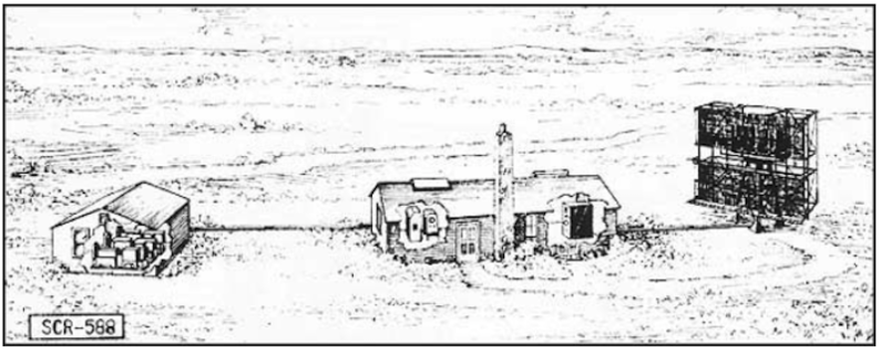 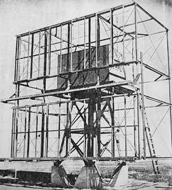 Two types of Air Warning Service (AWS) radar stations were built, long-range search radars (200~ mile range) and short-range Ground Control Intercept (GCI) radars (50~ mile range). The search radars would pick up and track possible enemy aircraft while the GCI radars would guide U.S. interceptor aircraft to these targets. The long-range search radar sites typically used the SCR-270 series radars while the GCI sites typically used the SCR-588 series radars. The Point Montara radar site was sited as a GCI/HF site with a SCR-588 radar set. The radar site was operational from sometime in 1943 until 1947. The site was used as a radar site by the 4th Anti-aircraft Command, Western Defense Command of the Army Ground Forces and probably supported the Anti-aircraft Training Center at Point Montara. Later, all air defense radar functions were transferred to Fourth Air Force, Army Air Forces.
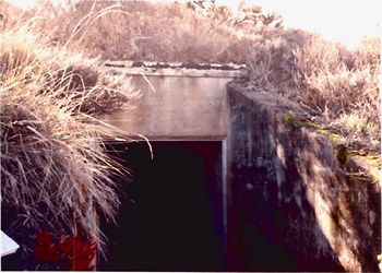
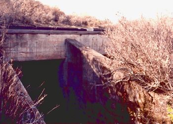
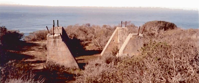
Physical PlantFrom the FUDS Reports: On 26 January 1943, the War Department acquired 135.00 leased acres from McNee Company (a ranch located at the site property) and 22.60 leased acres from Hibernia Savings & Loan Society (HSLS). Total acreage acquired was 157.60 (2,052.84 leased acres were scheduled to be leased from HSLS, however, that lease was canceled). This installation was a split site with the upper Radar Operations area separate from the lower Cantonment area. Improvements to the site were constructed between 1943 and 1947, they included two underground facilities (the radar operations facility and a power facility for the radar), concrete supports for a radar tower, and an underground storage tank. ClosureThe site was deactivated 8 Apr 1947 and the equipment was returned McClellan Field in Sacramento. Both of the original leases were terminated in November 1947. Current StatusThe site is currently owned by the State of California Department of Parks and Recreation and several private property owners. The majority of the site is currently used as a public park.
See Also: Sources:
Links:
Visited: 27 Apr 2019 Area
| |||||||
