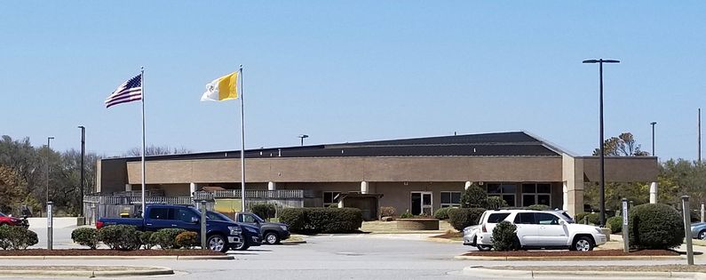
Kitty Hawk WWII Radar Site
|
Kitty Hawk WWII Radar Site (1942-1945) - A World War II U.S. Army Air Warning Service (AWS) Radar Site established in 1942. Used to provide early warning of enemy aircraft approaching the North Carolina Coast. Located in the town of Kitty Hawk on Bodie Island in Dare County, North Carolina. Deactivated in 1945. Also known as AWS Station 14.
HistoryThis radar site was established during World War II early in 1942 as a part of a chain of radar stations along the East Coast of the United States and Canada. These secret radar sites were built to provide early warning of approaching enemy aircraft and ships but also served to assist friendly aircraft that were lost or had in-flight emergencies. The AWS-14 site at Kitty Hawk was built on an 8-acre site purchased by the government for $ 1,018. This site is currently occupied by the Holy Redeemer Catholic Church and there are no remains of the radar site. The end of the war U.S. Army Facilities Report shows the purchase price of the land for the site but no construction costs over the lifetime of the post. Initially equipped with SCR-270/SCR-271 radar equipment which would have consisted of a radar tower along with buildings to house the radar equipment, an operations area, and two power generators. Conversations with two local residents who saw the site during and after the war indicated that the antenna tower was placed just about where the church building is today and that the tower and associated buildings were surrounded by a fenced area. The cantonment area stretched down the hill to the ocean side and contained barracks buildings along with support buildings. The camp location was then locally known as "Army Camp Hill". A large area north of the camp was designated a bombing range and residents of that area were relocated. Travel of island residents was restricted by military checkpoints that would allow residents to pass if military operations permitted. Both of the residents interviewed indicated that the radar tower remained in place for a number of years after the war. One resident remembered that the camp commander was a Captain Walters(sp) who often dined with his family and he indicated that the area did not have electricity and had some 300 residents at the time.
ClosureDeactivated in 1945 at the end of the war. Current StatusNo remains, now the site of a Catholic Church.
See Also: Sources:
Links:
Visited: 5, 11 Apr 2018
| ||||||
