File list
This special page shows all uploaded files. When filtered by user, only files where that user uploaded the most recent version of the file are shown.
| Name | Thumbnail | Size | User | Description | Versions | |
|---|---|---|---|---|---|---|
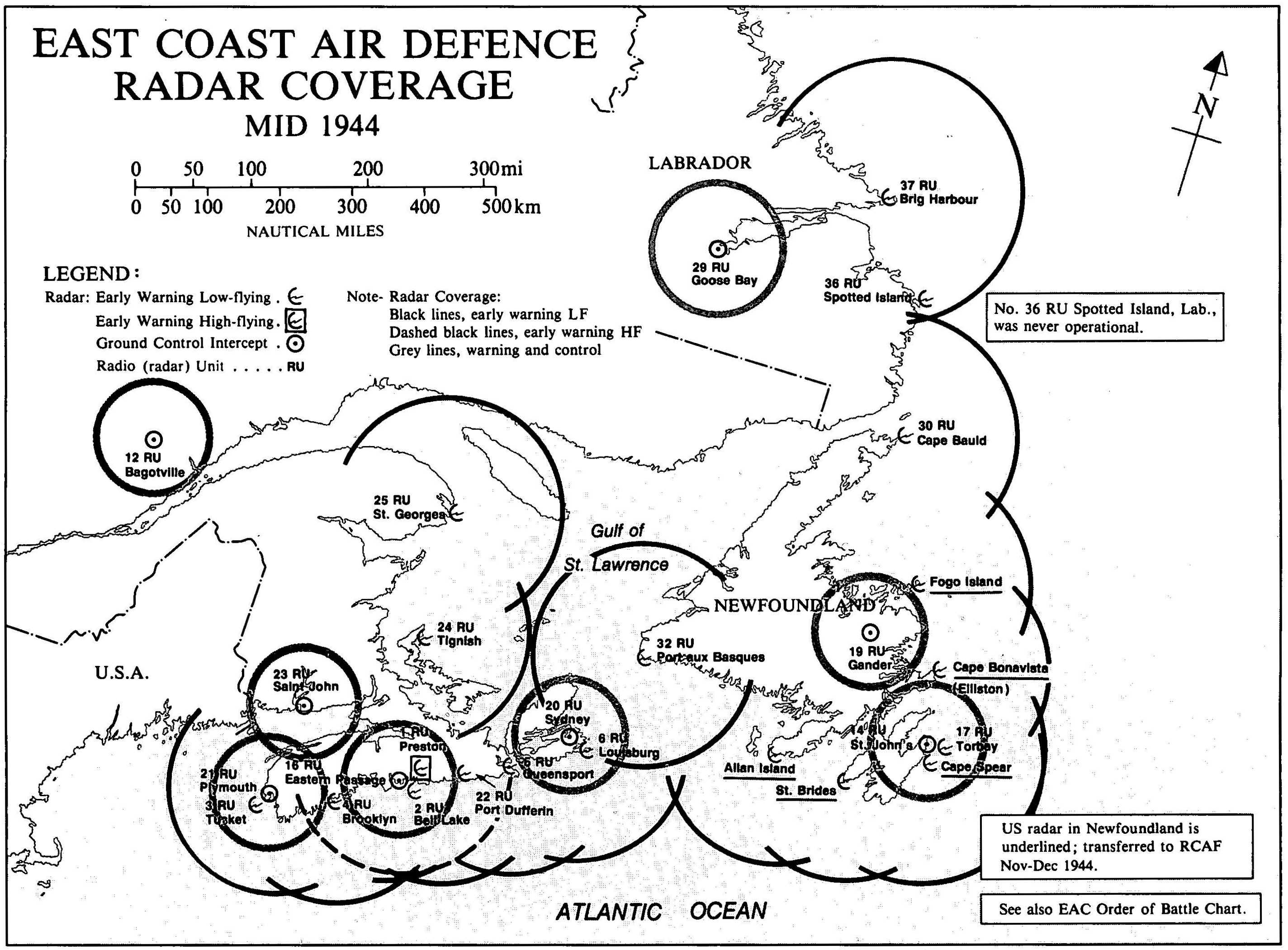
| 12:49, 19 December 2017 | East Coast Radar Coverage WWII.jpg (file) |  | 564 KB | Ken Heaton | (Planning for radar stations on the East Coast of Canada had started in 1940. Siting had been completed, equipment ordered and on site construction completed to enable the first stations to become active by mid 1942. The last of the stations would becom...) | 1 |
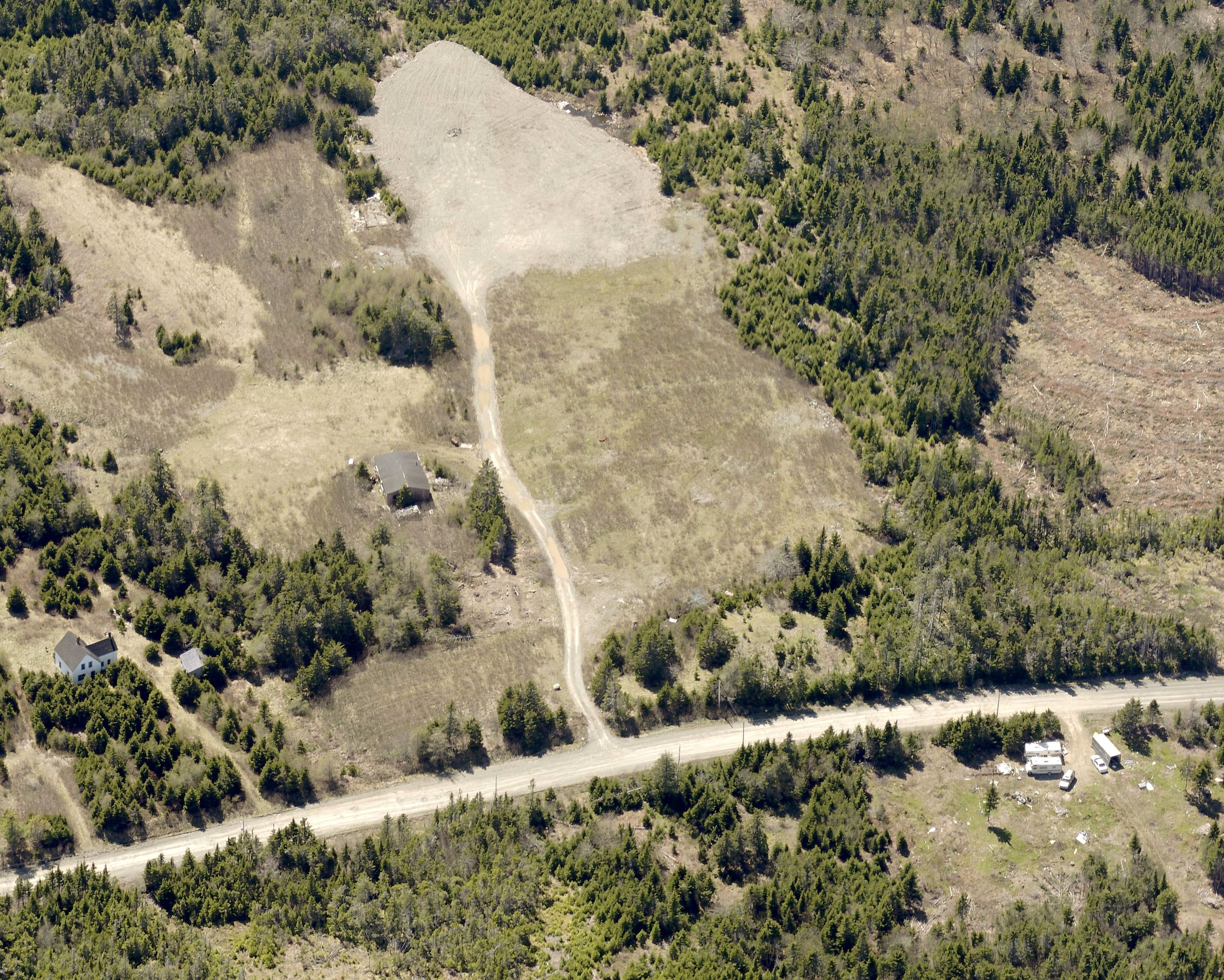
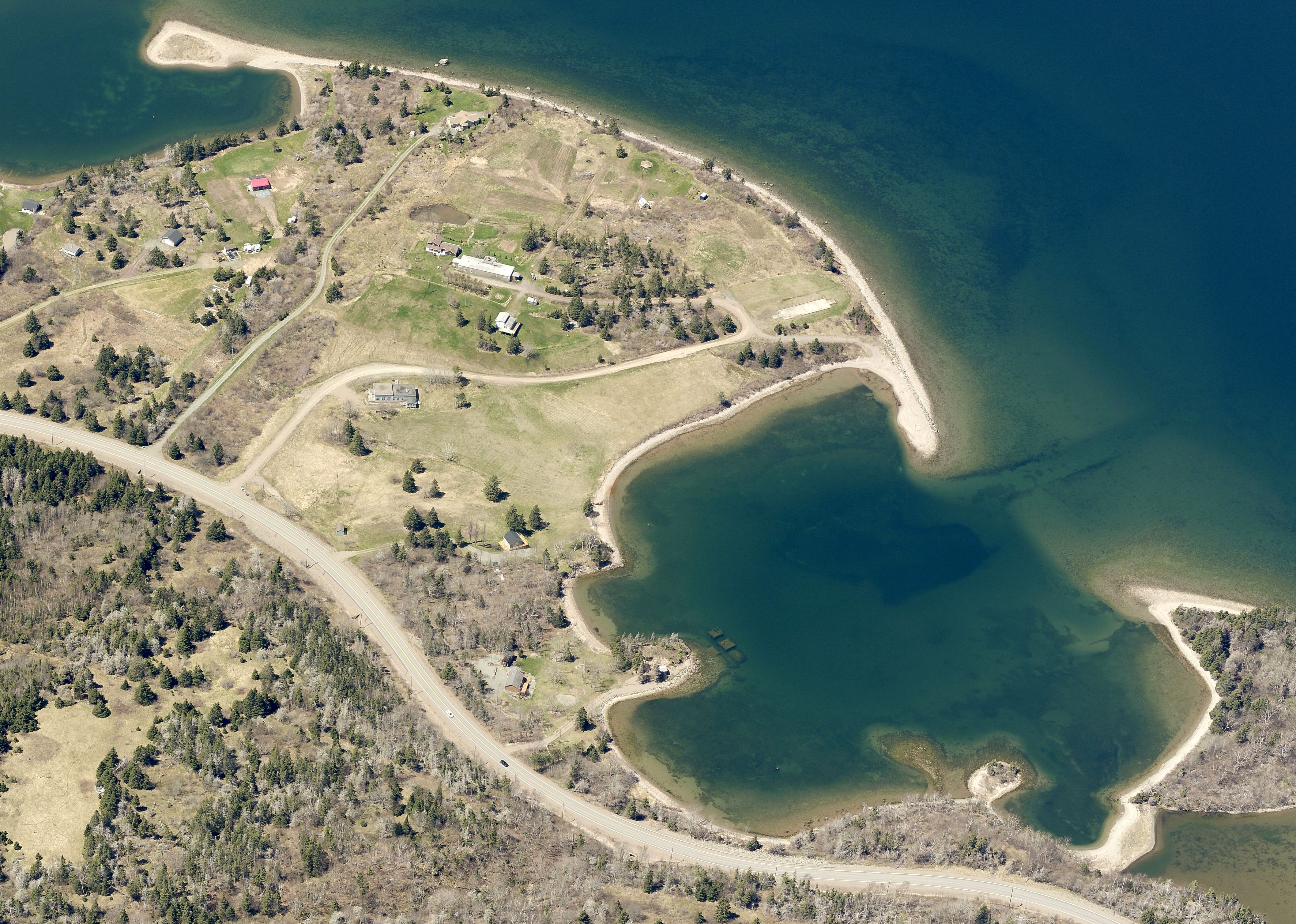
| 00:22, 19 December 2017 | Remains of No. 6 Radar Detachment, Louisbourg, Nova Scotia 2.jpg (file) |  | 1.92 MB | Ken Heaton | (Aerial view to the west of 6 RD Louisbourg Site, the Louisbourg radar complex as it appears today. 6 RU - Louisbourg Radar Site (1942-1945) - A World War II Royal Canadian Air Force (RCAF) Radar Station established in 1942. Located inland, 2 miles nor...) | 1 |
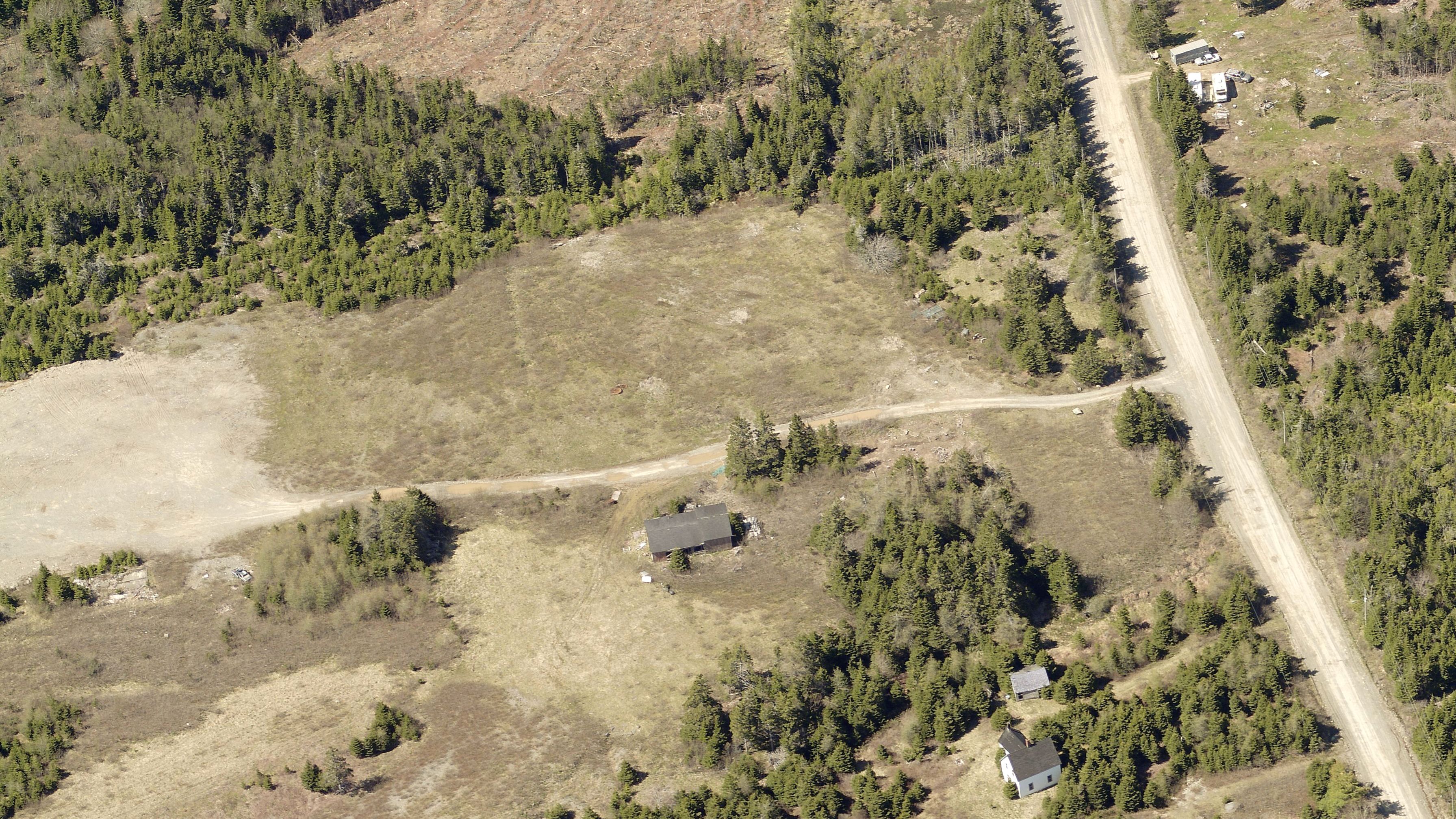
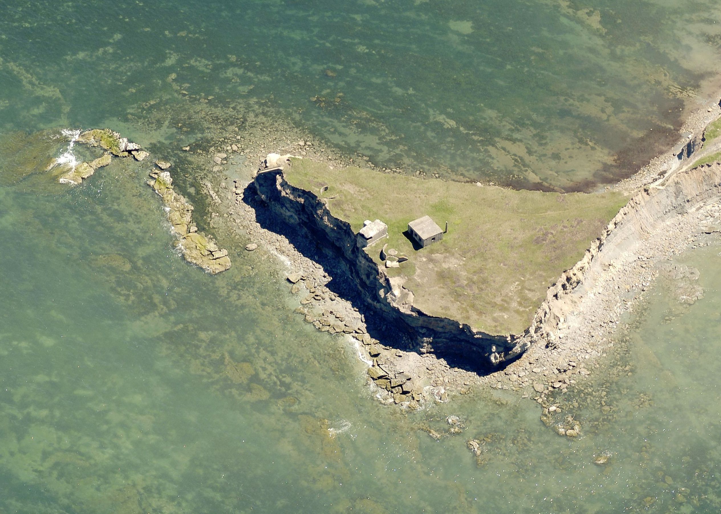
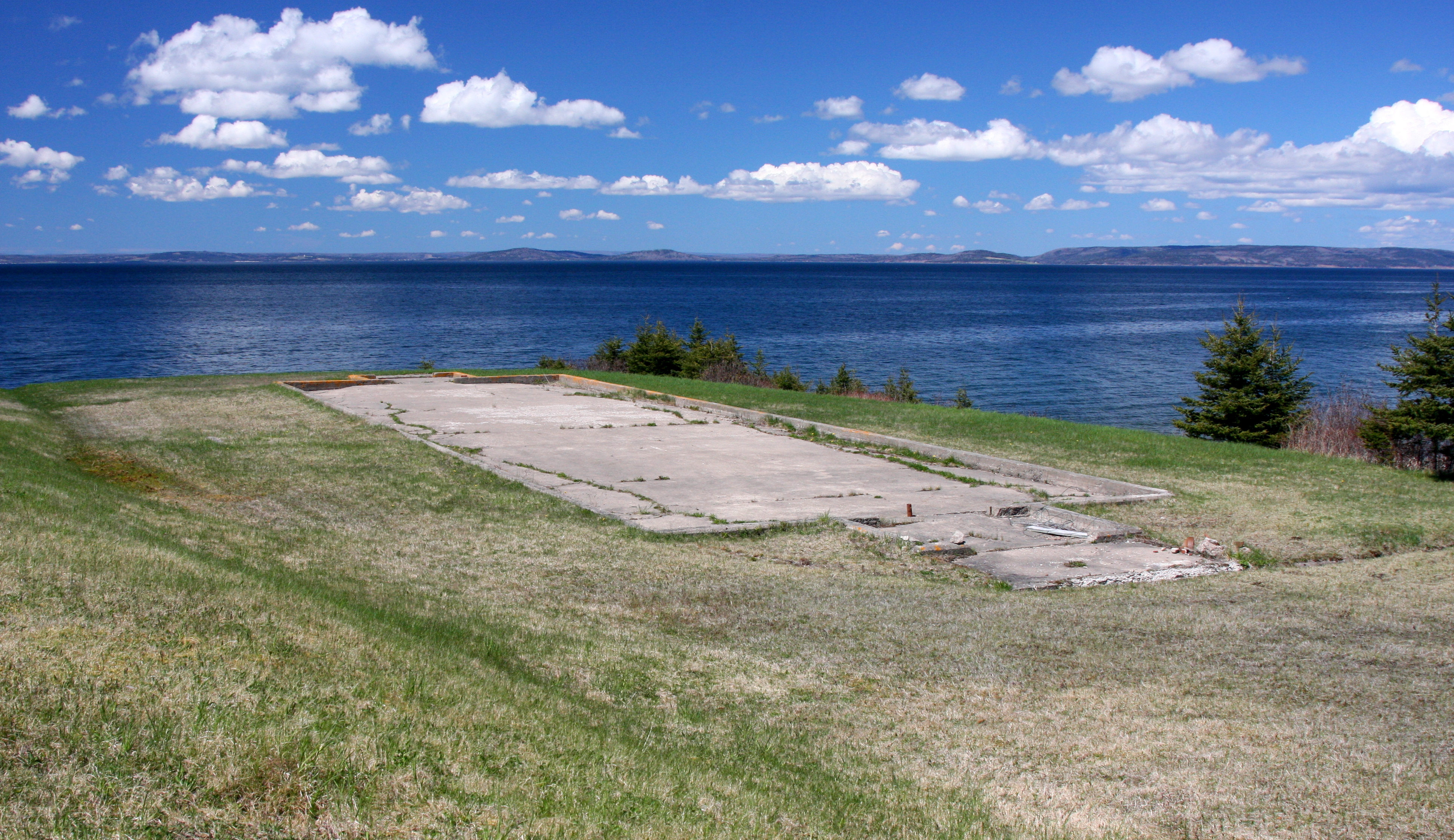
| 23:15, 18 December 2017 | Remains of No. 6 Radar Detachment, Louisbourg, Nova Scotia.jpg (file) |  | 1.72 MB | Ken Heaton | (Aerial photo of the Louisbourg radar complex as it appears today. 6 RU - Louisbourg Radar Site (1942-1945) - A World War II Royal Canadian Air Force (RCAF) Radar Station established in 1942. Located inland, 2 miles northwest of Louisbourg, on Cape Bre...) | 1 |
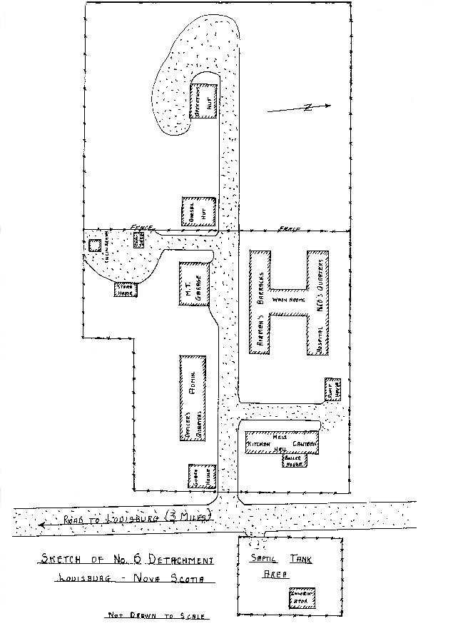
| 23:00, 18 December 2017 | No. 6 Radar Detachment, Louisbourg, Sketch.jpg (file) |  | 85 KB | Ken Heaton | (6 RU - Louisbourg Radar Site (1942-1945) - A World War II Royal Canadian Air Force (RCAF) Radar Station established in 1942. Located inland, 2 miles northwest of Louisbourg, on Cape Breton Island, Nova Scotia. Initially assigned a Radar Detachment desi...) | 1 |
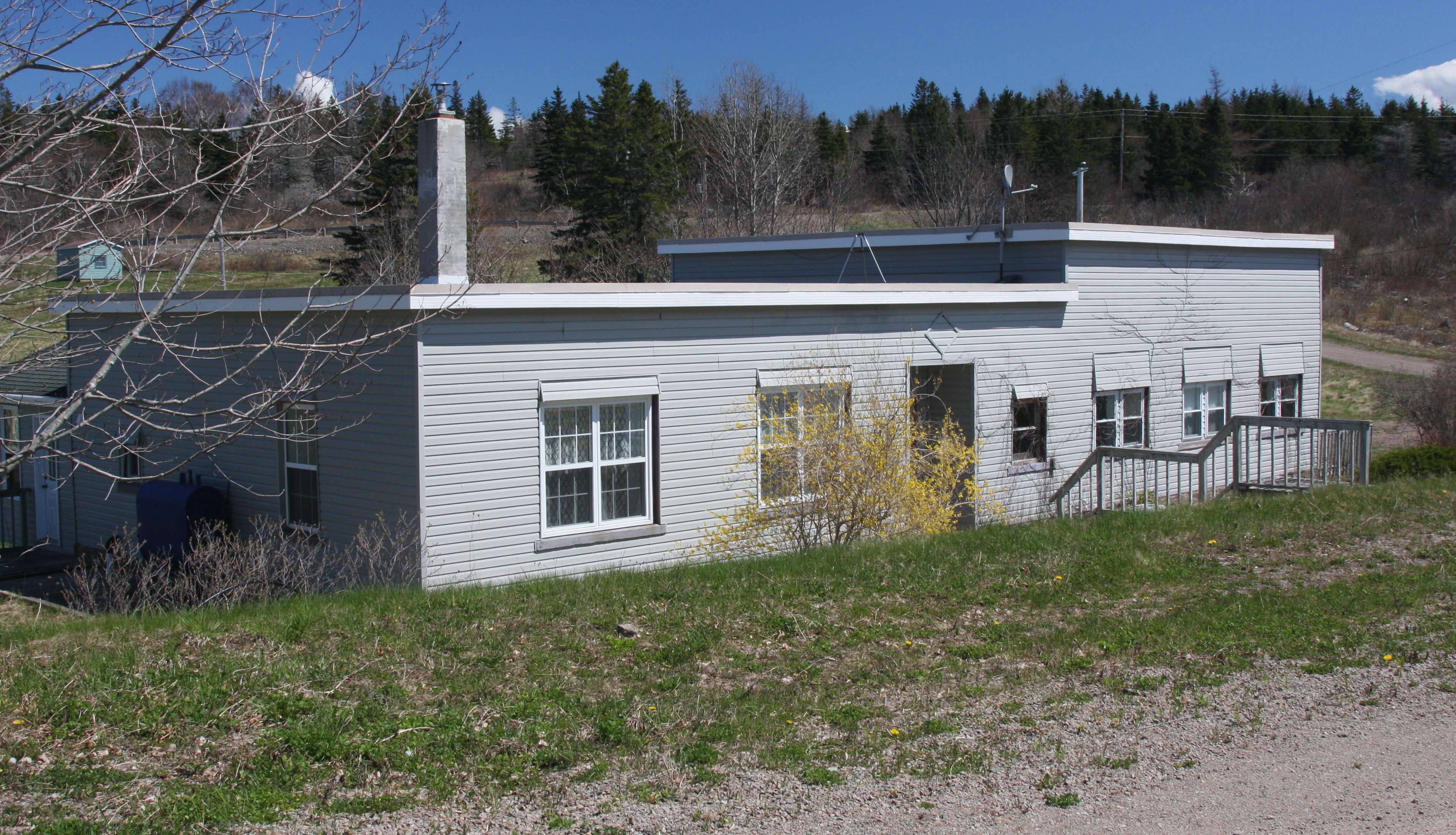
| 23:00, 18 December 2017 | No. 6 Radar Detachment, Louisbourg, Nova Scotia.jpg (file) |  | 113 KB | Ken Heaton | (6 RU - Louisbourg Radar Site (1942-1945) - A World War II Royal Canadian Air Force (RCAF) Radar Station established in 1942. Located inland, 2 miles northwest of Louisbourg, on Cape Breton Island, Nova Scotia. Initially assigned a Radar Detachment desi...) | 1 |
| 19:09, 17 December 2017 | Chart of the coast of New England, Nova Scotia, New France or Canada, with the islands of Newfoundld., Cape Breton, St. John's &c. 1746.jpg (file) |  | 17.41 MB | Ken Heaton | (Title A new chart of the coast of New England, Nova Scotia, New France or Canada, with the islands of Newfoundld., Cape Breton, St. John's &c. Description Scale [ca. 1:3 500 000] (W 71°--W 51°/N 52°50'--N 43°10'). Compass rose. Decorative title ca...) | 1 |
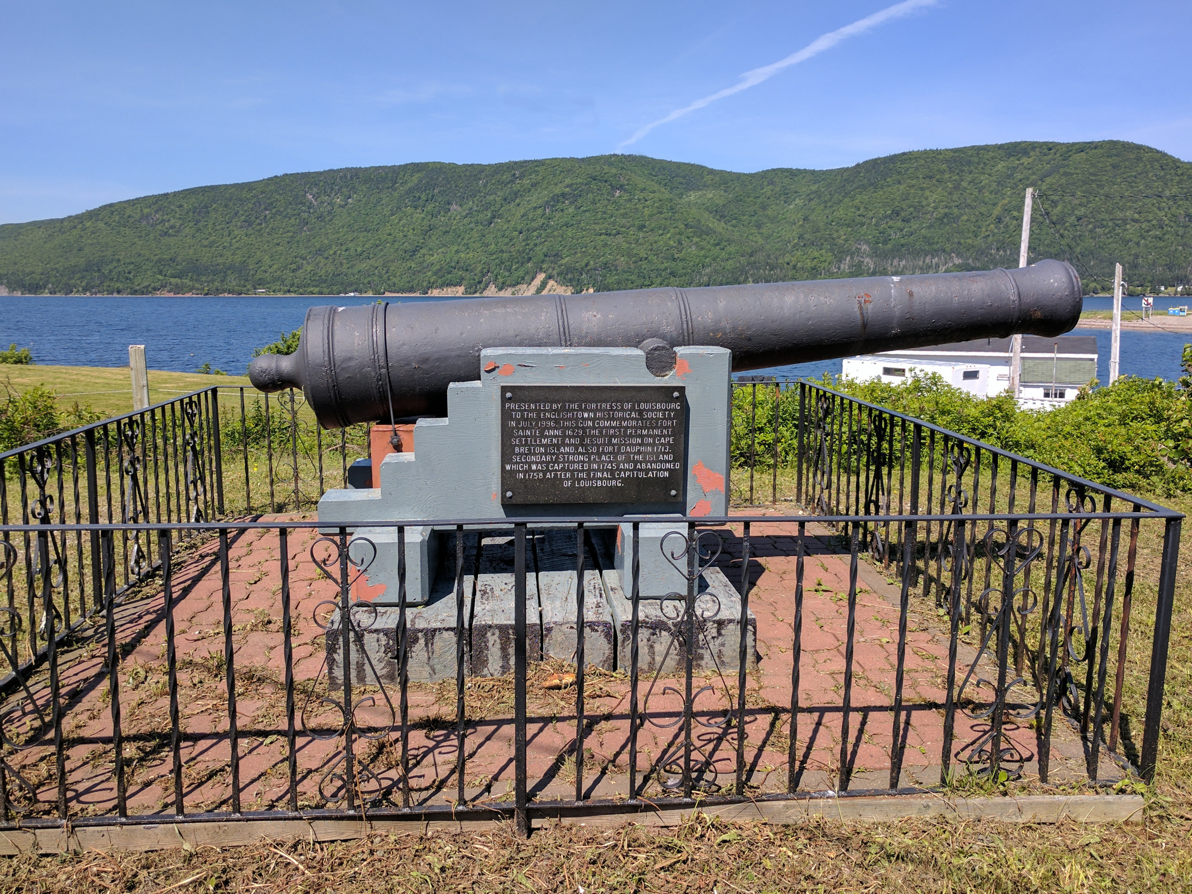
| 16:46, 17 December 2017 | Port Dauphin 1.jpg (file) |  | 331 KB | Ken Heaton | (Fort Dauphin (3) (1715 to 1758) - A French military colonial fort located at present-day Englishtown, Victoria County, Nova Scotia, Canada.) | 1 |
| 16:24, 17 December 2017 | Map1755-dauphin.jpg (file) |  | 140 KB | Ken Heaton | (Fort Dauphin Cape Breton (inset) from "A new and accurate map of the English empire in North America, 1755" Fort Dauphin (3) (1713 to 1758) - A French military colonial fort located at present-day Englishtown, Victoria County, Nova Scotia, Canada. Af...) | 1 |
| 13:24, 17 December 2017 | Sainte Anne Port Dauphin National Historic Site of Canada 3.jpg (file) |  | 4.31 MB | Ken Heaton | (Fort Sainte Anne (1639 to 1641) & Simon Denys Fort (1650-1659) (1639 to 1641, 1650-1659) - Two French colonial military forts located at present-day Englishtown, Victoria County, Nova Scotia, Canada. Fort Sainte Anne was built by Captain Charles Daniel...) | 1 |
| 12:54, 17 December 2017 | Sainte Anne Port Dauphin National Historic Site of Canada 2.jpg (file) |  | 132 KB | Ken Heaton | (Fort Sainte Anne (1639 to 1641) & Simon Denys Fort (1650-1659) (1639 to 1641, 1650-1659) - Two French colonial military forts located at present-day Englishtown, Victoria County, Nova Scotia, Canada. Fort Sainte Anne was built by Captain Charles Daniel...) | 1 |
| 12:53, 17 December 2017 | Sainte Anne Port Dauphin National Historic Site of Canada 1.jpg (file) |  | 60 KB | Ken Heaton | (Fort Sainte Anne (1639 to 1641) & Simon Denys Fort (1650-1659) (1639 to 1641, 1650-1659) - Two French colonial military forts located at present-day Englishtown, Victoria County, Nova Scotia, Canada. Fort Sainte Anne was built by Captain Charles Daniel...) | 1 |
| 12:53, 17 December 2017 | Sainte Anne Port Dauphin National Historic Site of Canada.jpg (file) |  | 62 KB | Ken Heaton | (Fort Sainte Anne (1639 to 1641) & Simon Denys Fort (1650-1659) (1639 to 1641, 1650-1659) - Two French colonial military forts located at present-day Englishtown, Victoria County, Nova Scotia, Canada. Fort Sainte Anne was built by Captain Charles Daniel...) | 1 |
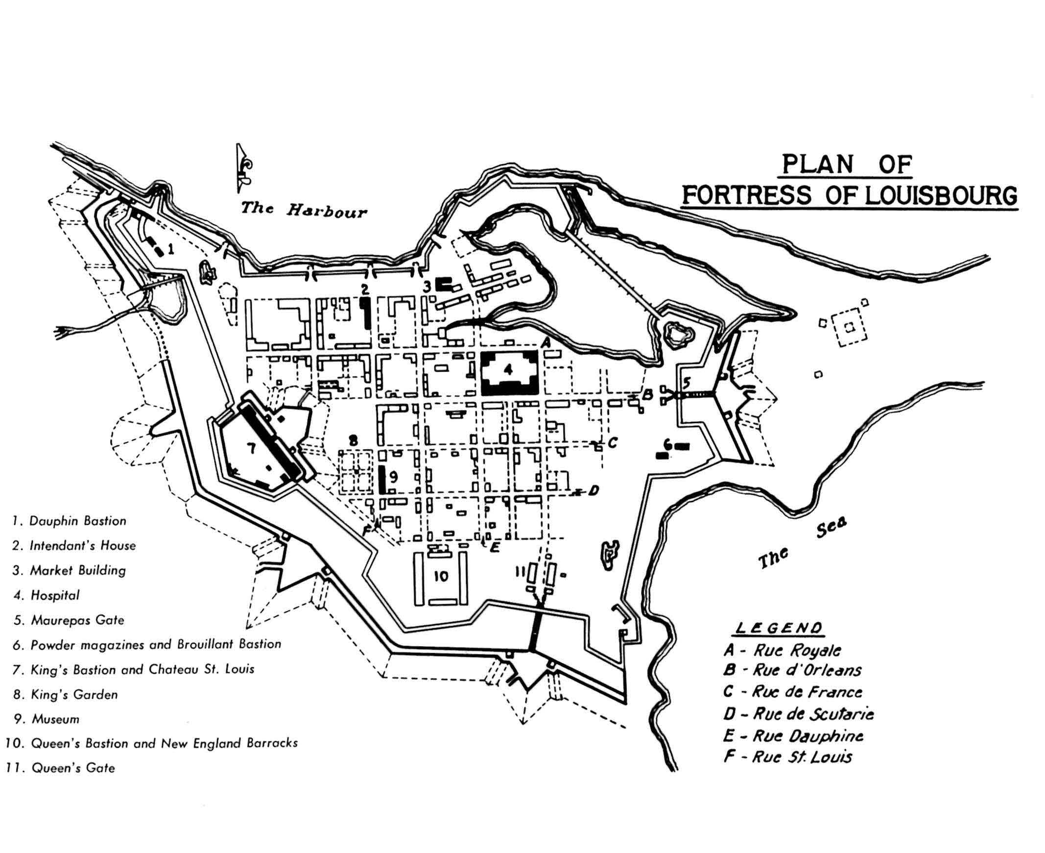
| 19:36, 16 December 2017 | Plan of the Fortress of Louisbourg.jpg (file) |  | 220 KB | Ken Heaton | (Fortress of Louisbourg (1719-1768) - A French colonial fortified city established in 1719 after Queen Anne's War on present day Cape Breton Island, Cape Breton County, Nova Scotia, Canada. Abandoned in 1768.) | 1 |
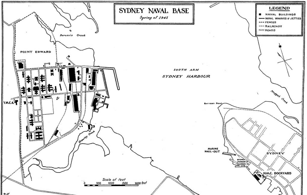
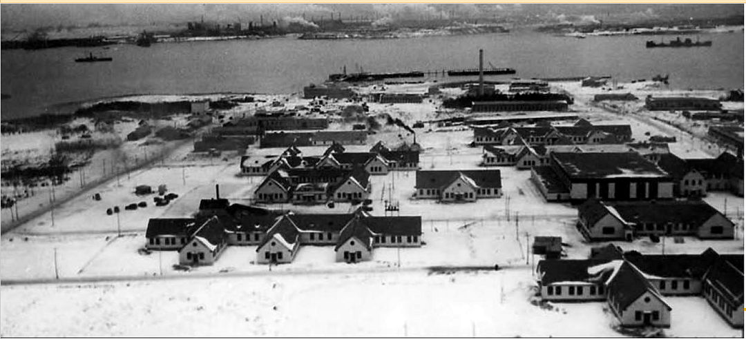
| 22:09, 15 December 2017 | Sydney Naval Base, Spring of 1945.jpg (file) |  | 111 KB | Ken Heaton | (HMCS Protector (1939 - 1964) - Royal Canadian Navy base HMCS Protector, also known as the Point Edward Naval Base (and sometimes Sydney Naval Base), was located next to Sydney Harbour, on Nova Scotia's Cape Breton Island. It was founded in 1940 and use...) | 1 |
| 22:05, 15 December 2017 | Sydney Naval Base, Spring of 1945.pdf (file) | 203 KB | Ken Heaton | (HMCS Protector (1939 - 1964) - Royal Canadian Navy base HMCS Protector, also known as the Point Edward Naval Base (and sometimes Sydney Naval Base), was located next to Sydney Harbour, on Nova Scotia's Cape Breton Island. It was founded in 1940 and use...) | 1 | |
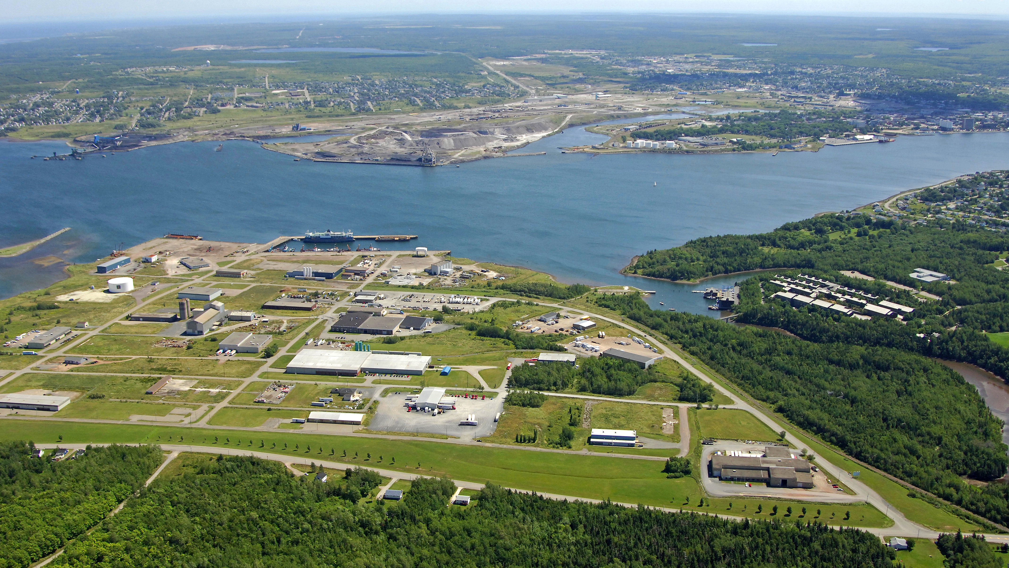
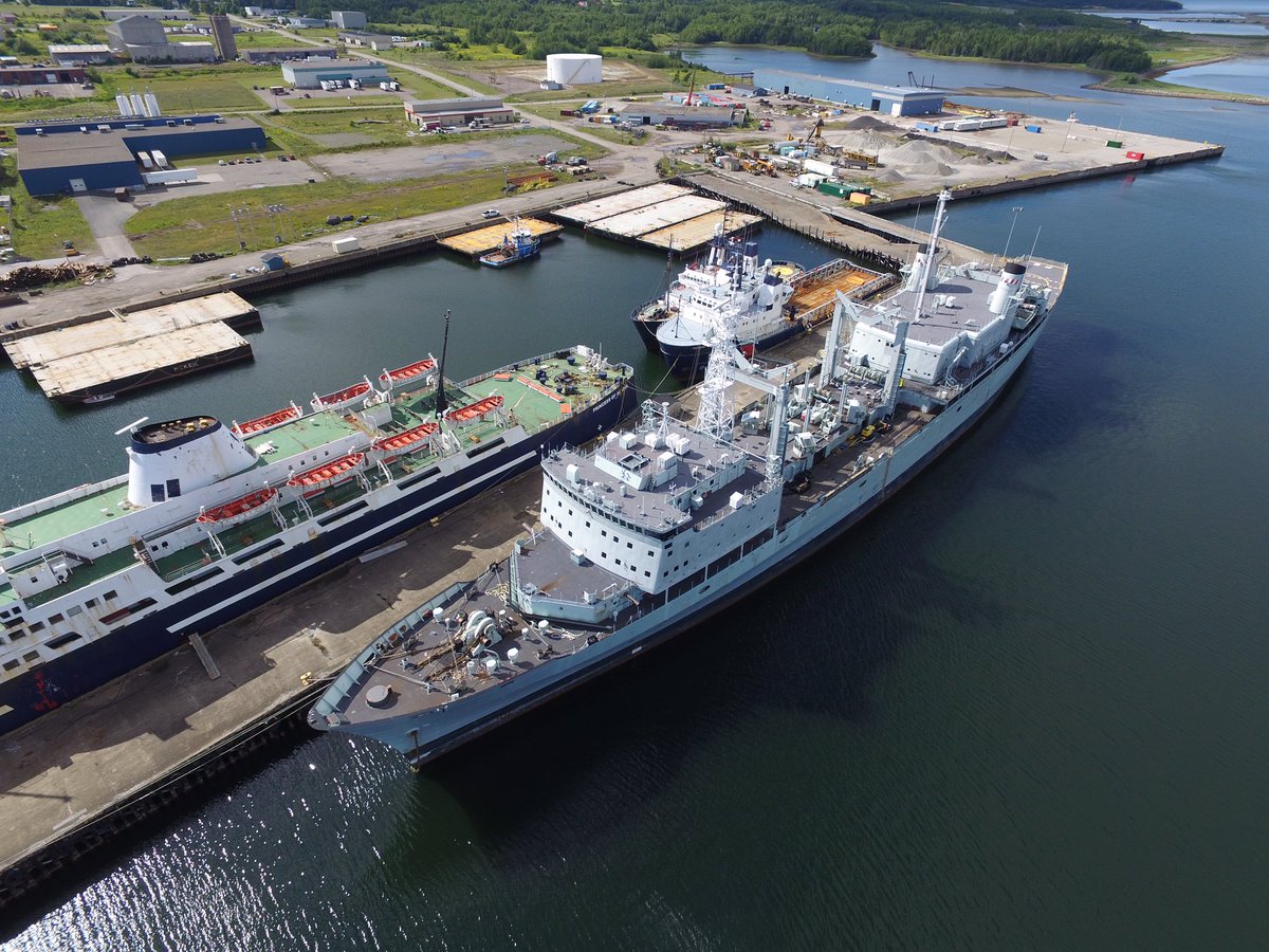
| 21:41, 15 December 2017 | SydPort Aerial View 2006.jpg (file) |  | 6.18 MB | Ken Heaton | (HMCS Protector (1939 - 1964) - Royal Canadian Navy base HMCS Protector, also known as the Point Edward Naval Base, was located next to Sydney Harbour, on Nova Scotia's Cape Breton Island. It was founded in 1940 and used by the navy during World War II....) | 1 |
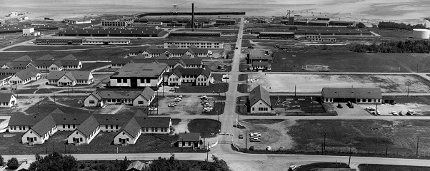
| 11:46, 15 December 2017 | HMCS Protector II.jpg (file) |  | 100 KB | Ken Heaton | (HMCS Protector (1939 - 1964) - Royal Canadian Navy base HMCS Protector, also known as the Point Edward Naval Base, was located next to Sydney Harbour, on Nova Scotia's Cape Breton Island. It was founded in 1940 and used by the navy during World War II....) | 1 |
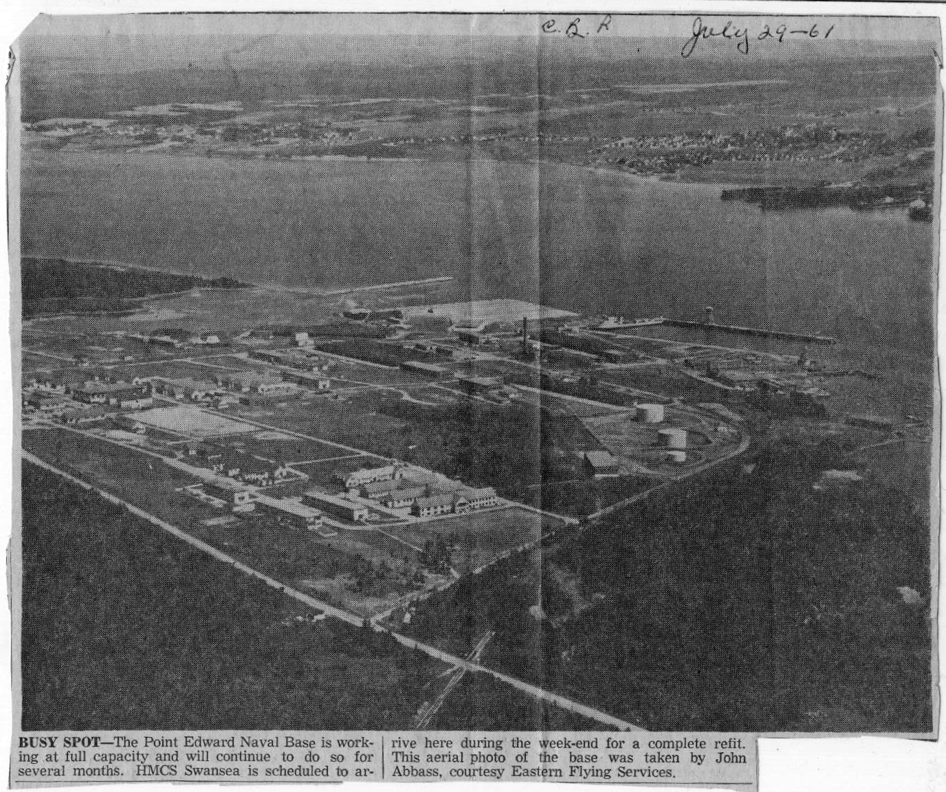
| 23:56, 14 December 2017 | Point-Edward-Naval-Base-Air-Photo.bmp.jpg (file) |  | 885 KB | Ken Heaton | (July 29, 1961 - HMCS Protector (1939 - 1964) - Royal Canadian Navy base HMCS Protector, also known as the Point Edward Naval Base, was located next to Sydney Harbour, on Nova Scotia's Cape Breton Island. It was founded in 1940 and used by the navy duri...) | 1 |
| 23:01, 14 December 2017 | SydPort.jpg (file) |  | 254 KB | Ken Heaton | (Sydport Industrial Park spans more than 240 hectares on Sydney Harbour, on Nova Scotia's Cape Breton Island. It is the site of the former Royal Canadian Navy base HMCS Protector, also known as the Point Edward Naval Base. It was founded in 1940 and us...) | 1 |
| 22:40, 14 December 2017 | HMCS Protector 1943.jpg (file) |  | 96 KB | Ken Heaton | (HMCS Protector (1939 - 1964) - Royal Canadian Navy base HMCS Protector, also known as the Point Edward Naval Base, was located next to Sydney Harbour, on Nova Scotia's Cape Breton Island. It was founded in 1940 and used by the navy during World War II....) | 1 |
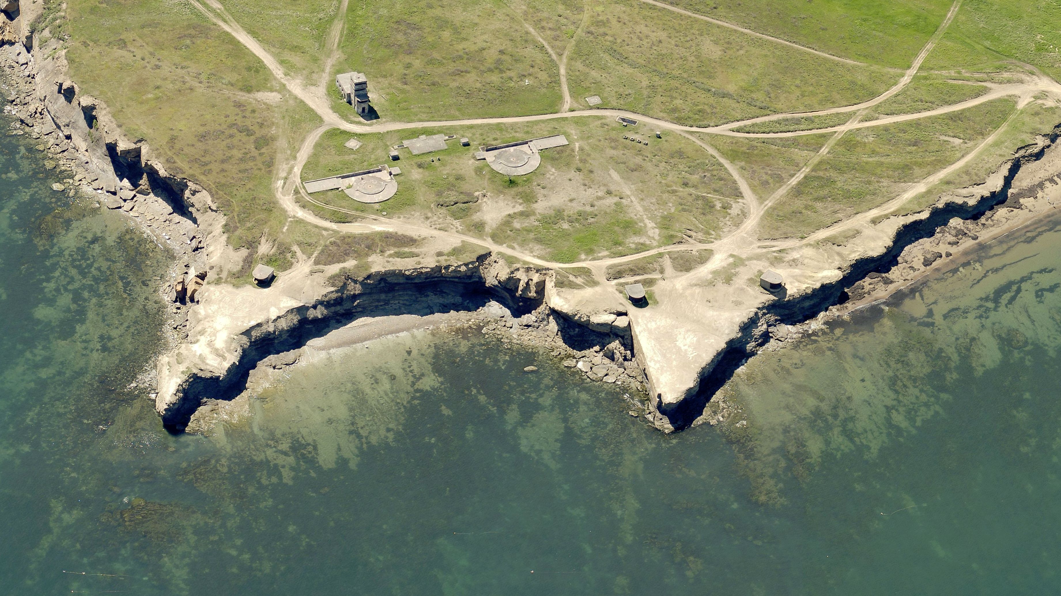
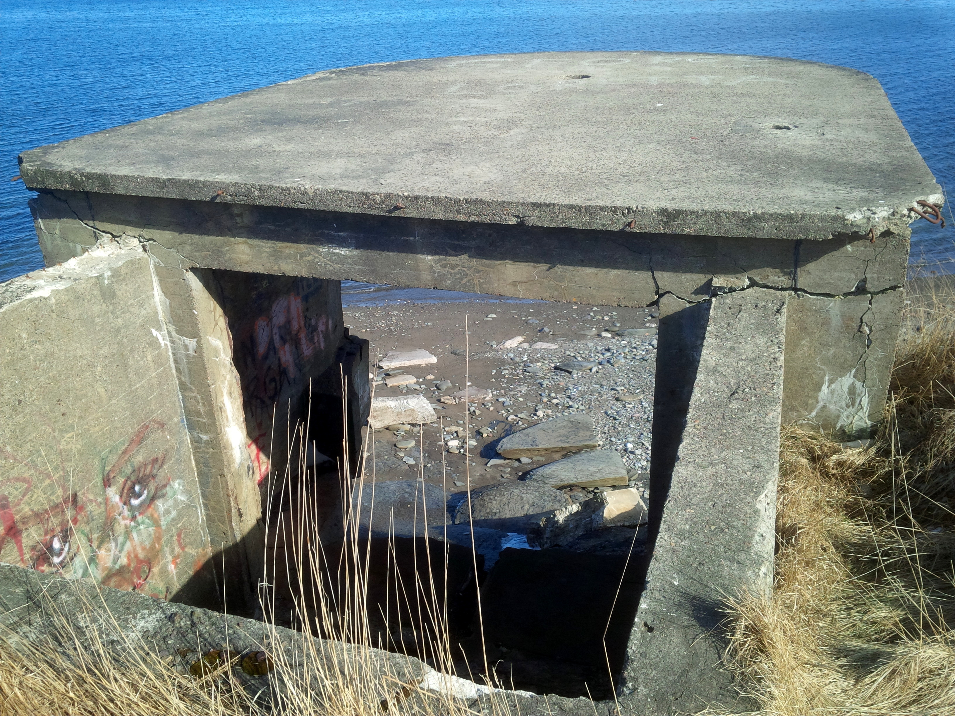
| 11:52, 14 December 2017 | Fort Petrie 2013.jpg (file) |  | 2.77 MB | Ken Heaton | (Fort Petrie (1914-1956) - A Canadian coastal fort established in 1914 during World War I on a cliff overlooking the entrance to Sydney Harbor in present day Cape Breton County, Nova Scotia, Canada. The site experienced at least two different periods of...) | 1 |
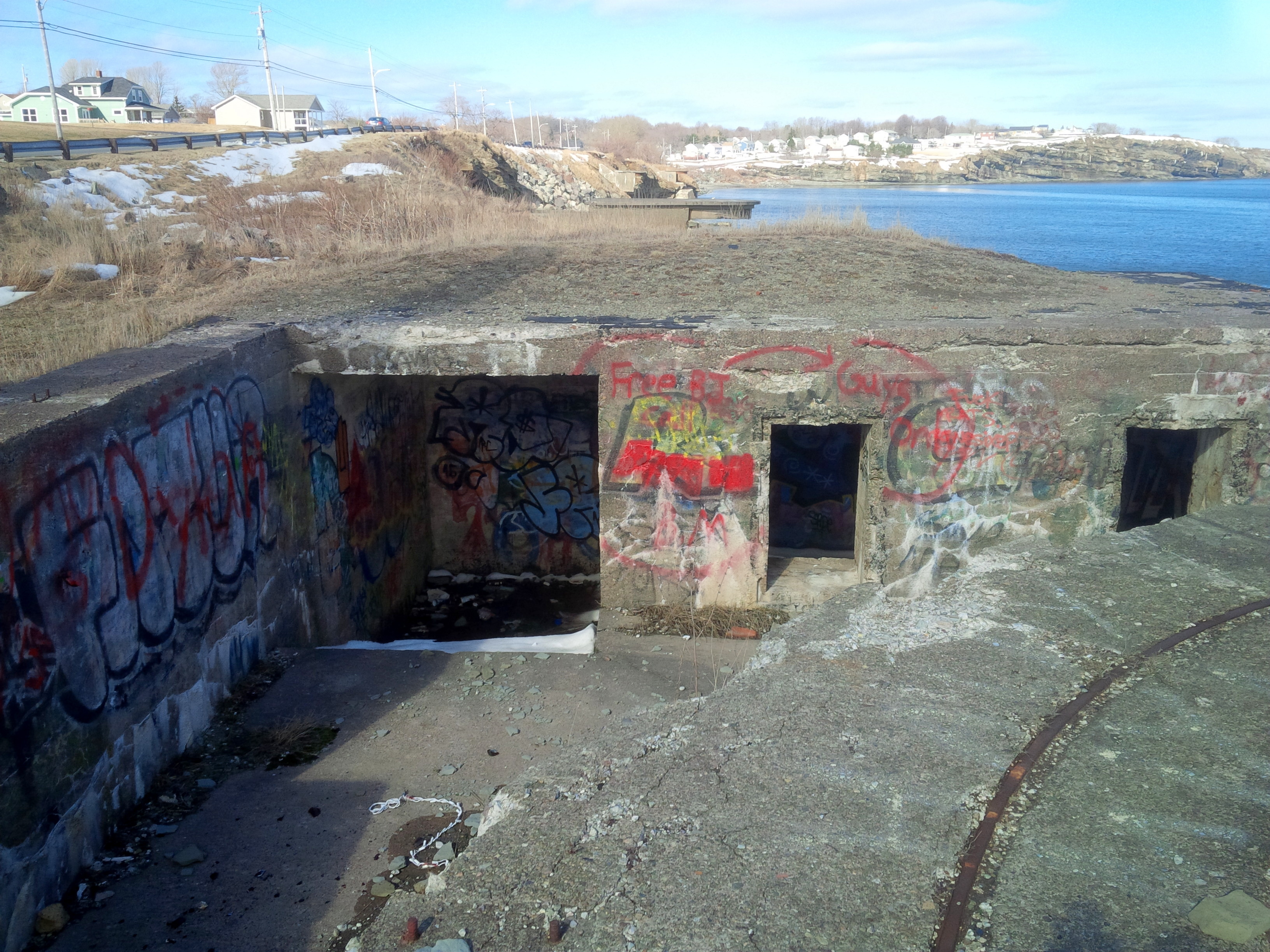
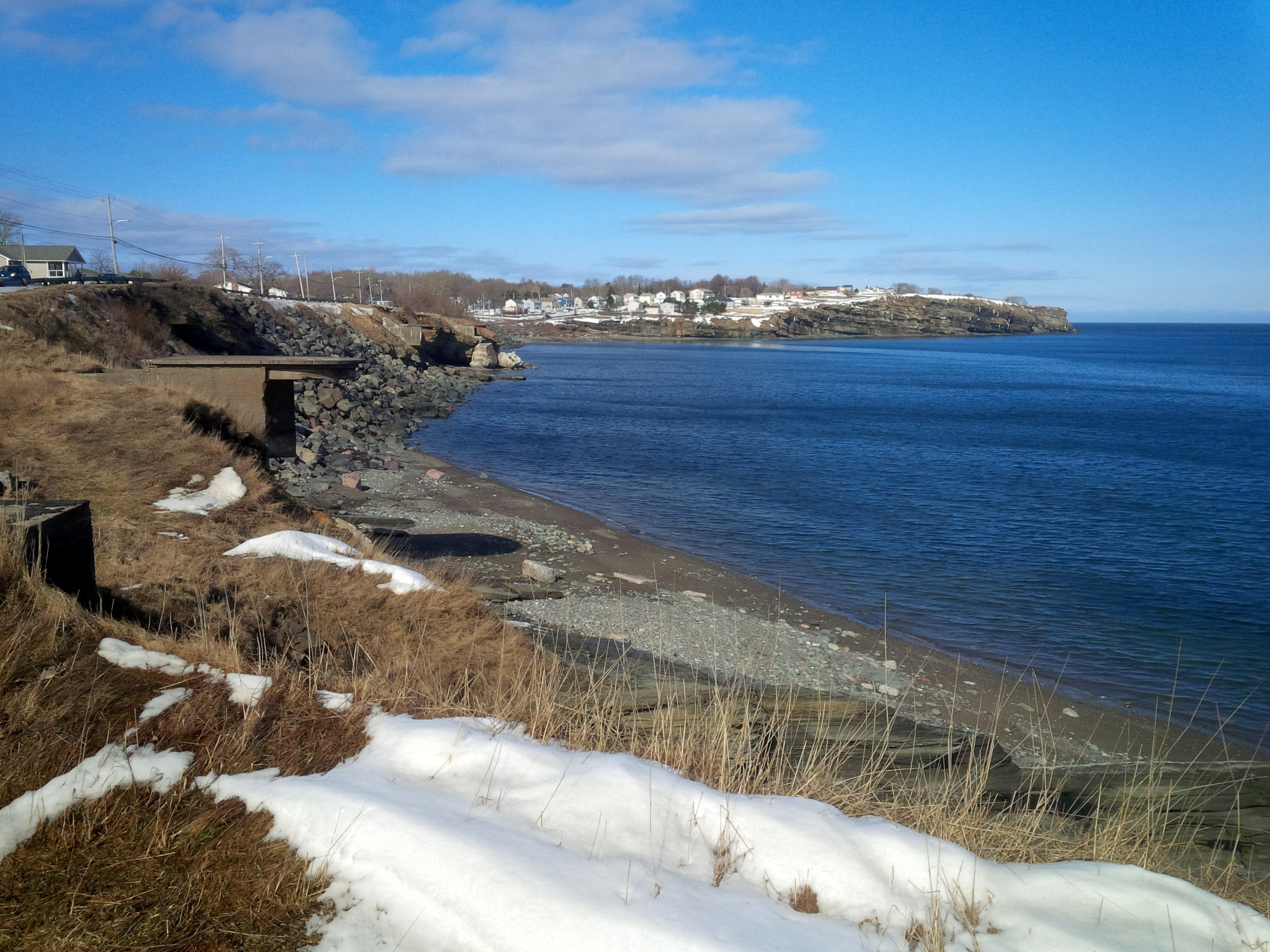
| 11:39, 14 December 2017 | Chapel Point Battery.jpg (file) |  | 1.29 MB | Ken Heaton | (Chapel Point Battery (1862-1948) - Chapel Point Battery was a coastal gun battery situated on a rocky cliff overlooking the entrance to Sydney Harbor, Cape Breton County, Nova Scotia, Canada. The site experienced three different periods of activity, (1...) | 1 |
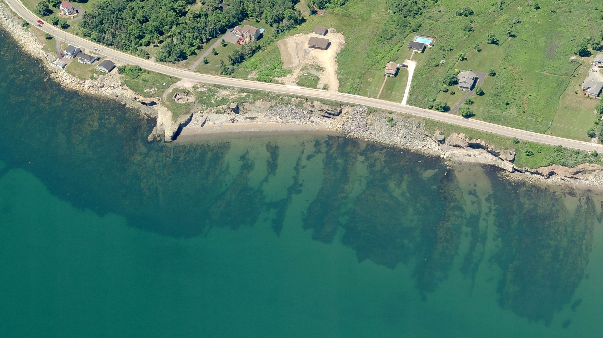
| 17:08, 11 December 2017 | Cranberry Head Battery.jpg (file) |  | 677 KB | Ken Heaton | (Cranberry Head Battery (1940-1948) - Cranberry Head Battery Battery was a coastal gun battery situated on a rocky cliff overlooking the entrance to Sydney Harbor, Cape Breton County, Nova Scotia, Canada.) | 1 |
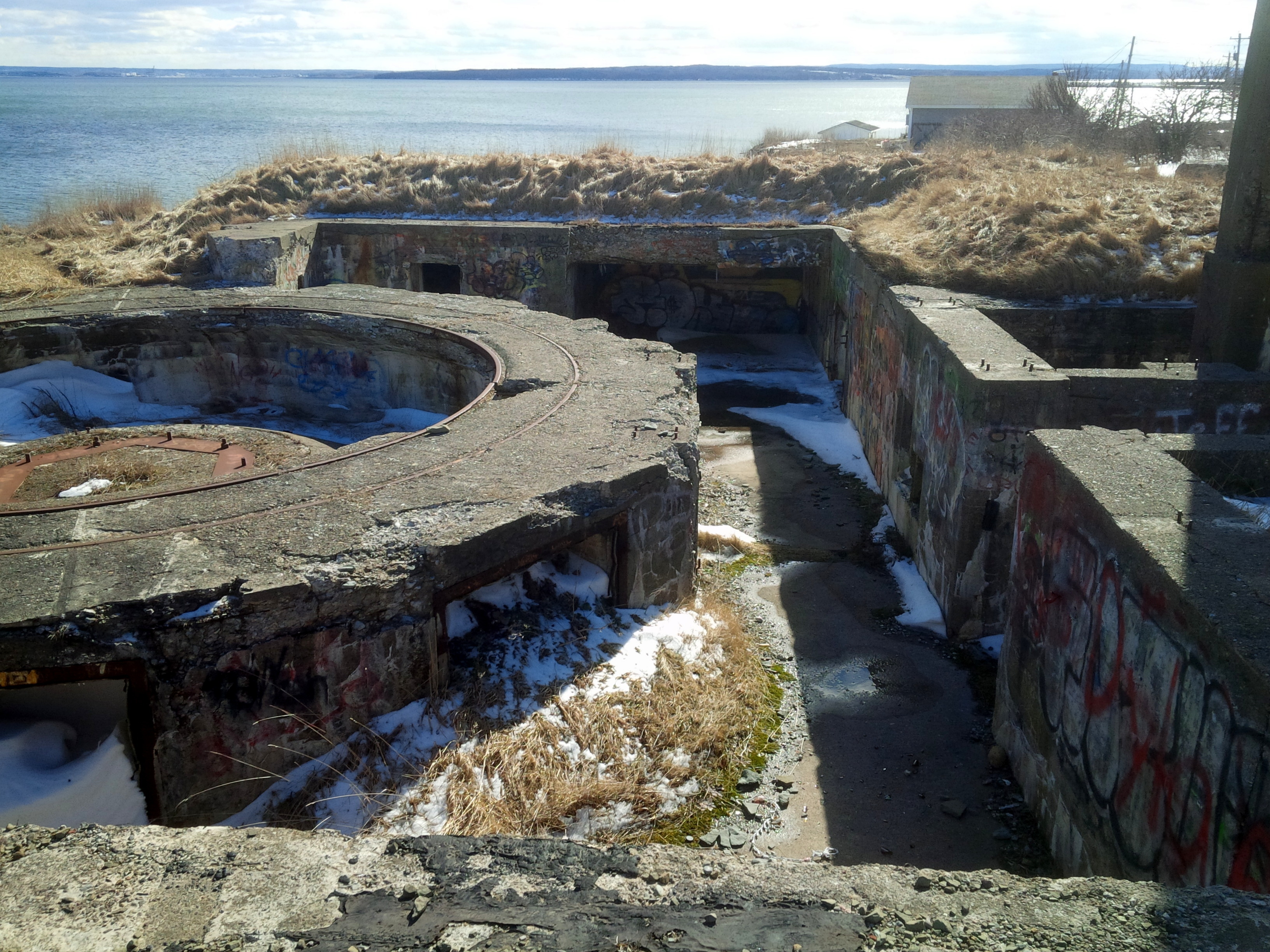
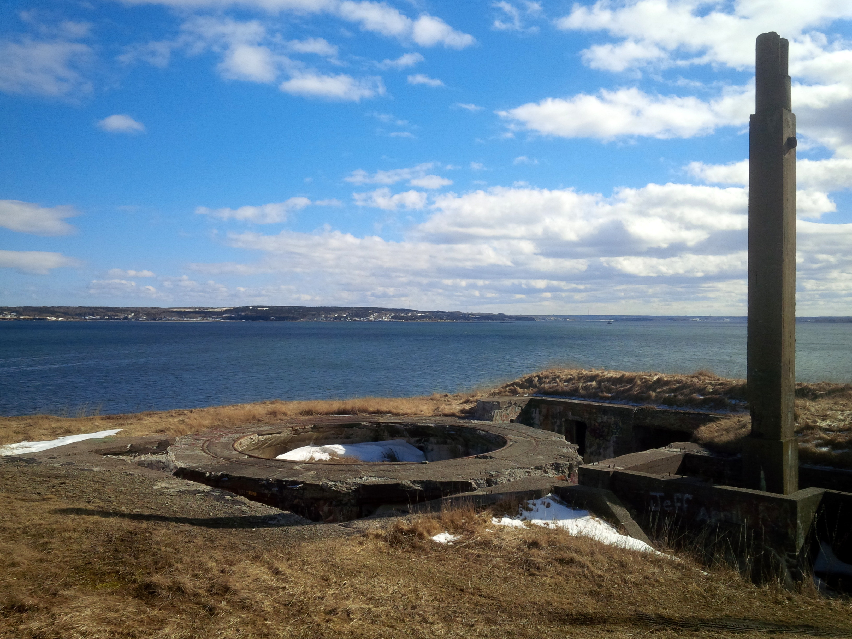
| 18:58, 10 December 2017 | Stubbert's Point Battery 8.jpg (file) |  | 2.56 MB | Ken Heaton | (Stubbert's Point Battery (1939 - 1951) - Stubbert's Point Battery was a coastal gun battery situated on a rocky cliff overlooking the entrance to Sydney Harbor, Cape Breton County, Nova Scotia, Canada. The site experienced two different periods of acti...) | 1 |
| 18:50, 10 December 2017 | Stubbert's Point Battery 5.jpg (file) |  | 2.17 MB | Ken Heaton | (Stubbert's Point Battery (1939 - 1951) - Stubbert's Point Battery was a coastal gun battery situated on a rocky cliff overlooking the entrance to Sydney Harbor, Cape Breton County, Nova Scotia, Canada. The site experienced two different periods of acti...) | 1 |
| 18:33, 10 December 2017 | Stubbert's Point Battery 6.jpg (file) |  | 1.68 MB | Ken Heaton | (Stubbert's Point Battery (1939 - 1951) - Stubbert's Point Battery was a coastal gun battery situated on a rocky cliff overlooking the entrance to Sydney Harbor, Cape Breton County, Nova Scotia, Canada. The site experienced two different periods of acti...) | 1 |
| 18:21, 10 December 2017 | Stubbert's Point Battery 7.jpg (file) |  | 568 KB | Ken Heaton | (Stubbert's Point Battery (1939 - 1951) - Stubbert's Point Battery was a coastal gun battery situated on a rocky cliff overlooking the entrance to Sydney Harbor, Cape Breton County, Nova Scotia, Canada. The site experienced two different periods of acti...) | 1 |
| 18:15, 10 December 2017 | Stubbert's Point Battery 4.jpg (file) |  | 2.14 MB | Ken Heaton | (Stubbert's Point Battery (1939 - 1951) - Stubbert's Point Battery was a coastal gun battery situated on a rocky cliff overlooking the entrance to Sydney Harbor, Cape Breton County, Nova Scotia, Canada. The site experienced two different periods of acti...) | 1 |
| 18:11, 10 December 2017 | Stubbert's Point Battery 3.jpg (file) |  | 1.85 MB | Ken Heaton | (Stubbert's Point Battery (1939 - 1951) - Stubbert's Point Battery was a coastal gun battery situated on a rocky cliff overlooking the entrance to Sydney Harbor, Cape Breton County, Nova Scotia, Canada. The site experienced two different periods of acti...) | 1 |
| 18:11, 10 December 2017 | Stubbert's Point Battery 2.jpg (file) |  | 1.48 MB | Ken Heaton | (Stubbert's Point Battery (1939 - 1951) - Stubbert's Point Battery was a coastal gun battery situated on a rocky cliff overlooking the entrance to Sydney Harbor, Cape Breton County, Nova Scotia, Canada. The site experienced two different periods of acti...) | 1 |
| 18:10, 10 December 2017 | Stubbert's Point Battery 1.jpg (file) |  | 1.6 MB | Ken Heaton | (Stubbert's Point Battery (1939 - 1951) - Stubbert's Point Battery was a coastal gun battery situated on a rocky cliff overlooking the entrance to Sydney Harbor, Cape Breton County, Nova Scotia, Canada. The site experienced two different periods of acti...) | 1 |
| 13:41, 10 December 2017 | 20160518 Johnstown Ordnance Depot.JPG (file) |  | 6.33 MB | Ken Heaton | (Royal Canadian Ordnance Corps Depot Johnstown was a large concrete reserve ammunition magazine for the major naval gun batteries in Sydney Harbour and Canso Strait, located at Johnstown, Richmond County, Nova Scotia, Canada, on the southeastern shore o...) | 1 |
| 13:40, 10 December 2017 | 20160518 Johnstown Ordnance Depot Magazine Foundation.JPG (file) |  | 5.3 MB | Ken Heaton | (Royal Canadian Ordnance Corps Depot Johnstown was a large concrete reserve ammunition magazine for the major naval gun batteries in Sydney Harbour and Canso Strait, located at Johnstown, Richmond County, Nova Scotia, Canada, on the southeastern shore o...) | 1 |
| 13:38, 10 December 2017 | 20160518 Johnstown Ordnance Depot Laboratory.JPG (file) |  | 5.06 MB | Ken Heaton | (Royal Canadian Ordnance Corps Depot Johnstown was a large concrete reserve ammunition magazine for the major naval gun batteries in Sydney Harbour and Canso Strait, located at Johnstown, Richmond County, Nova Scotia, Canada, on the southeastern shore o...) | 1 |
| 13:13, 10 December 2017 | Royal Canadian Ordnance Corps Depot Johnstown.jpg (file) |  | 2.32 MB | Ken Heaton | (Royal Canadian Ordnance Corps Depot Johnstown Laboratory Royal Canadian Ordnance Corps Depot Johnstown: Opened in the fall of 1943, the complex consisted of 3 magazines, similar to the ones at Debert and McGivney. Post-War, the site was used as a su...) | 1 |
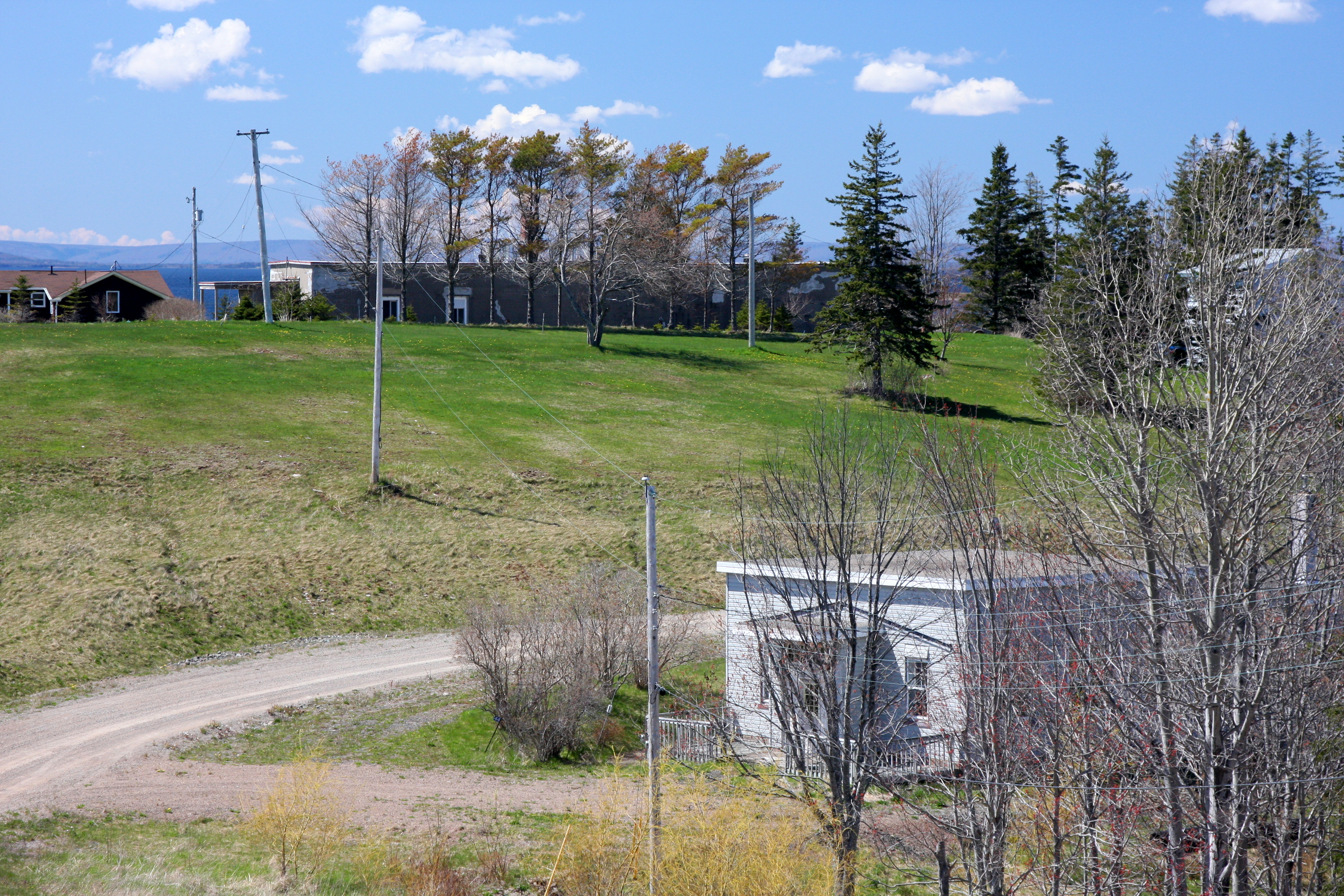
| 15:47, 25 March 2016 | Oxford Battery Encampemt.jpg (file) |  | 1.17 MB | Ken Heaton | ( Nearly two dozen wooden accommodation buildings were scattered about the rear of the gun positions, and they were designed on the advice of camouflage experts to resemble a village. The resulting army encampment at Fort Oxford was indistinguishable f...) | 1 |
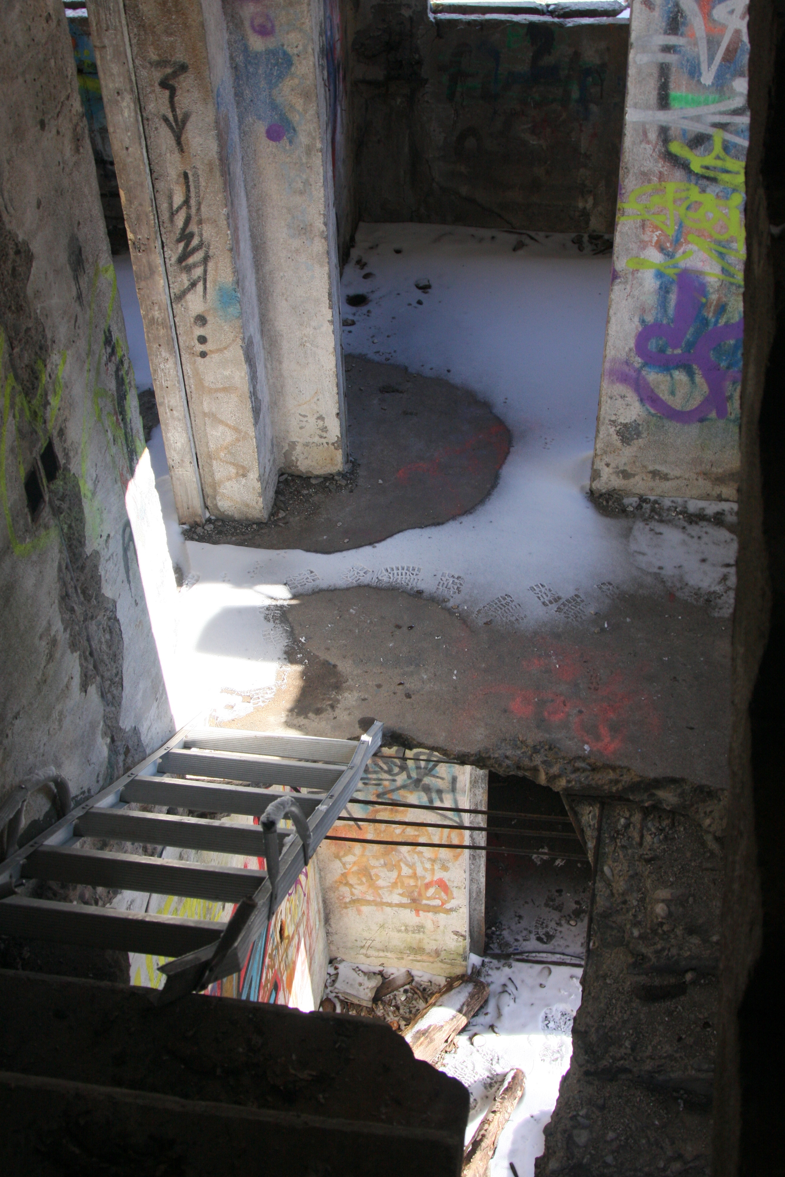
| 21:36, 7 March 2016 | 20160307 Fort Oxford Fire-Command Tower 0025.JPG (file) |  | 4.14 MB | Ken Heaton | (Interior stairwell of the Fort Oxford Fire-Control Observation Post.) | 1 |
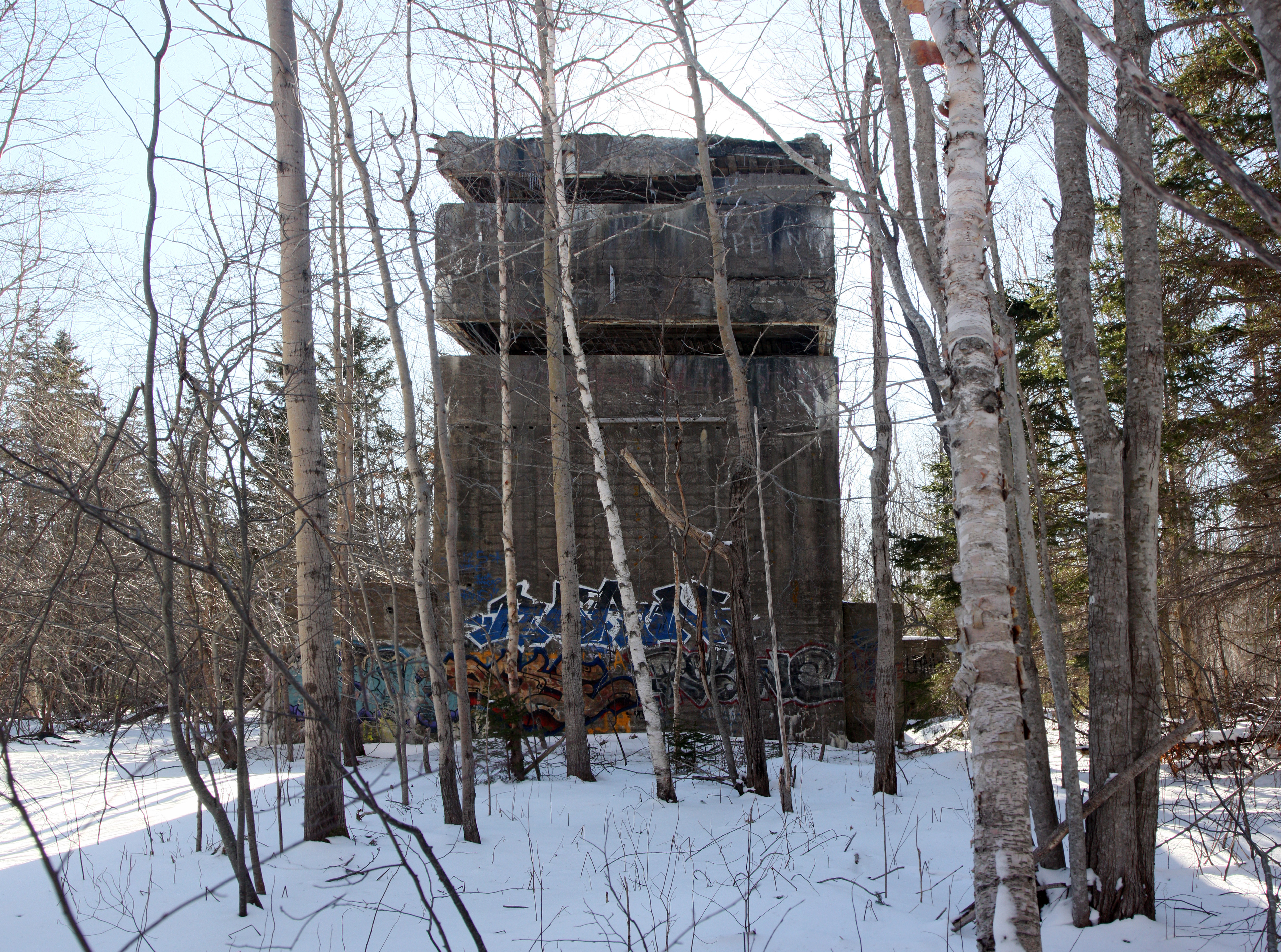
| 21:16, 7 March 2016 | 20160307 Fort Oxford Fire-Command Tower 0009.JPG (file) |  | 6.21 MB | Ken Heaton | (The rear of the Fort Oxford Fire-Control Observation Post, camera looking north-east.) | 1 |
| 21:15, 7 March 2016 | 20160307 Fort Oxford Fire-Command Tower 0007.JPG (file) |  | 6.44 MB | Ken Heaton | (The Fort Oxford Fire-Control Observation Post, camera looking north.) | 1 |
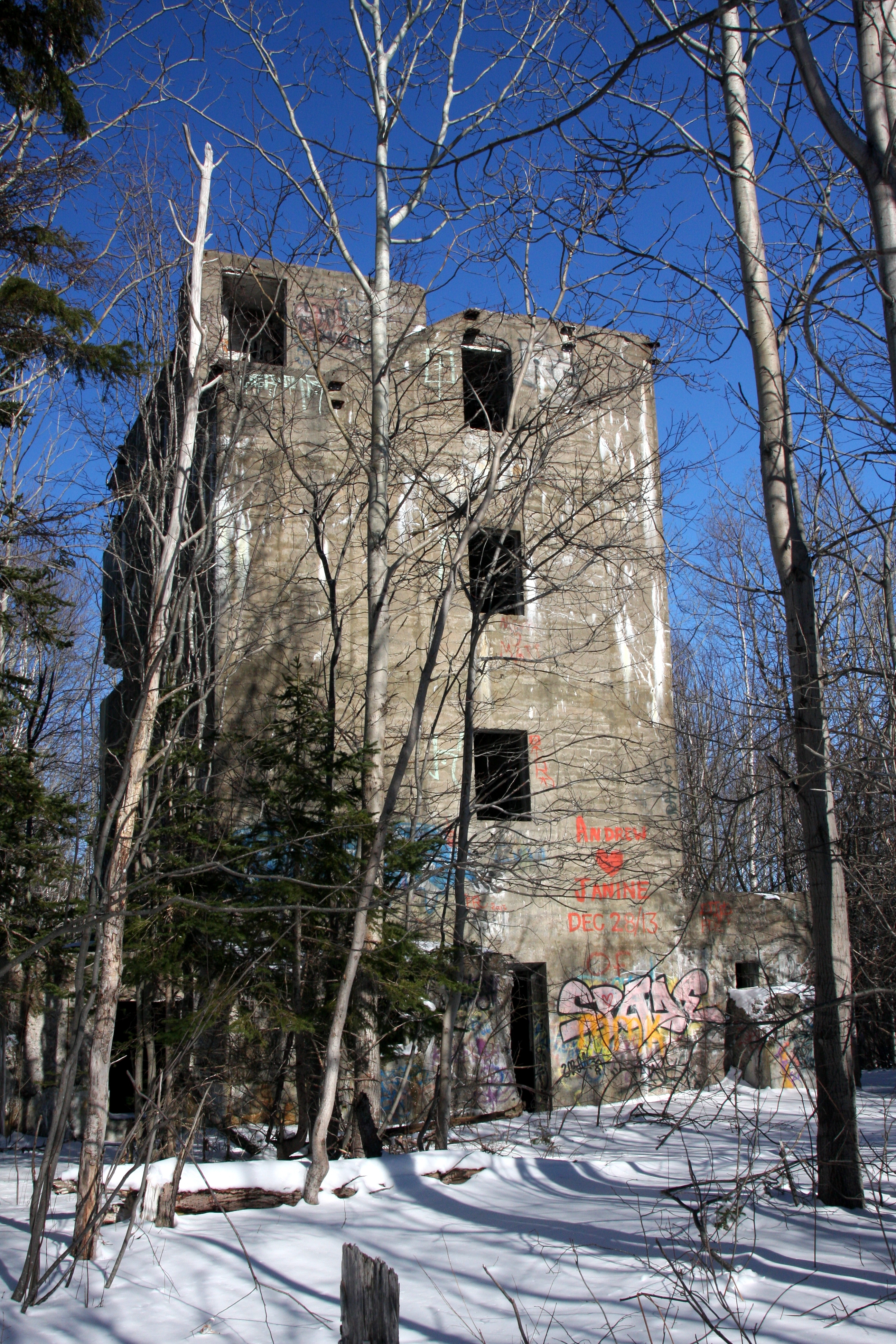
| 21:13, 7 March 2016 | 20160307 Fort Oxford Fire-Command Tower.JPG (file) |  | 7.19 MB | Ken Heaton | (The Fort Oxford Fire-Control Observation Post, north-east side.) | 1 |
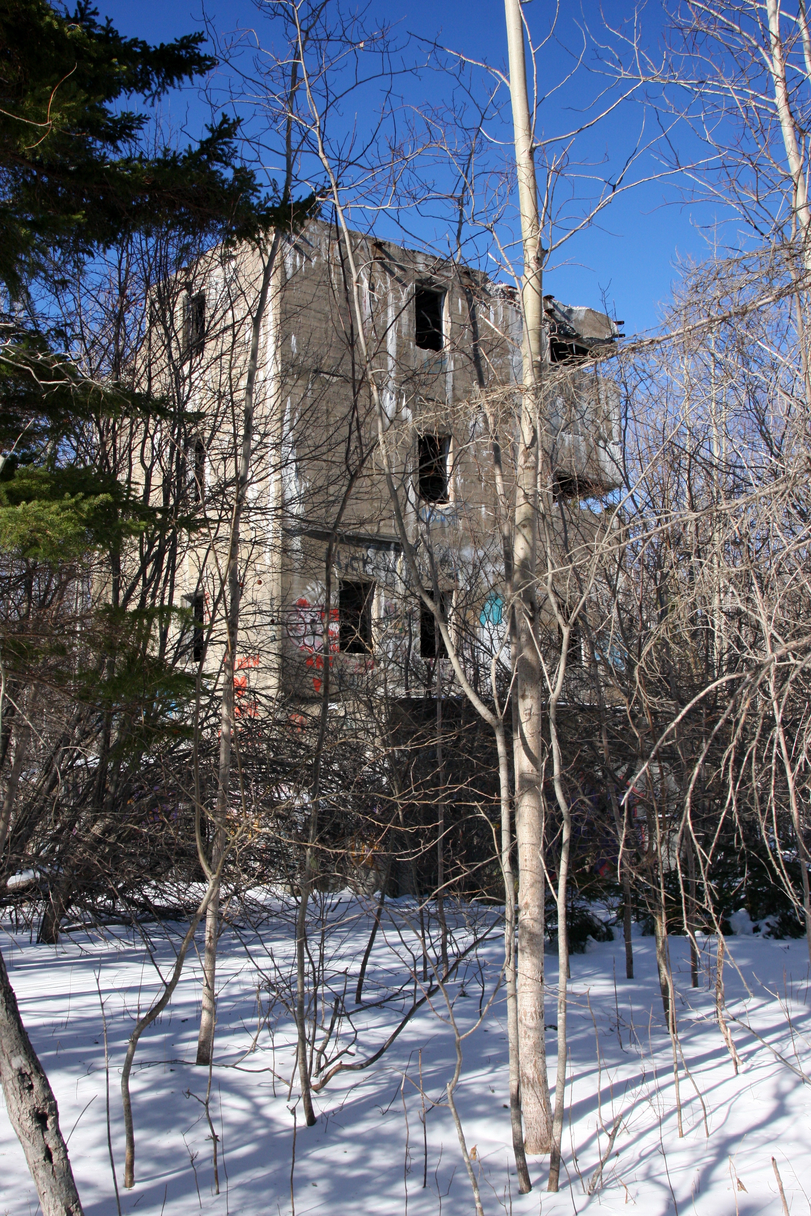
| 21:12, 7 March 2016 | 20160307 Fort Oxford Fire-Command Tower 0001.JPG (file) |  | 6.94 MB | Ken Heaton | (The Fort Oxford Fire-Control Observation Post, north-east side.) | 1 |
| 21:11, 7 March 2016 | 20160307 Fort Oxford Fire-Command Tower Side.JPG (file) |  | 7.65 MB | Ken Heaton | (The Fort Oxford Fire-Control Observation Post, camera looking north-west.) | 1 |
| 21:07, 7 March 2016 | 20160307 Fort Oxford Fire-Command Tower Panorama.JPG (file) | 13.67 MB | Ken Heaton | (Panoramic view from the roof of the Fort Oxford Fire-Control Observation Post. This view sweeps through about 180 degrees from the St Anns Bay and the highlands to the north-west, through the Cabot Strait to the north to Sydney Harbour to the south-ea...) | 1 | |
| 23:09, 6 March 2016 | Fort Lingan Aerial Photo.jpg (file) |  | 586 KB | Ken Heaton | (Fort Lingan Aerial Photo. The gun emplacements are across the top of the photograph, the barracks at the bottom left, in amoungst teh trees and teh fire control station is the "L" shaped structure toward the bottom right of the photo. The road show c...) | 1 |
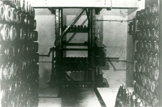
| 22:37, 6 March 2016 | Fort Lingan Magazine Elevator.jpg (file) |  | 85 KB | Ken Heaton | (Fort Lingan Magazine and Elevator. From this underground magazine at Lingan shells were delivered to the guns above ground by the ammunition hoist in the centre of the photograph.) | 1 |
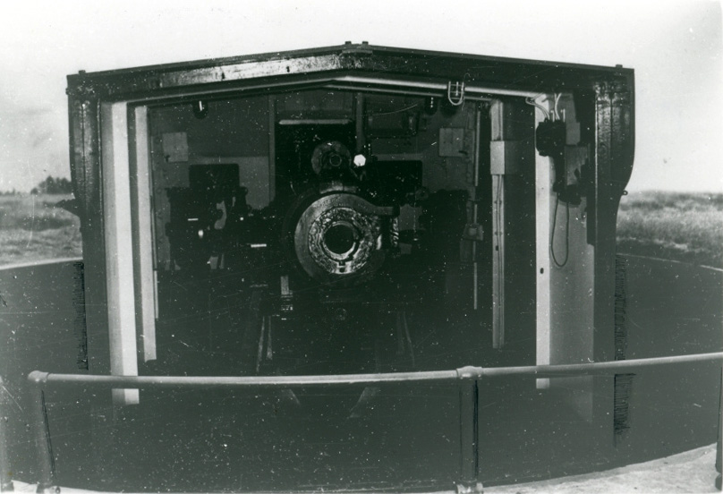
| 22:29, 6 March 2016 | Fort Lingan 6-inch Gun Breech.jpg (file) |  | 139 KB | Ken Heaton | (Fort Lingan 6-inch Mark 7 Gun with breech open 6-inch guns were one of the stalwarts of British coast defence ever since the first marks appeared during the early 1880s on a variety of barbette and disappearing carriages, but when the Mark 7 appeared ...) | 1 |
| 22:16, 6 March 2016 | Fort Lingan 6 inch High Angle Gun c1945.jpg (file) |  | 2.28 MB | Ken Heaton | (Fort Lingan 6-inch High Angle Gun ca.1945) | 1 |
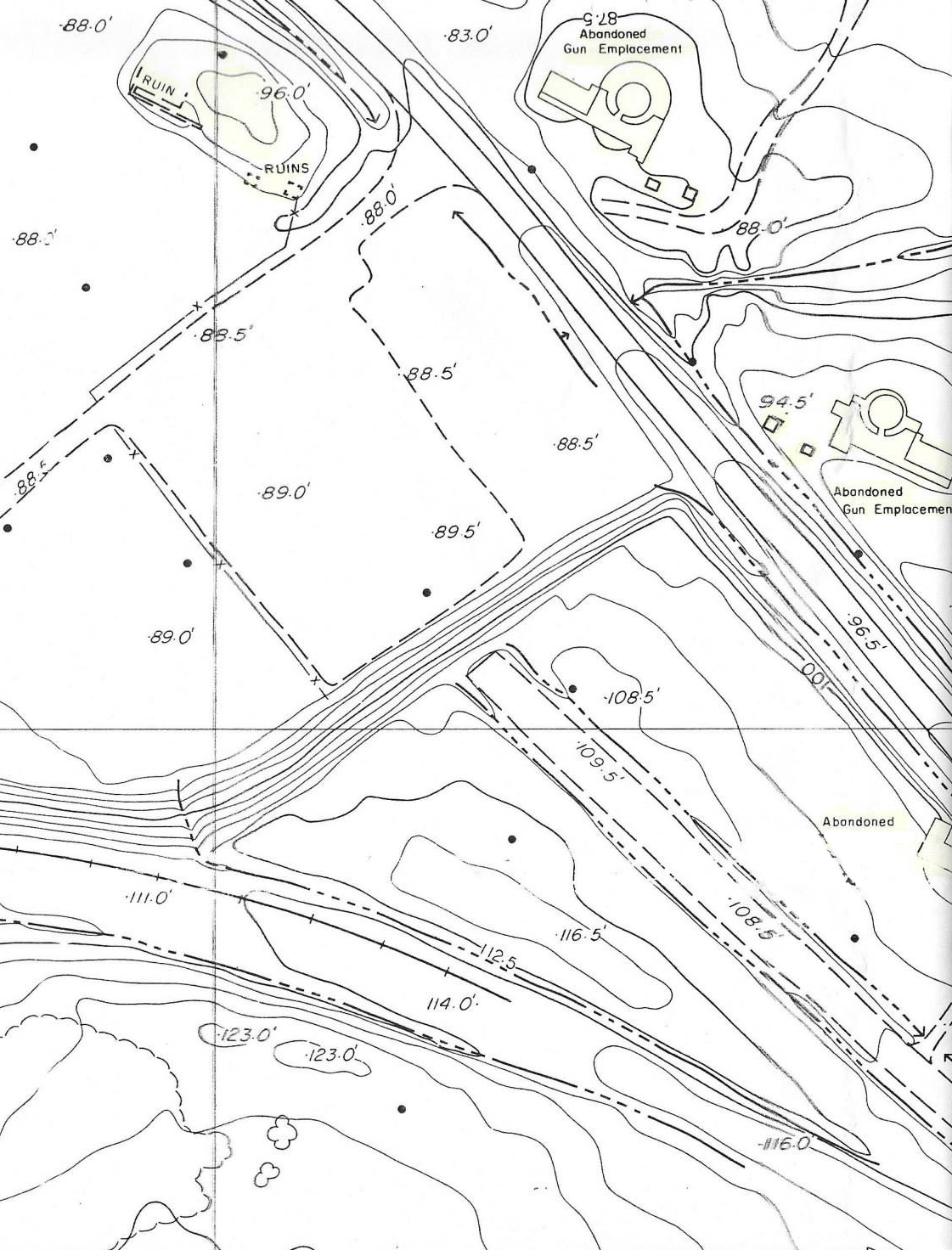
| 22:12, 6 March 2016 | Fort Lingan Site Plan.jpg (file) |  | 396 KB | Ken Heaton | (Fort Lingan Site Plan) | 1 |
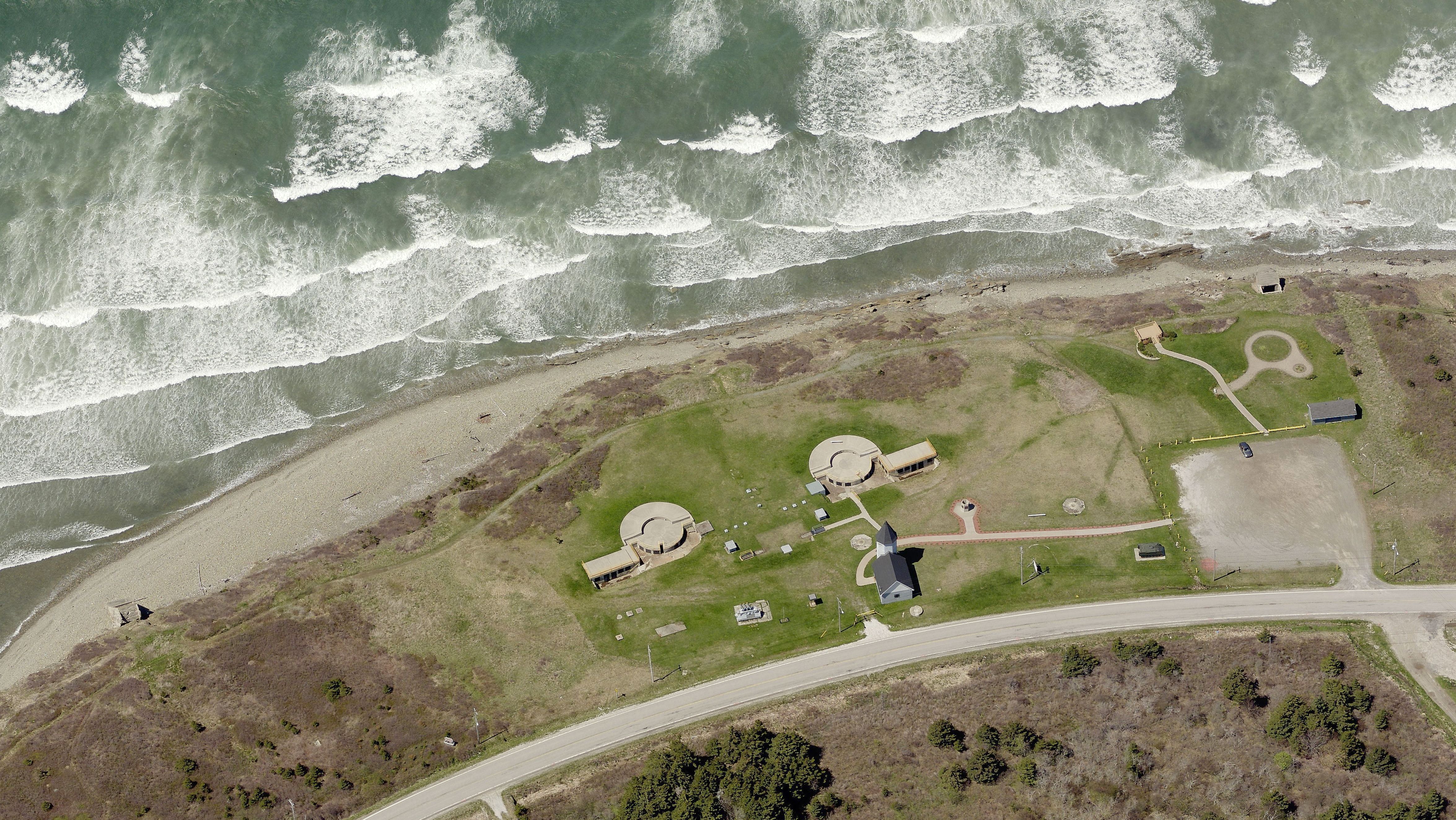
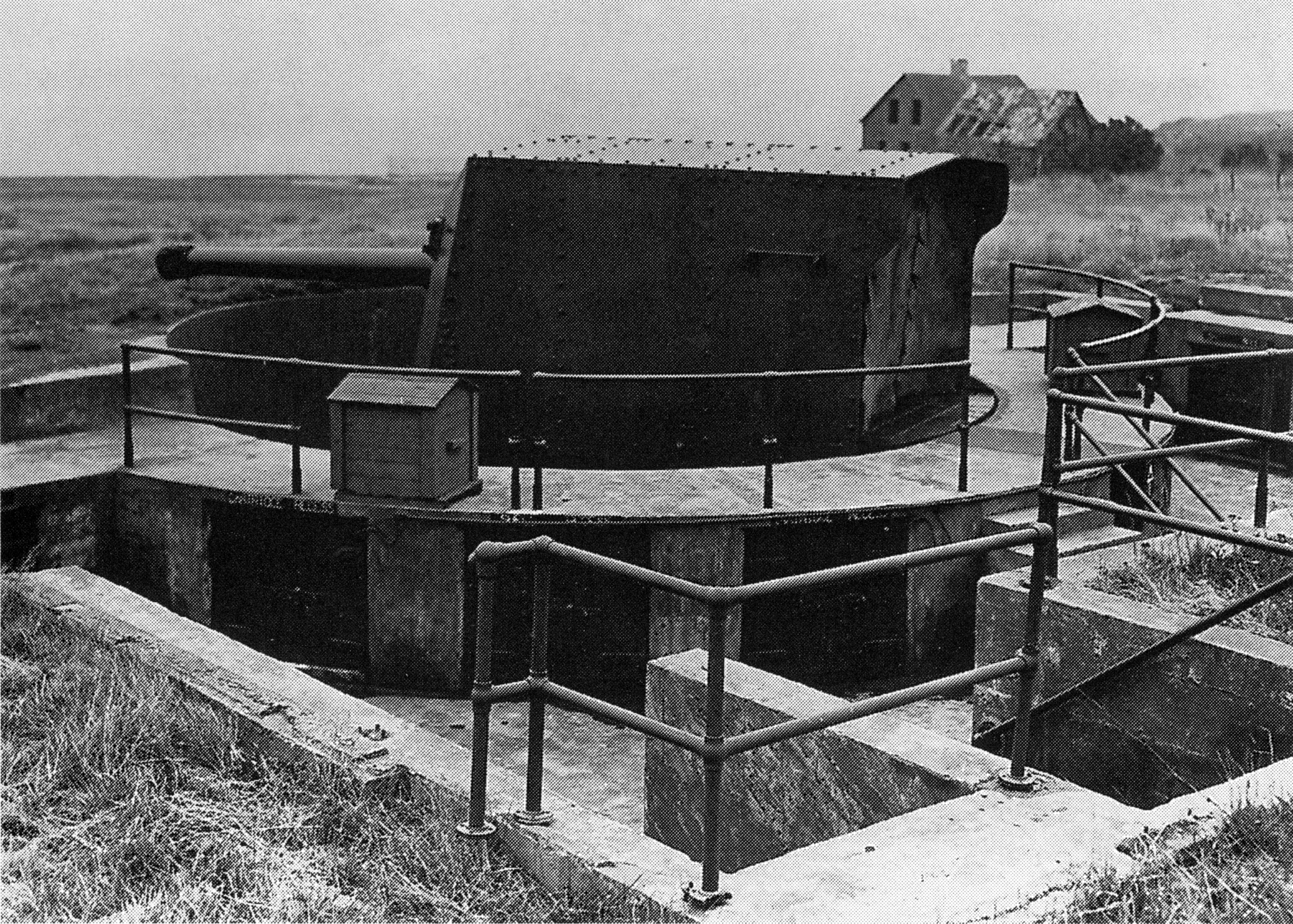
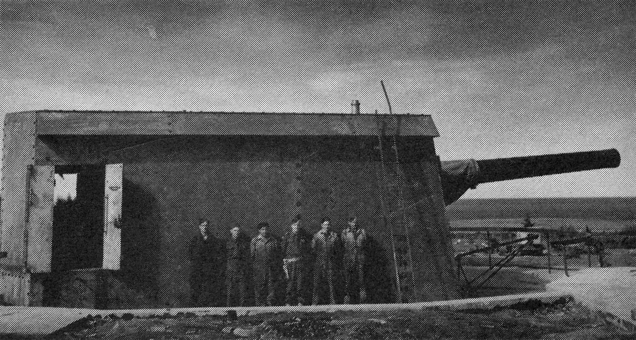
| 02:17, 6 March 2016 | Fort Oxford Gun Turret.jpg (file) |  | 1.51 MB | Ken Heaton | (Crew beside an assembled Mark XV 9.2 inch caliber coast gun of the Oxford Battery, 1944-45. This gun could fire a 380 pound shell up to 17 1/2 miles.) | 1 |
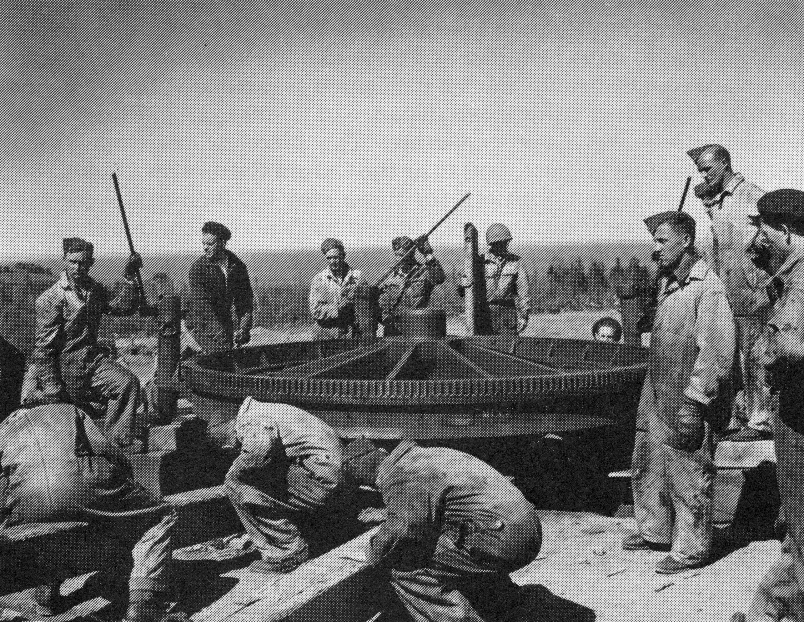
| 02:16, 6 March 2016 | Fort Oxford Gun Installation.jpg (file) |  | 2.16 MB | Ken Heaton | (Installation of the Mark IX pivot mounting for a 9.2 inch caliber gun of the Oxford Battery, probably in the summer of 1944.) | 1 |
First page |
Previous page |
Next page |
Last page |