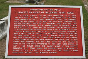
Second Texas Lunette
|
Second Texas Lunette (1862-1863) - A Confederate fortification established in 1862 as a part of the defenses of Vicksburg in Warren County, Mississippi. Named after the CSA, 2nd Texas Volunteer Infantry. Abandoned after the fall of Vicksburg in 1863.
HistoryBuilt as a crescent shaped earthworks overlooking the strategic Baldwin's Ferry Road into Vicksburg from the east. From the beginning of Union General Ulysses S. Grant's attack on Vicksburg the lunette was under heavy bombardment and attack from Union forces. The lunette defenders drove off the attackers and inflicted such heavy casualties on 22 May 1863 that the frontal attacks were abandoned in favor of mining operations underneath the lunette. The commander of the Second Texas is quoted as saying that, "along the road for more than 200 yards the bodies lay so thick that one might have walked the whole distance without touching the ground." The mining operations were not complete when Vicksburg was surrendered on 4 Jul 1863 and the lunette remained in Confederate hands until the surrender. Current StatusPart of Vicksburg National Military Park and the private Anshe Chesed Cemetery, Vicksburg, Warren County, Mississippi
Sources:
Links: Visited: 4 Dec 2009
| ||||||
