Ralston Fort
|
Ralston Fort (1755-1763) - A settler fortification probably established in 1755 near Bath, Northampton County, Pennsylvania. Named Ralston Fort after the landowner. Probably abandoned as a fortification after 1763. Alternately known as Brown's Fort.
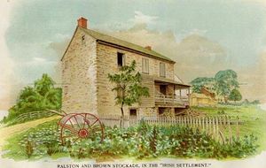
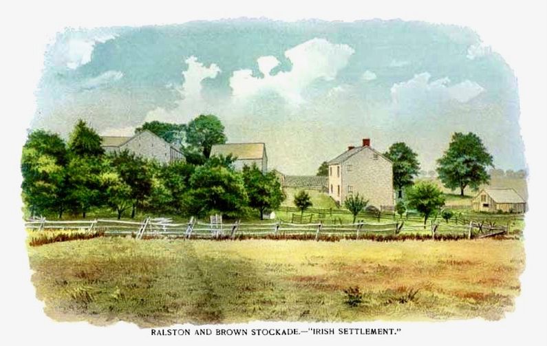
HistoryThe fort was probably built on the property of a farmer named Ralston, who's farm adjoined a farm owned by a man named Brown. There was apparently some difference of opinion on who owned the actual site and the fort assumed two names, Ralston Fort and Brown's Fort.  The origin and form of the fort are also somewhat clouded. It is probable that the origin of the fort dates back to the hostile Indian attacks in the Fall of 1755. The hostile Indian attacks of 8 Oct 1763 took place in just one day without warning and there would not have been any time to construct a stone defense. This is the same attack that impacted Fort Deshler on that same date. This 1763 attack is not attributed to a particular conflict but seems to have been the result of actions of a Lieutenant (later Captain) Jonathan Dodge, who "...committed many atrocious acts against his fellow soldiers, also against the inhabitants of Northampton County, but particularly against the Indians." The form of the fort is less clouded but still lacks clarity. It would appear from later descriptions of events that when the alarm was sounded on 8 Oct 1763, the women and children were secured in the nearby stone house and the men gathered at the "Fort". The fort is described as "...stone in foundation, 7 or 8 feet high, with logs on top of the walls extending like an overshoot barn all around, so that an Indian could not approach without being seen." and "There men awaited the enemy, the women and children were in that house, it was guarded by a detachment, and the house was pierced with loop holes to fire through." The fort location was described as "About fifty yards south of the house ... was the breastwork...". The majority of the pictures proporting to show the fort or the stockade really depict that two story stone house which stood for many years after the fort was disassembled. The form of the fort is variously described as a fort, a blockhouse, a breastwork or a stockade. Probably abandoned as a fortification after 1763 and disassembled some years later.
Current StatusNothing remains and no marker could be found commemorating the site. Some sources indicate that the site is near the modern intersection of Airport Road and Pennsylvania Route 329 and that is where the map point is set.
See Also: Sources: Links: Visited: No
| ||||||
