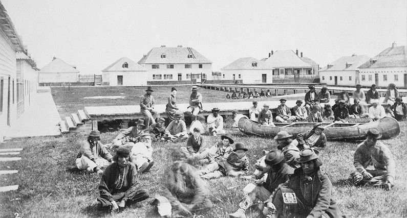
Norway House
|
Norway House (1814-1939) - A Hudson's Bay Company fur trading post, depot and fort first established on the Nelson River in 1826 at present day Norway House, Manitoba. Named after Norwegian axemen who opened up a land route from York Factory at Hudson Bay. Abandoned in 1939.
Norway House I (1814-1826)In 1816 Lord Selkirk sent out a band of Norwegians to build a road from York Factory to Lake Winnipeg and a series of supply posts along the route. They built Norway House at Mossy Point (west side of outflow) in 1817 replacing the former Jack River Post at that location. HBC Governor Simpson traveled through Norway House to the Columbia District in 1824-1825. He found a quicker route than previously used, following the Saskatchewan River and over the mountains at Athabasca Pass. This route was then used by the York Factory Express brigades who also passed through Norway House. In 1825 or 1826 much of the post was destroyed by fire. In 1826 the company abandoned its position on Mossy Point in favour of its present position on the Nelson River. Norway House II (1826-1939)Relocated up the Nelson River in 1826 to present site between Lake Winnipeg and James Bay. Treaty No. 5 was signed here in 1875. Current StatusPart of Manitoba Provincial Heritage Site No. 12 in Norway House, Manitoba. Three structures remain, the Archway Warehouse, Jail and Powder Magazine. 1) The Archway Warehouse, built in l840–l84l, is the oldest surviving Red River frame warehouse in western Canada and is Manitoba's oldest log edifice on its original site. 2) The Jail, erected in l855–56, is the oldest extant lockup in the province as evidence by the 1855 date chiseled above the doorway. Earlier wooden structures at Upper Fort Garry and York Factory have been demolished. 3) The Powder Magazine erected in l837–38, was the first structure built of stone in Manitoba. It is now in ruins but the stonework can still be seen.
See Also: Sources:
Links:
Visited: No | ||||||
