Northeast Cape Air Force Station
|
Northeast Cape Air Force Station (1953-1969) - A Cold War U.S. Air Force Station, part of the Alaska AC&W Radar Network. Initially functioned as an Early Warning radar site, with a Permanent System ID of F-09. Located on Saint Lawrence Island in the Bering Sea, just south of the Bering Strait. Closed in 1969.
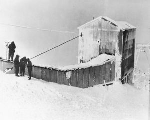
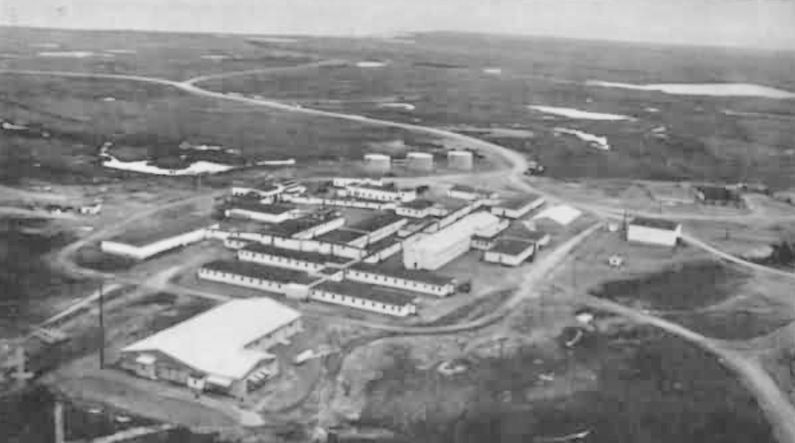
HistoryA contract for construction of the radar site was awarded in January 1951 and construction began on a split site with a lower cantonment area and an upper main site. Detachment F-9 of the 142nd ACWS, ANG, provided security for the unfinished site late in 1951. Construction was completed and the site became operational in December 1952. The Northeast Cape Air Force Station was then manned by the 712th AC&W Squadron which had been activated in December 1952 to operate and maintain the site. Initial radar equipment on the upper site included a FPS-3 (SN #17) search radar. The FPS-3 radar was upgraded to a FPS-20A search radar in 1963. IFF/SIF equipment was UPX-7. Radar scopes included OA-99s and later UPA-35s. In 1965 the FYQ-9 Semiautomatic Data Processing and Display System was implemented on Alaska AC&W radar sites automating the passing of track data to the direction centers. The result was reduced manpower requirements and increased efficiency. The Northeast Cape AFS was closed in Sep-Oct 1969 and the 712th AC&W Squadron was deactivated. Operation of the site was transferred to the White Alice Communications System (WACS) contractor who had been co-located with the AC&W Radar Site. The site was finally abandoned in 1974. Physical Plant The physical plant of Northeast Cape AFS was originally divided into an upper main site and a lower cantonment site. The upper main site housed the radar towers, backup generators, communications sites and crew quarters. The cantonment area housed the lower operations area, the enlisted quarters (BAQ), the bachelor officer's quarters (BOQ), the orderly room, the dining hall, recreation facilities, and other support areas. A small airstrip provided facilities for fixed wing aircraft and helicopters. Most of the buildings on the lower site were originally wood frame construction except for the powerhouse and the majority of them were connected by enclosed weather proofed walkways. This made it possible to wear normal uniforms in most of the areas. The upper and lower sites were connected by an overhead tramway and a road that was sometimes impassable during the winter. Primary electrical power for the upper site was furnished by the primary power plant on the lower site. Radar video was sent to the lower operations area via commercial Western Electric video transmission equipment. No family housing was provided as this was considered a remote unaccompanied tour (1 year). Annual bulk supply shipments were made during the summer months under the Mona Lisa and later the Cool Barge programs. Airlift of supplies, mail and personnel was available year-round, weather providing.
Air-Ground Radio CommunicationsSeparate radio facilities housed the radio equipment for communicating with aircraft. Northeast Cape White Alice Communications SiteAfter HF radio systems proved inadequate for command and control communications, the Air Force implemented the White Alice Communications System (WACS). This was a system of tropospheric scatter and microwave radio relay sites constructed during the mid-1950s to provide reliable communications to Alaska Air Command (AAC) AC&W system. The Northeast Cape WACS linked to Anvil Mountain (126 miles) east and to Tin City (161 miles). Two pairs of 60' tropo billboard antennas were used. The site was constructed in 1957 and went operational on 17 Feb 1958. The equipment and power building was 5,280 square-foot and POL storage was a single 500 barrel tank. This WACS site was co-located with the Northeast Cape AC&W site and shared support facilities with them. The AC&W site closed in 1969 and thereafter the WACS site served as a link between Tin City and Anvil Mountain and provided its own support under contractor operation. The specific links from Northeast Cape (OHC), both deactivated by 1972:
The Northeast Cape White Alice tropo site was inactivated in 1972. A pair of transportable 30' tropo dish antennas was added at Anvil Mountain WACS and a second pair at Tin City WACS to bypass their links to Northeast Cape when it closed in 1972.
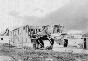
Current Status Most of the old AC&W site buildings have been demolished. The site has also had an environmental remediation project that has further erased signs of the old AC&W site and the White Alice tropo site.
See Also: Sources:
Links:
Visited: No
| ||||||||||||||||||
