Mission Ysleta
|
Mission Ysleta (1680-1848) - A Spanish colonial mission established in 1680 in present day El Paso, El Paso County, Texas. Abandoned as a mission in 1848. Also known as Mission de Corpus Christi de la Ysleta and Mission de San Antonio de la Ysleta.
Mission Ysleta HistoryEstablished in October 1680 by Spanish Colonial Governor Don Antonio de Otermin and Tigua Indians from Ysleta, New Mexico, who had fled the Pueblo Revolt of 1680 and relocated to the area south of present day El Paso, Texas. By 1682, the Tigua Indans had built a chapel made of mud, log and willow reeds and Ysleta Mission's first Mass was celebrated there on 12 Oct 1680. By 1691 the mission had an adobe church and in 1692 Governor Diego de Vargas bestowed a formal land grant to the mission community. The flood of 1740 destroyed the progress but it was all rebuilt by 1744. The mission church was constructed of sun dried adobe brick mostly by the Tigua Indians supervised by Franciscan priests. The church was built in the shape of the cross with the adobe walls covered with white stucco. The church at Ysleta faced east toward rising sun in accordance with Tigua Indian and Christian traditions. Originally the missions provided a structured community with lands surrounding the mission itself supporting the inhabitants. The Spanish colonial government provided some support and monies to keep the missions going. The nearby Presidio San Elizario was built in 1773 to provided a military garrison for protection against hostile Apache Indians and bandits. When necessary, a small number of soldiers might be stationed at the mission. The mission itself was built as a fort with a strong adobe wall enclosed the church and the large patio. The necessity for military fortifications was demonstrated by the losses in the province for the years 1771-1778:
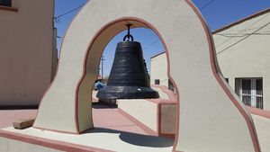
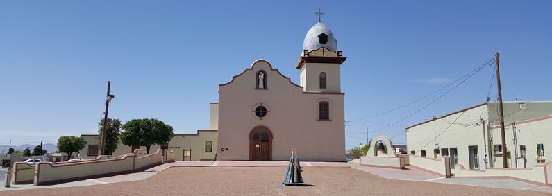
In the late 1790s a process of secularization began in which the mission lands were to be divided up amongst the inhabitants and the role of church was reduced to providing for the spiritual needs of the community. The Mexican War of Independence ended Spanish colonial government support of the missions, drove off the Spanish priests and by the late 1820s had reduced the missions to small enclaves surrounding the churches themselves. The Mexican Government maintained jurisdiction for some 20 years and some of the churches were abandoned during this period. Another devastating flood in 1829 changed the river's course and set Ysleta and the neighboring Socorro and San Elizario on the north bank. The 1744 mission was heavily damaged and before it could be rebuilt the Mexican War made the area a part of the United States. The Mexican War (1846-1848) and the Treaty of Guadalupe Hidalgo (2 Feb 1848) brought the missions on the east bank of the Rio Grande River around El Paso under United States jurisdiction and effectively completed the secularization process. The first American Flag probably arrived in Ysleta in 1846. Some of the land claims of the missions and churches in the annexed territory were not settled until the end of the U.S. Civil War (1865). Once the land claims were settled, the missions came under American church control with no support or restriction from the U.S. Government.  The church’s traditional Spanish architecture was changed in 1891 to include a new facade and a dome shaped bell tower. That bell tower was destroyed by a chemical fire in 1907. The 1908 reconstruction pulled together some of the more tradional element with the new bell tower,

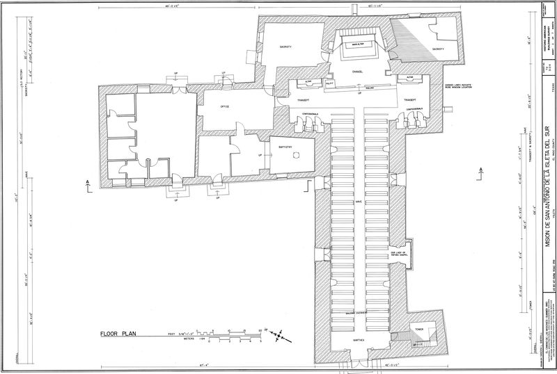
Current StatusThe Socorro Mission is part of the El Camino Real de Tierra Adentro National Historic Trail and has been documented by the Historic American Buildings Survey (HABS). The church is undergoing a renovation at the time of our visit.
See Also: Sources:
Visited: 26 Mar 2016
| |||||||


