John Grant's Station
|
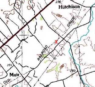
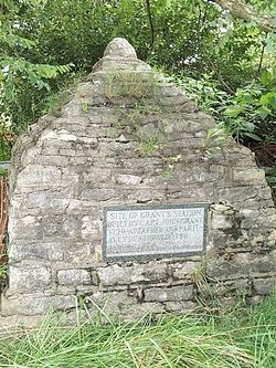
HistoryThe station was intended for 20-30 families then crowded into Bryant's Station (Drake 1942). It was attacked and burned in June of 1780 by 60 Indians, during which two men named Stucker and a woman named Mitchell were killed. This attack was by a group which splintered off from Byrd's large war party after Martin's and Ruddle's Stations were taken. The Indian attack led to its abandonment in 1780, but it was rebuilt by Grant in 1784 (Dunn 1945; Ardery 1939). The Grants sold the Bourbon County property in the late 1780s and 1790s. John Grant listed the following inhabitants in a letter to Col. John Todd dated 24 Apr 1780 (Drake 1942). They included John Tamplin, John Jackson, John Van Cleave and his son John, George Stucker and his son George, Samson Culpepper, Stufel Stucker, Philip Drake, Christopher Harris, William Van Cleave, Manoah Singleton, Thomas Gilbert, William Liley, William Loring, Robert Harras, James Rowland, Josiah Underwood, Frederick Hunter, William Morrason, James Gray, Henry Miller, Stephen Murphy, Michael Stucker, Edmond Lilley, Samson Hough, William Ellis and six others he would not "properly call effective". George Summitt, who later built Summitt's Station in Nicholas County, lived at Grant's Station in 1780. Current StatusThe station site itself (designated 15Bb76) is located at the head of a small tributary of Houston fork approximately six hundred feet northwest of present Bryan Station Road. It is marked by a pyramidal stone monument placed there by the Martin's Fort Chapter of the Children of the American Revolution (C.A.R.). A spring which has been partially walled provides a source for the small tributary which flows to the northeast from the station. The 1784 house stood to the west of the spring and run.
See Also: Sources:
Links: Visited: No | ||||||

