Fort Wyman
| More information at Warlike, Wikidata, Wikipedia
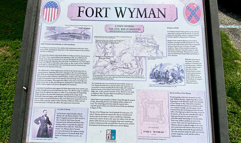
HistoryEstablished in 1861 by the 13th Illinois Infantry as one of two named forts guarding the critical railhead at Rolla, Missouri. Rolla was the primary forward supply depot for the Union armies in southern Missouri and northern Arkansas throughout the war. Union forces first seized the town on 14 Jun 1861 and held it throughout the war. Tons of war material, food, and forage passed from arriving trains into warehouses and then onto long trains of wagons headed for troops in the field and in fixed installations. Fort Wyman itself was built as a standard 300-foot square redoubt designed for use as a gun platform surrounded by a 6-foot deep ditch and 10 foot high earthworks. There were two blockhouses built on opposing corners to provide protection for riflemen and artillery pieces protecting the redoubt walls. The only structures inside the redoubt were a powder magazine, a well, and artillery emplacements. Scale drawings were made of Fort Wyman in 1865 by Captain William Hoelcke and his plan of the fort is reproduced on a readerboard at the old Phelps County Courthouse and here. The operations at Rolla had grown significant enough to warrant a second fort to be built on the north side of town in 1863. This fort was named Fort Dette after Captain John F. W. Dette, the officer who supervised the construction. This second fort was located on the present-day campus of the Missouri University of Science and Technology Rolla. U.S. troops remained in the Rolla area until the U.S. property was removed and the post at Rolla was abolished in August 1865 Current StatusThe outline of Fort Wyman was visible from the air into the 1990s but development since then has removed all visible traces.
See Also: Sources:
Links:
Visited: 21 Jul 2021
| |||||||
