Fort St. Leon
|
History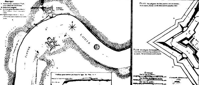 French Fort St. Leon (1746-1766)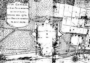 As early as 1722 Bienville may have established unnamed batteries and a warehouse at English Turn. In 1746 construction begins on two English Turn batteries and forts, one set on each bank. In 1747 formal plans are drawn for two Forts and two batteries. In 1748 the batteries are damaged by strong winds and then repaired. On 12 Apr 1749 a drawing of the fort indicates upriver side of the great battery unfinished, The garrison may have left before the end of that year By 24 Apr 1752, an inventory of artillery in Louisiana showed the two forts at English Turn to be the most heavily armed posts in French Louisiana with some 30 18-pounder cannons and 1247 pieces of 18 pound shot along with 12 cannons of smaller size. By the fall of 1752, the two forts have 4 companies, some 200 men at the two forts with a common commander. In 1754 the French & Indian War began between the French & the British. The start of the war (undeclared until 1756) found the English Turn Forts and Batteries in poor shape because of the earlier decision not to use masonry to face them. In October 1755 the battery rebuilding was was well along and for the first time, the fort is referred to as Fort St. Leon. French Canada fell to the British in 1760 and France ceded New Orleans and lands west of the Mississippi River to Spain to keep them out of British. In 1763, at the Treaty of Paris, England received Canada and everything France owned on the left (descending) bank of the river except the town of New Orleans and the island where it stood. A British spy reported in 1765 nineteen guns at Fort St. Leon and twenty-one guns at Fort St. Mary.
Spanish Fort St. Leon (1766-1803)The Spanish did not send a governor to Louisiana until 1766 and while there were discussions about the fortifications at English Turn little was done to restore them. In 1773 another British spy reported the batteries in ruins and that they had formerly consisted of
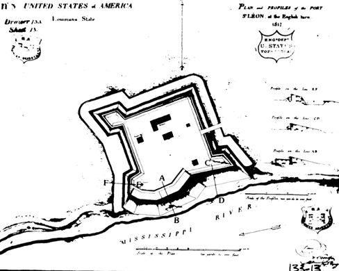
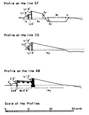
Louisiana was retroceded to France in 1800 and the transfer of the colony from Spain to France took place on 30 Nov 1803. On 20 Dec 1803, the colony was transferred to the United States, a result of the Louisiana Purchase. American Fort St. Leon (1809-1817)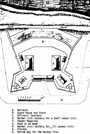 In 1807-1808 new concerns over a possible war with Great Britain, prompted President Thomas Jefferson to renew fortification programs; the resulting program came to be known as the Second System of coastal fortifications. The only fortification in Louisiana directly funded by this program was the downriver Fort St. Philip (not completed until 1810). An American Fort St. Leon at English Turn was likely envisioned as a backup should Fort St. Philip not hold any enemy. The American Period at the site of old Fort St. Leon began with a new fort in the process of being erected at English Turn in December 1807. Engineer Captain William K. Armistead reported to the War Department that the site was very commanding requiring any ship to pause at the entrance of English Turn until the wind would change so as to carry the ship through. A fort plan drawn in 1809 indicated that the fort was intended to have nine guns, a magazine, and barracks for one company. On 18 Oct 1809, Major William McRae, Director of Fortifications, transmitted the "Plan of the Fort at the English Turn". It shows a battery of three angles for cannon, facing the river and behind the levee, with two full bastions at the rear. The salient point of each bastion is fitted for a cannon. Seven buildings are located within the fort. The fort was likely still under construction when it was damaged by the hurricane of August 1812. With war declared in 1812, the fort was likely re-built but the configuration is unknown. The original plan described a small fort measuring 160 feet maximum length without the rear bastions, and 212 feet maximum width measured along the levee front. It stood behind a levee about 45 feet from the water's edge. Official records refer to "a battery of masonry." Two barracks buildings 45 feet by 25 feet could have housed a garrison of 30 to 40 enlisted men. Each of the barracks had a kitchen. The officer's quarters could house about 6 persons. A powder magazine, a guardhouse, and a store are also on the plan, as well as a raised way for musket fire. A ditch is not mentioned.
1813 Fort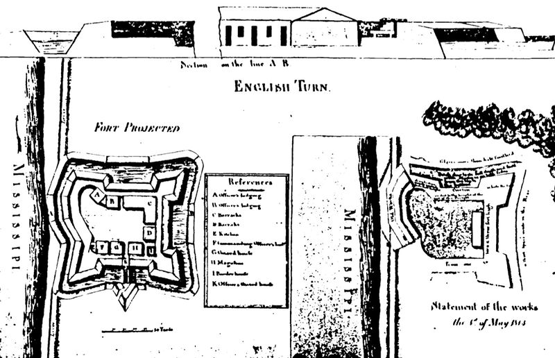 A & B Officers Lodging, C & D Barracks, E kitchen, F Commanding Officers House, G Guard House?, H Magazine?, I Powder ??, K Officer's ?? There is little other architectural information on this building period or how much the fort was damaged in the hurricane. By the time the fort was being rebuilt from the hurricane damage, additional land had been purchased. Progress was halted in 1813. An increasing British threat in November 1814 caused repairs to resume, only to be abandoned late in December. On 4 Jan 1815, Captain James H. Gordon was given command of Fort St. Leon and ordered to put the fort in a defensible status by 18 Jan 1815 (14 days). He mounted two cannons and erected a hotshot furnace. Some 235 men were at the fort involved in making it defensible. The reason for the hurried preparations was that the attempted British invasion of New Orleans had begun and down the river Fort St. Philip was being bombarded by five British ships for nine days. Fort St. Philip withstood the bombardment and the British ships did not pass. Over 1000 shells were fired at the Fort St. Philip but the 366 man garrison suffered only two dead and seven wounded. Had the British ships succeeded in breaking through, Fort St. Leon would have been tested next and with only two guns it probably would have not been able to stop five British warships.
1817 Fort
1862 FortificationThere is some indication that the fort site was bombarded and destroyed by Admiral Farragut in 1862 during his Civil War advance up the Mississippi River. Current Status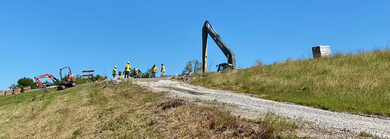 Archeological site 16PL35 only. Louisiana marker Marker #LA-LL-1, Fort St. Leon is supposed to be located on River Road but could not be spotted on satellite images or by an On-Site Visit.
See Also: Sources:
Links: Visited: 30 Sep 2020
|
