Fort Prince Charles
| More information at Warlike, Wikidata, Wikipedia
Fort Prince Charles (1776-1779) - A Patriot Revolutionary War fortification established as Fort No. 9 in 1776 in New York City, New York County, New York. Captured by the British in 1776 and held by them until 1779. Renamed Fort Prince Charles after British Prince Charles in 1777. Destroyed and abandoned by the British in 1779. Also known as Charles Redoubt.
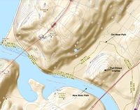
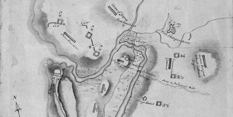
History of Fort Prince CharlesA Patriot Revolutionary War fortification first established as Fort No. 9 in 1776 in present day New York City. Initially constructed as an earthen redoubt. Captured by the British in the 16 Nov 1776 battle for Fort Washington and held by them until the fall of 1779. The British renamed Fort No. 9 as Fort Prince Charles after British Prince Charles. Occupied by Hessian troops who reconstructed and improved the fortifications. In 1779 the British constricted their outer defense line to shift manpower to other locations and many of the outposts were destroyed and abandoned. Fort Prince Charles was abandoned and destroyed by the British in 1779 as a part of this consolidation. Current StatusNo remains. Said to be located on Marble Hill, at Fort Charles (Corlear) Place and Kingsbridge Avenue. Marker located at St. Stephen United Methodist Church, 146 West 228th Street at Marble Hill Avenue, Bronx, N.Y. (not verified).  Note: In Revolutionary War times this fort was located below the south bank of the Harlem River but in modern times it is located above the north bank of the river. The construction of the 1895 ship canal bypass and in-filling of the old river bed in 1914 caused Marble Hill to be shifted from Manhattan Island to the Bronx side of the river. The original path of the Harlem River/Spuyten Duyvil Creek is still reflected in the northern boundary of New York County (Manhattan).
See Also: Sources:
Links: Visited: No
| ||||||
