Fort Mackinac
| More information at Warlike, Wikidata, Wikipedia
Fort Mackinac (1780-1895) - First established in 1780 by British troops during the Revolutionary War on Mackanic Island in present day Mackinac County, Michigan. Twice returned to United States control by treaties that ended the Revolutionary War and the War of 1812. Designated a National Park in 1875 and garrisoned by U.S. Army troops to protect it until it was turned over to the State of Michigan in 1895.
Revolutionary War (1775-1783) Fort Mackinac was constructed on Mackinac Island by British forces under Major Patrick Sinclair after the decision to abandon Fort Michilimackinac (2) on the mainland. The chosen site was a 150' high limestone bluff on the southeast end of the island. The British Government did not surrender their Great Lakes forts when the war ended in 1783 with the Treaty of Paris. It took theJay Treaty of 1796 to settle the issue of the Great Lakes Forts. In the interim the British fur trade flourished. With the issue finally settled, American troops occupied Fort Mackinac on 1 Sep 1796 under the command of Major Henry Burbeck.
War of 1812 (1812-1814)   At the start of the War of 1812 in June 1812, Fort Mackinac was garrisoned with about 60 men under the command of Lt. Porter Hanks. On 17 July 1812, a force of British troops and their Indian allies landed on the northern end of the Mackinac Island and surprised the American garrison which promptly surrendered. The British then built Fort George at the highest point on the island overlooking Fort Mackinac, anticipating an American attempt to retake the island. Just two years later, in July 1814, an American squadron of five ships landed a force of about seven hundred men on the north side of the island and attempted to assault Fort George. The assault failed and the defeated American forces retreated back to their ships and sailed off. The war ended in December 1814 with the Treaty of Ghent and the Americans reoccupied the Island in July 1815. Fort George was renamed Fort Holmes after Major Andrew Holmes who was killed in 1814 assault of Fort George. In the post war years, Fort Mackinac and Fort Holmes were used as staging points for troops headed elsewhere and that sometimes left the post almost unoccupied. The Mexican-American War and the U.S. Civil War saw little military activity on the island and much of the time only an ordnance sergeant cared for the post. In 1875 the post was designated Mackinac National Park, only the second National Park in the country. This designation brought troops to the park just as it had in Yellowstone National Park, the first National Park. The troops not only protected the park but also functioned as park rangers for visitors. Unlike Yellowstone, Congress closed the fort and the park in 1895 and turned it over to the State of Michigan. Michigan then created their first State Park from the properties.
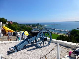
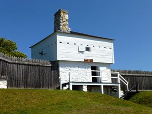
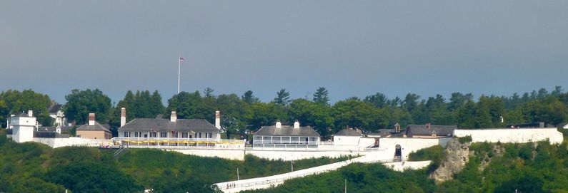
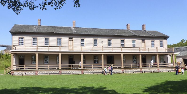
Current Status 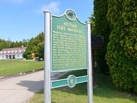 Must See! Part of Mackinac State Park, Mackinac Island, Mackinac County, Michigan. A very complete example of a Revolutionary War fort. Fourteen original buildings remain including the North, East, and West Blockhouses, Commissary Building, Post Headquarters, Quartermaster's Storehouse, Bathhouse, Soldiers Barracks, Schoolhouse, Hill Quarters, Hospital, Officer's Stone Quarters, Wood Quarters and Guardhouse. Island access is by commercial ferry from St. Ignace harbor, roundtrip fare is about $25 per adult. There is an additional $11 entrance fee to the fort. There are no autos on the island and transportation there is provided by commercial bike rental companies and commercial horse drawn carriages/conveyances. The horse drawn conveyance tours offer the easiest way to get an overview of this extraordinary island but they do have a limited number of stops and it may be difficult to get good photos. The tours do stop at the fort and you can spend as much time there as you want. The best deal for non-bike riders is to purchase a package at the ferry terminal that includes the roundtrip fare, fort access and the horse drawn tour, that costs about $56 per adult. Buy the $2 visitor guide sold on the ferry and on the island, it is outstanding.
See Also: Recent Blog Posts: Sources:
Visited: 26 Aug 2013 Fort Mackinac Picture Gallery
| |||||||||
