Fort Johnston (2)
| More information at Warlike, Wikidata, Wikipedia
Fort Johnston (2) (1748-1891, 1955-2005) - Originally established as a colonial fort in 1748 in Southport, Brunswick County, North Carolina. Named for the then colonial Governor of North Carolina, Gabriel Johnston (1734-1752). The original fort was destroyed during the Revolutionary War but was rebuilt as a Second System coastal defense fort in time for the War of 1812. Confederates seized the fort at the beginning of U.S. Civil War but it was retaken by Union forces in 1865. Abandoned in 1881 but used by federal agencies until 2005. Also known as Fort Pender, Johnston's Fort and Fort Branch (1) at various times.
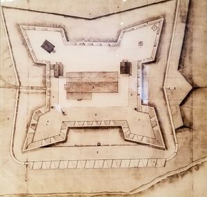
Colonial Period (1630-1775)Construction on Johnston's Fort began in 1748 and was declared complete in 1749 but some construction continued into the 1750s. The post was garrisoned by just a few dozen North Carolina militia soldiers. Revolutionary War (1775-1783)During the Revolutionary War the British Governor of North Carolina abandoned the fort, removed the cannons and supplies and fled aboard a British warship. American revolutionaries destroyed the fort. In 1778 the General Assembly appropriated money to rebuild the fort and in the back and forth of the war, it was destroyed again. After the war what remained of the fort deteriorated further. First System (1794-1808)Fort Johnston was selected as one of the original sixteen coastal forts to be included in the Federal First System coastal defense plan. The State of North Carolina ceded the property to the Federal Government in 1794. Construction began in July 1794 but progressed slowly. Lieutenant Joseph G. Swift supervised the construction of Fort Johnston from 1804 to 1807. Second System (1808-1816) By the time President Thomas Jefferson initiated a new coastal fortification construction program known as the Second System in 1808, Fort Johnston was already in dilapidated condition. Major Joseph G. Swift was the superintending engineer assigned to built the Second System forts in Georgia and the Carolinas 1809-1812. During an 1810 inspection, the fort was still in a dilapidated condition. It is likely that the design and construction of Fort Johnston was similar to that of Fort Hampton (1) at Beaufort Inlet because of limited funding and because they shared the same supervising engineers. Fort Johnston was a small horseshoe-shaped structure with a two-story brick barracks and a brick magazine along the back. The structure was 122 feet wide and 93 feet deep. The rounded parapet was a concrete-like material made with sea shells, sand, and water called tabby.
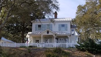
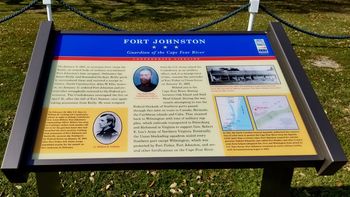
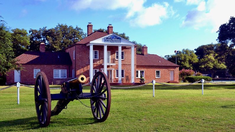
U.S. Civil War (1861-1865)The fort was seized by Confederate forces in April 1861 at the beginning of the U.S. Civil War and it became an earthworks fort, mounting four guns. The post was renamed Fort Branch in 1863 and Fort Pender in 1864. The Union captured the fort in January 1865 and held it through the end of the war, the name reverted to Fort Johnston. Fort Johnston was deactivated as a seacoast defense post on 21 Feb 1881. In the following years, the post had a number of Federal tenants including the Weather Bureau, the Signal Corps, the Corps of Engineers and finally a Military Ocean Terminal. The post finally closed in 2004 and is now the North Carolina Maritime Museum. Current StatusFort Johnston was turned over to the City of Southport, NC in 2006. It is now The Fort Johnston-Southport Museum and Visitors Center. The only building remaining at the original site is the 1810 Garrison House. Three other fort buildings still exist in town but have been moved from their original sites. The circa 1852-1860 Hospital building is located at 413 East Bay Street. Three historic markers located in front of the site. The two other buildings are located at 120 West West Street, and at 216 North Atlantic Ave.
Sources:
Links:
Visited: 16 Mar 2018
| ||||||


