Fort Johnson (9)
|
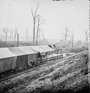
Johnsonville Supply Depot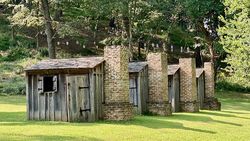 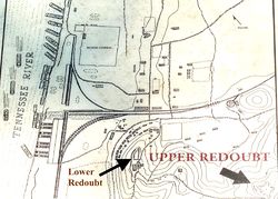 In 1863 an extension of the Nashville & Northwestern Railroad to the new Johnsonville Union Supply Depot on the eastern bank of the Tennessee River created a depot with river and rail access vital to Union operations in the area. To protect the depot and the supply lines Union forces constructed Fort Johnson at the depot in 1863. Initially, Fort Johnson included a small earthworks redoubt, with surrounding protective rifle pits.
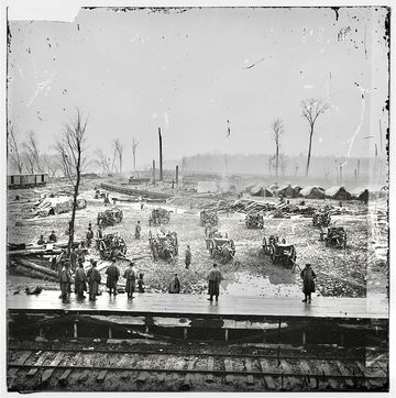
Lower Redoubt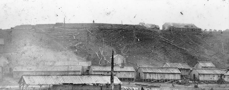 The original Redoubt was situated on a ridge directly behind and above the supply depot warehouses. Elements of the 12th and 13th U.S. Colored Troops under Colonel John A. Hottenstein and contraband labor constructed the Lower Redoubt between May and the first week of November 1864 after completion of the Nashville and Northwestern Railroad from Kingston Springs in Cheatham County to Johnsonville. When completed this redoubt and its surrounding rifle pits were manned by both black and white infantry and artillery units. The Lower Redoubt was an irregularly shaped work with one bastion. It measured approximately 210 feet by 100 feet. These earthworks were built five to six feet high and reinforced with stones or logs. Interior ditches allowed soldiers to stand and be protected by the earthen walls while outer ditches made scaling the earthwork more difficult. Ten field guns were positioned near the lower redoubt and several can be seen on the far right of the photo above. The weaknesses of this particular redoubt included too low an elevation and a flawed orientation that did not allow complete coverage of approaches to the depot.
Battle of Johnsonville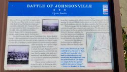 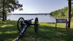 Confederate General Nathan B. Forrest attacked the depot on 4 Nov 1864, shelling the depot and the depot artillery positions from hidden positions across the Tennessee River. Union Colonel Charles R. Thompson ordered all supply vessels at the depot set on fire to prevent their capture. The flames from the burning ships spread to the depot and to the supplies stored ashore with losses in the millions of dollars. Confederate forces withdrew without actually taking the depot but the damage had been done. Forrest described the Union losses as 4 gunboats, 14 transports, 20 barges, 26 pieces of artillery, $6,700,000 worth of property, and 150 prisoners. Union estimate of the monetary loss was lower, 1 to 2 Million dollars. After the Battle of Johnsonville Major General John M. Schofield, (Cullum 1585) was dispatched to Johnsonville with two battalions of troops to repair the damage and strengthen the defenses. Key to the improvement of the defenses was the construction of an upper redoubt with the ability to cover the whole Depot as well as the approaches and attacks from across the river.
Upper Redoubt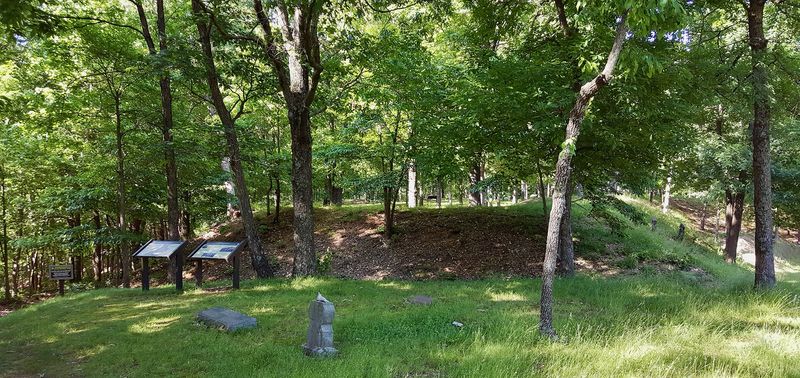 Established after the battle to provide additional defenses for the Union's Johnsonville Supply Depot. This defense was constructed as an earthworks redoubt by soldiers from the 12th & 13th U.S. Colored Infantry. The upper redoubt was situated on a hill overlooking the lower redoubt which had proven to be inadequate during the Battle of Johnsonville because of difficulty in hitting targets on the opposite (west) bank of the Tennessee River. The redoubt was constructed with what had become by 1864 a standardized earthworks design that used wooden frames to form the tamped earth walls. The internal walls would be backed with vertically stacked wooden planks held in place by posts and large woven stick baskets filled with earth called Gabions. The external walls were earth sloping down into deep ditches fronted with logs and branches placed as obstacles to advancing troops. Inside the redoubt, there was a large central magazine protected by a deep cover of earth. This was an irregular-shaped redoubt with four bastions, one on each corner. The bastions provide the flanking or salient fire for the main walls. The redoubt measured approximately 255 feet by 120 feet, and it is approximately 12 to 15 feet in height. The new upper redoubt was built between 5 Nov 1864 and 24 Nov 1864. The trees were then cleared all the way to the river providing a clear field of fire.
Post WarThe Upper Redoubt was never attacked during the remainder of the war and was abandoned some months after the war ended in May 1865. By July 1865 the Union army had ceased operations at the depot but some troops remained to suppress any guerrilla activity, The 12th U.S. Colored Troops continued to guard the Nashville and Northwestern rail line until they were mustered out of service on 11 Dec 1865. Current Status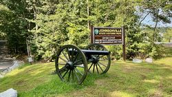 Now part of the Johnsonville State Historic Park. The Upper Redoubt is at the top of the Redoubt Ridge drive but somewhat hidden from view unless you know it is there. The roughly three-acre upper redoubt site has several excellent reader boards inside and a couple at the entrance but there is no large sign that points to the redoubt. There is a large depression inside the redoubt walls that is the remains of the magazine. There is at least one external marker for Fort Johnson at the Benton County I-40 Eastbound Rest Area
See Also: Sources: Links:
Visited: 8 Sep 2020, 13 May 2016
| |||||||
