Fort Hoskins
|
Fort Hoskins (1856-1865) - This fort was established in Benton County, Oregon as the result of a concentration of Indians at the Siletz Agency after the Rogue River Indian War. Fort Hoskins was constructed and initially garrisoned by Company G and F of the 4th U.S. Infantry under Captain Christopher C. Augur, and was named for First Lieutenant Charles Hoskins (Cullum 881), who had been killed in the Battle of Monterrey in September of 1846 during the Mexican War while serving alongside Auger. With the outbreak of the U.S. Civil War in 1861, troops here were summoned east. State volunteers garrisoned the fort until it was permanently closed when the war ended in 1865.
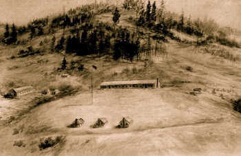
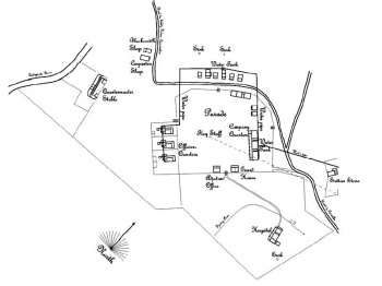
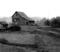
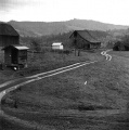
Fort Hoskins Early HistoryCaptain Augur and Company G of the 4th U.S. Infantry arrived in Kings Valley, Oregon on 25 Jul 1856. He was authorized by his commander, Brig. General John E. Wool, to construct Fort Hoskins on a site chosen by Capt. Augur. Gen. Wool did not initially agree with Capt. Augur on the location but was convinced by Augur that it was the proper place after a lengthy correspondence. The fort site overlooked the eastern entrance to the Siletz reservation and like Fort Yamhill had the dual purpose of keeping the Indians and the settlers from attacking one another. The site chosen was strategic in that it overlooked the Luckiamute Indian trail, one of two trails known at the time to the Siletz valley. The other trail was controlled by Fort Yamhill. The fort site was also close to the community of Kings Valley which could provide labor and logistical support for construction and later for operation. Fort Hoskins was constructed during the winter of 1856-57. It was not a traditional military fort and lacked even a blockhouse or other fortifications. A simple low picket fence surrounded the fort which sat on a low bluff overlooking a bend in the Luckiamute river. The fort was built to house two companies of soldiers and had 15 to 20 buildings, including officer quarters and soldier barracks, storage, guardhouse, bakery, hospital, barns and a corral. The guardhouse was used to confine drunken soldiers, Indians and recaptured deserters. The largest building on the post was the barracks where the enlisted men slept on the top floor and bathed, cooked and ate on the lower floor. The 2 acre parade ground had a 100 foot flagpole at its center, measuring two feet in diameter at the base. A jar, buried at the base of the flagpole when it was erected, was found in later years containing coins and a company roster. The roster included the names of Officers at the post in charge of Companies F & G of the 4th U.S. Infantry. Lady at the post was Mrs. C.C. Augur, wife of Capt. C. C. Augur and their six children. Construction of a 35 mile road over the coastal mountain range to the Siletz Blockhouse at Logsden on the Siletz river was undertaken by 2nd Lt. Philip H. Sheridan of U.S. Civil War fame in the last days of August 1856. The road was completed but proved to be so rough and difficult that only one wagon was ever taken over it. The blockhouse was livable by the end of October, 1856 but the rainy season halted work on it. The blockhouse was later disassembled and floated downriver to Siletz and reassembled on Government Hill. Lt. Sheridan was also responsible for the construction of the Yaquina Bay Blockhouse near present day Newport, Oregon. Lt. Sheridan was detailed to Fort Hoskins from Jul 1856 to Apr 1857 from Fort Yamhill and as the junior officer on the post, served as the quartermaster. Up to 150 men at a time were based at Fort Hoskins, though many were detailed to the Siletz Blockhouse at Siletz Agency or elsewhere. Life at the fort was uneventful and the lack of meaningful activity and lax discipline resulted in low moral, carousing and desertion were commonplace. There was also a problem of the soldiers fraternizing with the local Indian women which lead to serious health and discipline problems. Lt. H. H. Garber was court martialed over an incident involving an Indian woman he took on a trip to Fort Vancouver. Lt. Garber was suspended from rank and pay for six months on 23 Dec 1858 and subsequently died in the fort hospital on 12 Oct 1859. His tombstone survives as the only known one from Fort Hoskins in the Kings Valley Cemetery. The 1860 U.S. Census for the post shows Capt. Auger, his wife Jane and 7 children living on the post. Two of those children were born at Fort Hoskins. Also at the fort was a 2nd Lt., an Assistant Surgeon, 135 enlisted men (mostly born in Ireland), a hospital steward and a blacksmith and his family. The total complement present for the census on 18 and 19 Jul 1860 was about 140 military and about 13 civilians. U.S. Civil War (1861-1865)By the outbreak of the U.S. Civil War in 1861, Fort Hoskins was no longer necessary because new routes had been established through the Coast Range Mountains. The 4th U.S. Infantry was redeployed to the east coast and both Fort Hoskins and Fort Yamhill were manned by a series of Union volunteer units throughout the war. On 7 Oct 1864 the fort was reduced to caretaker status with only three men left at the post and its functions were consolidate at Fort Yamhill. The fort was reopened and served briefly as a training base for the 1st Oregon Volunteer Infantry. Fort Hoskins was closed for good on 16 Apr 1865 at the conclusion of the U.S. Civil War. On that date Company B and Company F of the 1st Oregon Volunteer Infantry marched out of the fort and the land reverted to lessor, Henry VanPeer. All the remaining property was sold at auction. In Nov 1866 the fort site was purchased from Roland Chambers by Samuel and Mary Frantz, his family lived in the old fort hospital building until about 1869 when he built what is now known as the Frantz-Dunn house. His children, the Frantz brothers, O.E. and B.Y., lived on the property for over seventy years. The Richard and Dennis Dunn families (relatives of the Frantz family by marriage) occupied the Frantz-Dunn house on the property until 1992 when it was purchased by Benton County. Units at Fort Hoskins
Current Status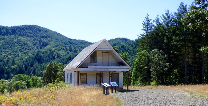
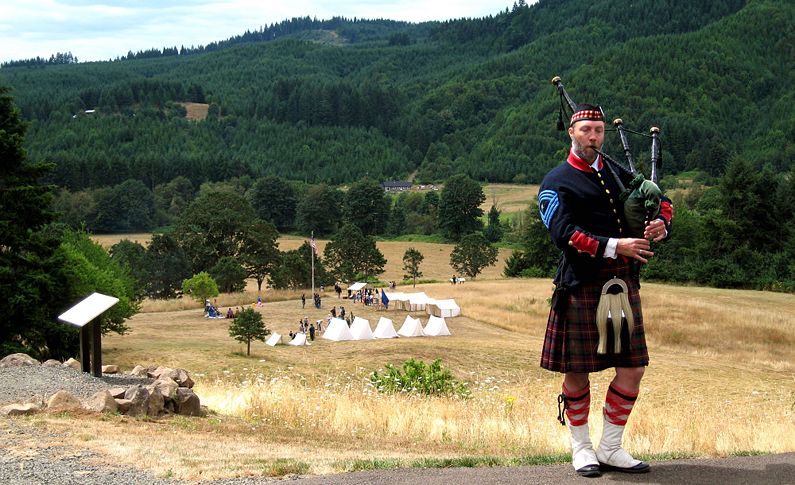
The site is one mile west of State Highway 223, on Fort Hoskins road, in the upper reaches of Kings Valley at the site of the previous settlement of Hoskins. The property occupies a low ridge at the "big bend" of the Luckiamute River, which flows south and west of the property. Benton County acquired the property in 1992, as the site of an interpretive park. The site was predominately forestland, and included a historic farmhouse, a few remnant outbuildings, several acres of abandoned pasture, and an old orchard. Prior to purchase the property had been managed for over 100 years as a family farm. The property was last actively farmed by Dick Dunn in the early 1970s. By the 1990s the farmstead was rapidly deteriorating. Open pastures were filling in with fir and blackberries. Most commercial timber was harvested in 1985. With the exception of the Frantz-Dunn house, the farm buildings were in a state of rapid decay. Archaeological examinations in 1976 and 1977 allowed for re-creation of much of what is now known about the fort and its history. Recognizing the significance to local history, and interested in developing a new park in this region, Benton County embarked on a long term restoration plan. The habitat at the site is now returning to what it was in the 1850's. A covered pavilion, a parade ground with a flag pole, and an interpretative walk around the perimeter of the old fort complete with descriptive plaques gives visitors to the site a real sense of the history of the fort and the natives of the area. On Friday 29 July 2006 a celebration of the 150th Anniversary of the Fort's establishment was held at the Benton County Museum. The celebration included the opening of a Fort Hoskins exhibit a musical program, refreshments and an appearance of Dr. David Brauner at the unveiling of his book on Fort Hoskins called Fort Hoskins: An Illustrated History. The following day an all day program was held at the fort site that include reenactors, a visit from Lt. Sheridan, a bagpiper, a musical program and a talk by Dr. Brauner on the history of the fort. Dr. Brauner also conducted a walking tour of the site. A 2015 visit found that an original officer's quarters building had been located, moved onto the fort site and prepared for restoration.
Sources:
Fortification ID:
Visited: 16 Aug 2015, 31 Jul 2006, 8 Jul 2006 Picture Gallery
| |||||||||||||||||||||||||||||||||||||||||||
