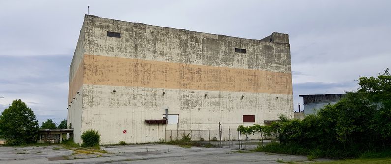
Fort Heath Radar Site
|
Fort Heath Radar Site (1959-1962) - A Cold War U.S. Air Force Radar Site established in conjunction with the Nike System's Boston Air Defense Area. Located on Fort Heath, Suffolk County, Massachusetts. Initially assigned a Permanent ID of MM-1 and a Sage ID of MM-1. Closed in 1962. HistoryEstablished in 1959 and became operational in 1959 as Fort Heath radar site manned by the 820th Radar Squadron. Initial equipment included two USAF FPS-6B height-finder radars and two US Army FPS-6A height-finder radars. Search radar video was provided by a joint use FAA maintained ARSR-1 search radar. The Army continued to use the radar facility until the end of 1964 when the Nike control center there was deactivated. The FAA continued operating the ARSR-1 radar of the former Fort Heath -- renamed Winthrop, MA -- until the mid to late 1990s. The ARSR-1 was deactivated when the FAA began operating a new ARSR-4 JSS radar at the former North Truro Air Force Station on Cape Cod.
SAGE System Operation
The site began operation as a SAGE site in 1959 initially connected to the Stewart SAGE Direction Center DC-02. On 1 Dec 1961, the squadron designation was changed from 820th Radar Squadron to the 820th AC&W Squadron ClosureThe Fort Heath radar site and the 820th were deactivated on 1962.
Current Status
See Also:
Sources:
Links:
Visited: No
|