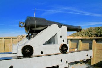
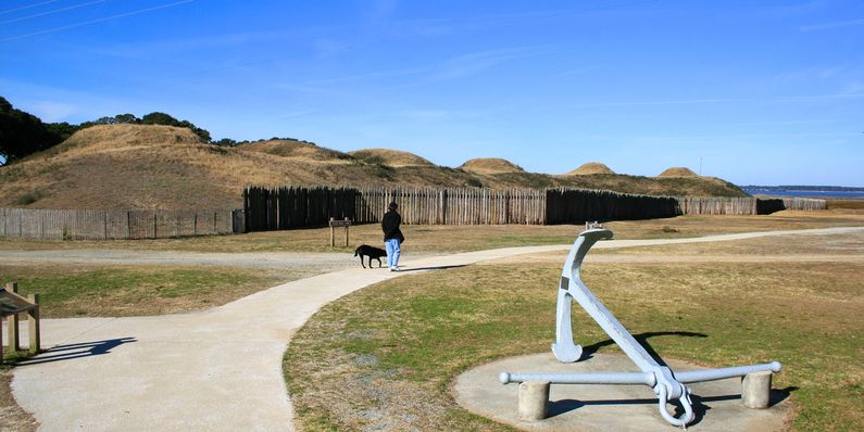
Fort Fisher (2)
More information at Warlike, Wikidata,
|
Fort Fisher (2) (1861-1865) - A Confederate Coastal fortification established in 1861 as Battery Bolles during the U.S. Civil War on the peninsula between the Cape Fear River and the Atlantic Ocean in New Hanover County, North Carolina. Battery Bolles was named for Captain Charles P. Bolles and it was later included in the Fort Fisher complex that was named for Captain Charles F. Fisher, who was killed at the battle of First Manassas (21 Jul 1861). Fort Fisher was captured by Union forces on the second attempt on 15 Jan 1865 and remained in Union hands until abandoned at the end of the war in 1865.
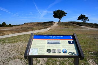
U.S. Civil War (1861-1865)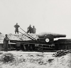 The fortifications on Federal Point were made necessary by the Federal blockade of the entrance to Wilmington harbor. By fortifying the point, Confederate gunners could keep Federal gunboats far enough away to enable blockade runners to slip into the harbor. Constructions began early in 1861 on what became Battery Bolles. Major Charles P. Bolles started the fortifications and the battery was named for him. A series of officers oversaw a piecemeal expansion of the batteries until the arrival of Colonel William Lamb in July 1862. Colonel Lamb designed an "L" shaped fortification with a sea face almost a mile long and a land face that spanned the width of the point. He incorporated the existing batteries into the plan and built new batteries to fill the gaps. At the end of the sea face, he built a towering 43-foot high battery that came to be known as the Mound Battery or Battery Lamb. The completed fortifications included bombproofs, magazines, covered ways, massive traverses and protected gun positions. A separate 4 gun Battery Buchanan was built at the south end of the point to guard the inlet. By October 1864 the works were essentially complete and the batteries mostly armed. The list of batteries and armament indicates that this was a formidable fortification.
First Battle of Fort FisherFort Fisher was successful in keeping the port of Wilmington open to Confederate blockade runners through the end of 1864. In October 1864 pressure was mounting to take Fort Fisher and to close the last Confederate port at Wilmington. Wilmington was playing a major role in keeping Richmond and Petersburg supplied and in the war. Planning for the taking of Fort Fisher included both naval and ground forces. The U.S. Army was reluctant to participate, knowing that it would be difficult to reduce the extensive earthworks. Rear Admiral David D. Porter was in command of the naval forces and General Benjamin F. Butler commanded the Union army forces. General Butler came up with a scheme to fill a ship with gunpowder and explode it near enough to the North Bastion and the earthworks to create an opening. That plan failed on the 25th of December when the ship drifted too far away to do any damage and exploded without any effect. Union ships then bombarded the Fort and the landing zone north of the Fort, Union troops landed and moved toward the landside defenses of Fort Fisher. Heavy Confederate fire drove off the attackers and bad weather stranded part of the expedition on the beach. The Union forces on the beach made good their escape and the first attack was over. General Ulysses S. Grant replaced General Butler by Major General Alfred Terry.
Second Battle of Fort Fisher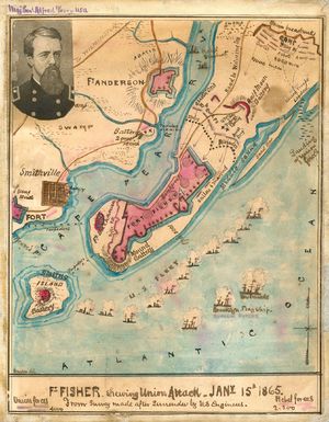 The second attack began with a bombardment by the 58 ship Union fleet on 12 Jan 1865 followed by the landing of Union troops on the north side of the land face. The Union navy bombardment succeeded in destroying most of the heavy guns along the land face and the Union troops made their way to the front of the land face. The landside attack was supplemented by a naval storming party at the North Bastion. The Union force eventually took the traverses and poured through the riverside gate into the fort. By 10 pm on the 15th, the fort was taken. The following day at dawn the main powder magazine exploded killing about 200 troops on both sides. The cause of the explosion is unknown but it was rumored that Union souvenir hunters entered the magazine with lanterns. The loss of Fort Fisher was quickly followed by the capture of Wilmington and that was followed by the fall of Richmond and Petersburg and the surrender at Appomattox.
Sources (for both battles)
World War IIDuring World War II the Fort Fischer Military Reservation functioned as the main off-site firing range for Camp Davis. The old Fort Fisher consisted of Civil War era earthworks and gun battery remains that bisected the island. The east side of the island had a long stretch of sandy beach known as Kure Beach and on the west side was the Cape Fear River. U.S. Highway 421 runs down the east side, along the beach past the old fort site and then crosses over to the west side at Federal Point on the Cape Fear River. Anti-Aircraft firing positions were erected all along the beach, between the highway and the Atlantic Ocean. These included batteries of 40 mm guns, 90 mm guns and 50-caliber machine guns. In practice, the training involved aircraft from the airfields at Camp Davis towing targets across the ocean range and the gun positions firing live ammunition at the targets. On the west side at Federal Point, a mechanized vehicle target range was constructed in 1942. Anti-aircraft gunners were trained here to also operate against tanks and other armored vehicles. Facilities supporting the training range were built between the highway and the Cape Fear River in the area surrounding the old Civil War fort. By 1944, the post included an 80-seat cafeteria, a 350-bed hospital, and a dental clinic. Ammunition bunkers were built along the highway north of the U.S. Civil War Battery Buchanan and some damage to the battery resulted. The construction of a large airstrip also destroyed much of the remaining land-side Civil War defenses. Cold WarAs the cold war escalated in the 1950s a network of radar sites all across the United States was established to guard against Soviet nuclear-equipped bombers. Just north of the site of the main works of the old Civil War fort and in the area of the WWII training facility, the U.S. Air Force established Fort Fisher Air Force Station (see separate page) as one of those radar sites. Fort Fisher AFS operated from 1955 to 1988 and was replaced by a Federal Aviation Administration (FAA) radar site just a bit further north that remains in operation today. Current StatusThe old Civil War fort area is a State Historic Site with a visitor center and interpretive trails. The site of the Fort Fisher Air Force Station is now the Fort Fisher Air Force Recreation Area. The Fort Fisher FAA Radar Site is operational north of the Air Force recreation area.
See Also: Sources:
Visited: 16 Mar 2018, 27 Jan 2010
| ||||||||||||||||||||||||||||||||||||||||||||||||||||||||||||
