Fort Ellsworth (2)
|
Fort Ellsworth (2) (1861-1865) - A Union U.S. Civil War Fort first established in 1861 in present day Alexandria, Virginia. Named Fort Ellsworth after Union Colonel Elmer E. Ellsworth who was killed by the proprietor while trying to remove a Confederate flag from an Alexandria hotel. Abandoned in 1865 at the end of the war.
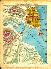
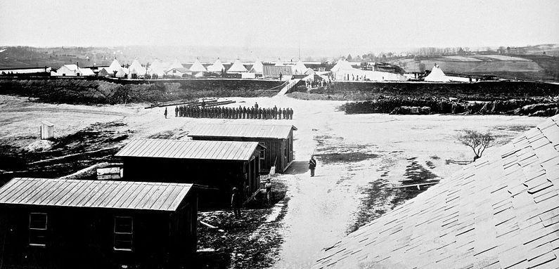
History of Fort EllsworthOne of the ring of Union fortifications surrounding Washington DC during the U.S. Civil War, see Washington DC Fort Ring.  Fort Ellsworth was also one of 33 forts on the Virginia side of the Potomac River that made up an outer defense line for Washington DC known as the Arlington Line. Established in 1861 as a large earthworks at the edge of Alexandria, Virginia. The fort mounted 29 guns and had a perimeter of 618 yards. Maps of the day show a rectangular outline with a bastion at each of the four corners all surrounded with earthworks. Construction began on 25 May 1861 under the supervision of General John Newton (Cullum 1112). The fort was located at the current site of the George Washington Masonic National Memorial on Shuter's hill at King St. and Callahan Dr. in Alexandria. A 17 May 1864 report from the Union Inspector of Artillery noted the following: "Fort Ellsworth, Major Rice commanding.–Garrison, four companies Second Connecticut Heavy Artillery– 1 major, 18 commissioned officers, 1 ordnance-sergeant, 522 men. Armament, four 6-pounder field guns (smooth), three 24-pounder siege guns (smooth), nine 8- inch sea-coast howitzers (smooth), one 100-pounder Parrott (rifled), three 30-pounder Parrotts. Magazines, two; dry and in good order. Ammunition, full supply and serviceable. Implements, complete and in good order. Drill in artillery, fair. Drill in infantry, ordinary. Discipline, fair. Garrison of sufficient strength." Abandoned in 1865 at the end of the war.
Current StatusMarker and some traces of the fort remain in Alexandria, Virginia. The outline of northwest bastion reportedly can still be seen. USGS Geographic Names Information System (GNIS) Database Entry: 1492961
See Also:
Sources:
Links: Visited: No
| ||||||
