Fort Dodge (2)
|
Fort Dodge (2) (1850-1853) - A U.S. Army post established in 1850 as Fort Clarke by Major Samuel Woods, 6th U.S. Infantry in Webster County, Iowa. First named for Colonel Newman S. Clarke and renamed Fort Dodge 25 Jun 1851 after Colonel Henry Dodge, 1st U.S. Dragoons. Abandoned in 1853, when its garrison was transferred to Fort Ridgely.
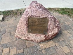
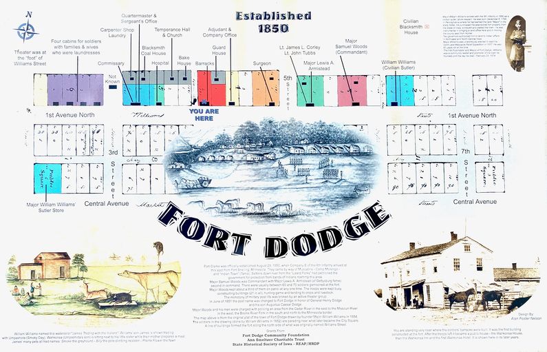
HistoryIn 1835 the future site of Fort Dodge was identified as suitable for a fort by an expedition under Lieutenant Colonel Stephen Kearny. The site was located at the confluence of the Des Moines River and Lizard Creek at the current-day city of Fort Dodge, Webster County, Iowa. Fifteen years later, the post was established on 2 Aug 1850 by Major Samuel Woods (Cullum 926), 6th U.S. Infantry as an open plan post (without a stockade). As-built, the post came to include some 21 buildings strung out in a line that covered several present-day city blocks. Major Woods was the post commander while his second in command was Major Lewis A. Armistead (who later fought heroically and died at Gettysburg). The post was abandoned on 1 Jun 1853 and sold in 1854 to the former post sutler William Williams, who then laid out the town of Fort Dodge. Current Status Marker and reader board at the actual site of the fort at the intersection of 1st Ave North and North 4th St. No period fort buildings at this location. At another location across town is an attraction called the "Fort Museum and Village," which contains a fort replica (not of Fort Dodge) but it does have artifacts and exhibits that pertain to Fort Dodge and one building that is said to be original to Fort Dodge. The replica fort is more similar to those built during the 1862 Sioux uprising and has similarities to the one built at Iowa Lakes in 1862-63. The museum and fort replica are well worth a visit and one can easily spend a couple of hours here.
Sources:
Visited: 29 Jul 2020
| |||||||
