Fort Dobbs (1)
| More information at Warlike, Wikipedia
Fort Dobbs (1) (1755-1764) - A colonial fort established in 1755 during the French & Indian War by Captain Hugh Waddell and North Carolina provincial soldiers. Located near Statesville in Iredell County, North Carolina. Named after Arthur Dobbs, Royal Governor of North Carolina. Abandoned in 1764.
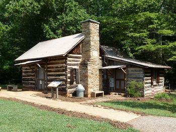
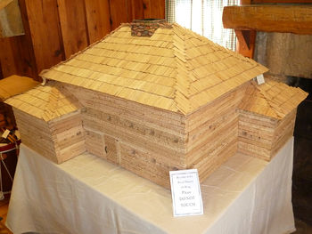
French & Indian War (1754-1763)Fort Dobbs was built to protect settlers from hostile Cherokee Indians and to project the power of the provincial government to what was then the western frontier. The post was constructed as a rectangular log fort 53' by 40' with projecting bastions at the northeast and southwest corners. The building was three stories high with over a hundred gun ports. Construction began in the fall of 1755 and was completed in 1756. The post could accommodate a company of rangers numbering about 50 men. A separate building outside the fort housed the officers. The fort came under attack by a group of more than 60 hostile Cherokee Indians in 1760 but the fort withstood the attack. The post was no longer on the western frontier in 1763 and the fort was abandoned in 1764. The fort was described as in ruins in 1766. The site was used as farmland over the years until the DAR purchased the site in 1909 and eventually donated it to the State of North Carolina. Archaeological excavations began in 1967. Current StatusFort Dobbs State Historic Site. The fort site is outlined with rope and the basement has been dug out. The 1910 DAR marker is located on the site. The visitor center is located at the back of the site in a log cabin.
See Also: Sources:
Links: Visited: 15 Jul 2010
| ||||||


