Fort Baton Rouge
|
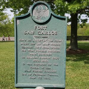
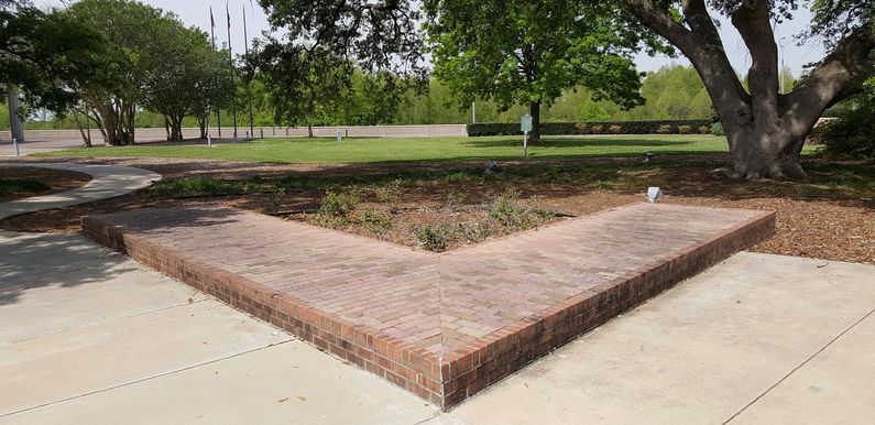
British New Fort Richmond (1764-1768)The Treaty of Paris (1763) ended the French & Indian War and France ceded the territory east of the Mississippi to the British including the territory that became the West Florida Province. British forces took control of this newly created West Florida Province in 1763 and built New Fort Richmond on the east bank of the Mississippi River in present-day Baton Rouge, Louisiana. British Fort Richmond (1778-1779)The fort was rebuilt in August 1778 and was known as just Fort Richmond. The new fort had parapets of packed earth, an 18' wide by 9' deep moat and was armed with 13 guns of differing calibers. American Patriot forces briefly took the new fort in 1778, but it was soon recaptured by the British. Spanish Fort San Carlos (1779-1810)Spanish forces under Bernardo de Galvez captured Baton Rouge from the British on 21 Sep 1779 during the Revolutionary War. Spain was an ally of the American Patriots and the capture of Baton Rouge denied the British use of the Mississippi River. British Lt. Colonel Alexander Dickson surrendered the fort after an eight-day siege. The Spanish then rebuilt the fort. The new fort, known as Fort San Carlos was shaped like a six-pointed star and armed with 16 gun guns. The fort was rebuilt again by the Spanish in 1799. American Post at Baton Rouge (1810-1819)The fort was briefly occupied by local British and American settlers in September 1810 as a part of the "West Florida Republic". The U.S. Army took possession of the fort in December 1810, naming it the Post at Baton Rouge. They demolished the post circa 1819 when the Pentagon Barracks was built just to the north of the site. Current Status The site is well marked with a Fort San Carlos marker and a low brick wall outlining parts of the star fort trace. The Fort San Carlos marker appears to be located near the center of the fort trace. A nearby map shows the fort location and other points of interest but it is in poor shape. Other pertinent markers are located in the Galvez Plaza.
See Also: Sources:
Links:
Visited: 9 Apr 2016
| |||||||
