Fort Augusta (2)
|
Fort Augusta (2) (1737-1767, 1775-1782) - A colonial fort established in 1737 in present day Augusta, Richmond County, Georgia. Active during the French & Indian War and in the Revolutionary War. Named Fort Augusta after a royal Princess. Captured by the British in 1779 and renamed Fort Cornwallis, Recaptured by Patriots in 1781. Abandoned as a fortification at the end of the war in 1782. Demolished in 1786.
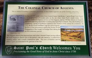
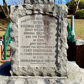
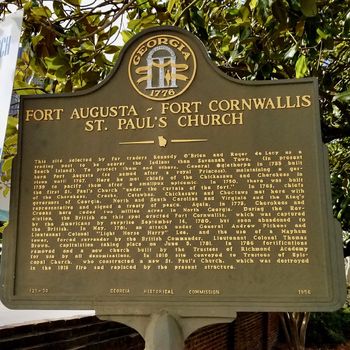
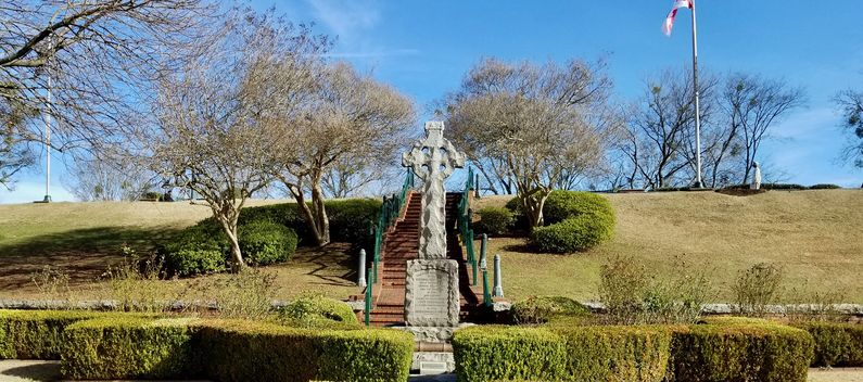
Fort AugustaEstablished in 1737 by General James Oglethorpe to protect area fur traders and settlers. Built as 110-foot square stockade with bastions on the four angles. The first Saint Paul's church was built beside the original fort in 1750. French & Indian War (1754-1763)The fort and the adjacent church were used as a refuge during the French & Indian War. The small church was heavily damaged by the refugees and a second church was built after the war. The fort remained garrisoned through 1767. Revolutionary War (1775-1781)During the Revolutionary War the fort was first occupied by Patriots from 1776 to 1779. The British captured the fort in January 1779 and renamed it Fort Cornwallis. They rebuilt and enlarged the fort to encompass the adjacent church and its graveyard. Patriots forces recaptured the fort briefly in September 1780 but soon after abandoned the fort back to the British. In May 1781, Fort Cornwallis was besieged by Patriot forces under General Andrew Pickens and Lieutenant Colonel “Light Horse Harry” Lee, forcing the British Loyalist Commander, Lt. Colonel Thomas Brown, to surrender the fort on 5 Jun 1781. During the siege, a 30' Maham tower (designed by Hezekiah Maham) was erected by the Patriots that looked down into the interior of the fort. The tower was a log structure filled in with earth. At the top, a six-pounder cannon was able to fire directly into the interior of the fort and sharpshooters could keep the fort occupants busy. The British garrison was forced to dig trenches to protect themselves. On 5 Jun 1781, the British garrison of 300 surrendered. The fort remained in Patriot hands for the rest of the war. Following the end of the war, the fort was demolished in 1786, and a new larger church was built on the site. The present church was built in 1918. Current Status The site is marked by a Celtic Cross Memorial and stone marker behind St. Paul's Episcopal Church at Sixth and Reynolds Streets. Other Historical Markers also at the site along with a period cannon and an interpretive panel.
See Also: Sources:
Links:
Visited: 9 Feb 2018
| ||||||


