Dallas Center Air Force Station
|
Dallas Center Air Force Station (1955-1957, 1960-1967) - A Cold War U.S. Air Force Radar Station established in 1955. Located near Dallas Center, Dallas County, Iowa. Initially assigned a Permanent ID of M-122. Closed in 1957 and converted to an unmanned gap filler site (P-71D then P-81A and finally Z-81A). The gap filler site deactivated in December 1967.
HistoryEstablished in Jul 1955 and became operational in 1956 as Dallas Center Air Force Station manned by the 650th Aircraft Control & Warning (AC&W) Squadron. The 38.92 acres site was acquired by purchase and condemnation from a local landowner between March 1954 and November 1956. Initial equipment included the TPS-1D search radar. Manual System OperationIn July 1955, the 650th AC&W Squadron moved to Dallas Center Air Force Station assigned to the 31st Air Division (Defense) (31st ADD) Headquartered at Snelling Air Force Station in Minnesota. The 31st ADD provided command and control over subordinate radar stations from the Snelling Manual Direction Center P-36. The Snelling AFS (MCC) was connected to Dallas Center via telephone lines and track data could be passed from Dallas Center AFS Operations to Snelling MCC via voice, teletype, and encrypted teletype. On 1 Mar 1956 command and control of Dallas Center AFS and the 650th shifted to the 20 Air Division and the Richards-Gebaur Manual Direction Center SM-169 located at Richards-Gebaur Air Force Base, Missouri. Operations continued in the manual mode until the Dallas Center AFS was closed on 8 Oct 1957. Open houses were held in 1955 and 1956.
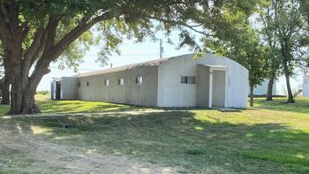
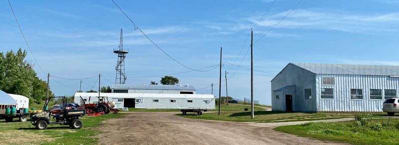
ClosureIn mid-1957, because of a shortage in maintenance and operations funds, the Dallas Center AFS was placed in a "deferred" status even though it was operational with a TPS-1D. Dallas Center AFS and the 650th were deactivated on 8 Oct 1957. Gap FillerAfter the radar station closed a small 0.69-acre compound at the north end of the site was established for an unmanned FPS-14/FPS-18 gap-filler radar annex (P-71C) for Omaha AFS, Nebraska. On-site debris in 2002 included an FPS-14 antenna sail and Pedestal (AB 421) and an FPS-18 type tower from that installation. The GSA reported the site excess 38.23 acres on 30 Oct 1959, and then quitclaimed it to a private party on 7 Mar 1961, reserving road and utility line easement to the 3.15 acres. The gap-filler annex reportedly was activated in May 1960 and deactivated in December 1967. Relatives of the original private party still own the 38.92 acres, which include the site and access, on which the manned radar station was located. Two buildings and the radar tower are still extant, the site now being used for Greenhouses for truck crops. Physical PlantThe physical plant of the 38.23-acre site included a gate shack; power building; mess hall; administration building; two supply buildings; 65-man airmen`s barracks; base auto shop; water storage and pump house; above and underground storage tanks; sanitary sewer system; streets, drives, sidewalks, and parking areas.
Current StatusNow Hilltop Farms fresh produce at 22018 T Ave, Dallas Center, IA 50063.
See Also: Sources:
Links: Visited: 7 Aug 2020
| |||||||||||||||||||||||||||||||||||||||


