Chapel Point Battery
|
Chapel Point Battery (1862-1948) - Chapel Point Battery was a coastal gun battery situated on a rocky cliff overlooking the entrance to Sydney Harbor, Cape Breton County, Nova Scotia, Canada. The site experienced three different periods of activity, (1862-1870), World War I (1914-1917) and World War II (1940-1948). Last deactivated in 1948.
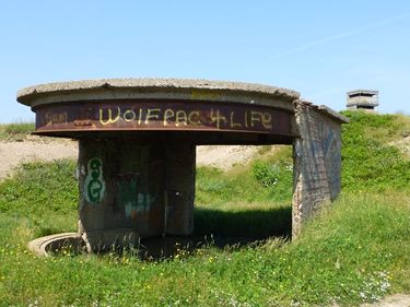
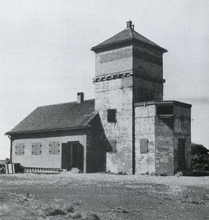
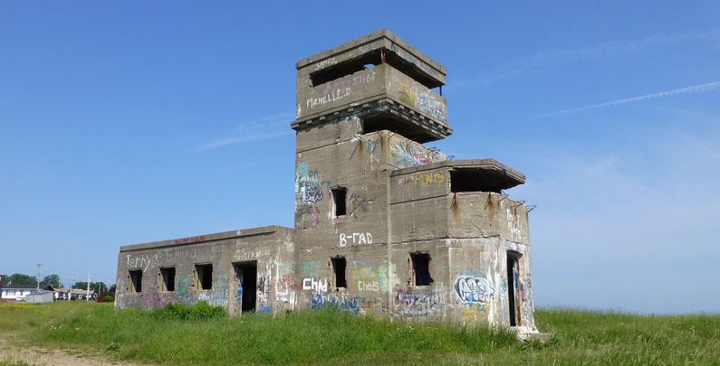
Chapel Point Battery HistoryPart of the Harbor Defense of Sydney. The site was originally purchased by the War Office on 25 Jun 1862 and a thirteen gun battery with a blockhouse was authorized on 7 Oct 1862. The battery itself was built with stone from Scotland and the blockhouse was built of brick. The construction of this battery to guard the harbor entrance was undertaken in response to fears of invasion from the United States after the U.S. Civil War. The perceived threat disappeared and the battery was disarmed and abandoned. The stone and brick used in the construction was later used in the construction of a local church and there are no visible remains of the original battery. World War I (1914-1918)With Canada's entry into World War I on 31 July 1914 two 4.7-inch field mounted artillery pieces were deployed to the site but were withdrawn in November 1915. In 1916 a single 4.7-inch field mounted artillery piece was redeployed to Chapel Point but was relocated to Cranberry Head Battery in May 1917. World War II (1939-1945)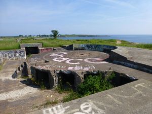 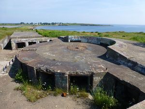 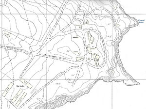 The Chapel Point World War II Battery was built in 1940 by contractor E.G.M. Cape at a cost of $150,000. The facilities at the battery came to include two reinforced concrete gun emplacements, a four story concrete BC/Fire control station disguised as a church and three concrete searchlight shelters. Two 4.7-inch MK7 quick-firing (QF) guns were emplaced in the concrete gun emplacements. These two guns were replaced with two 4-inch twin barrelled MK16 guns in 1944. A similar battery was constructed across the harbor at Fort Petrie during the same time frame. This battery served as the harbor examination battery for most of the war. The gun emplacements featured sloped semicircular concrete shields some fifteen feet thick that gave the gun detachment good frontal protection. Dug into the outer flank of each position were two heavily built concrete rooms, banked with earth and rock fill to roof level. One was the store for gun equipment and the other was the shelter for the gun crew on duty. The gun emplacements at each battery were set one hundred feet apart so that a hit on one would not disable the other. They were connected, some fifteen feet underground, by a long magazine, at each end of which an ammunition hoist shaft running up to the rear of each emplacement. Perhaps the most important modern feature was the heavy protection for the magazines. Atop the 2.5-foot-thick roof of the ammunition storerooms was three feet of packed sand, and above that a 4.5-foot-thick burster, overlaid by 7.5 feet of soil. The burster and the intervening layer of sand would diffuse the detonation of a hit on the battery. To strengthen further the structure, access to the magazines was not direct, as it had been in earlier works, but through a tunnel at the base of the staircase from the surface. For this reason, and because the magazine was more deeply buried than in previous designs, the were also escape shafts for the magazine crew. To the rear of the positions was a three-storey concrete tower, the battery command post. On the top two floors there were wide-view windows. The battery commander's fighting position was on the upper storey where the depression rangefinder was mounted on a concrete pedestal that extended down through openings in the lower floors to the structure's foundations to prevent damage to the building's envelope throwing the rangefinder out of alignment. The second storey was for the officer in charge of the battery's searchlights, and voice tubes allowed the two commanders to talk directly to one another. All doors in the permanent works were of heavy steel construction and steel blast shutters covered every window. The battery was deactivated after the end of the war in 1948 and later turned over to the town of Sydney Mines and remains their property.
Current Status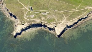 The site is undeveloped town property accessible by footpaths at the east end of Amber Street or Church Street. The site contains the remains of the fire control station, two concrete gun emplacements and three searchlight shelters. All of the concrete structures are damaged and covered with grafitti. No period guns or mounts in place. Prior to Sydney Mines amalgamating with what would become the Cape Breton Regional Municipality, the former town was taking steps to restore Chapel Point Battery. A study was commissioned by the town in 1991. But by the time it was commissioned and the town was ready to proceed, amalgamation took place, ending the project. There is a new proposal to build a national memorial on this site, the Atlantic Memorial Park. The Atlantic Memorial Park is intended to provide Canadians a monument, and a historic themed site to honour military contributions overseas, and at home. The goal is to provide visitors with an educational experience similar to visiting the famous Vimy Ridge memorial located in France. The project area is intended to span over a 120 acre area, and see multiple projects constructed in phases over a 5-year time period. Park components will include a restored Chapel Point Battery, a family park, a First Nations encampment, walking trails in a large woodland area, a beautiful ocean beach, and a feature monument on a spectacular cliff side setting overlooking Sydney Harbour. In the news
See Also: Sources:
Links:
Visited: 7 Jul 2013
| ||||||
