Camp Chase (1)
|
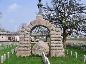
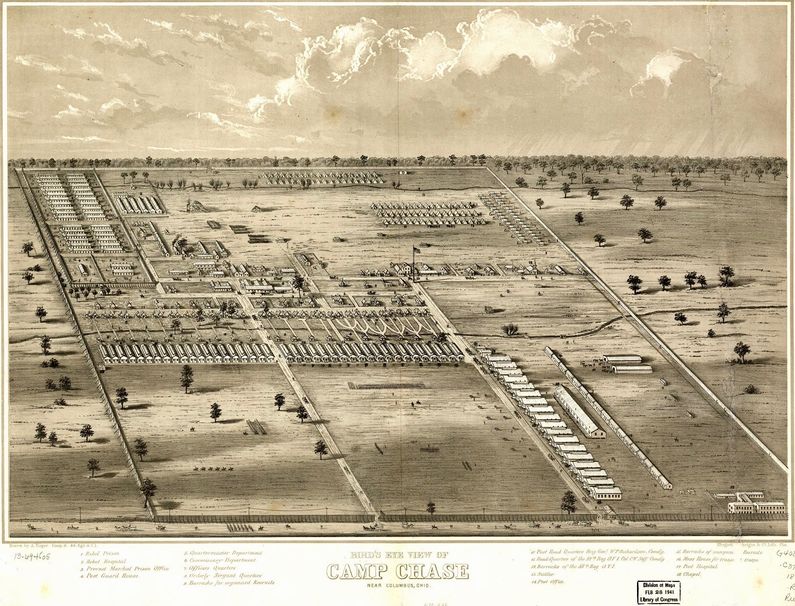
HistoryEstablished in May 1861 as an Ohio Volunteer training camp and later as a Confederate prisoner of war camp. As many as 150,000 Union soldiers and some 25,000 Confederate prisoners passed through the camp between 1861 and 1865. The prison camp at Camp Chase started receiving military prisoners in April 1862. The camp already housed some political prisoners and the Governor of Ohio considered the camp under his command. The Governor had appointed a series of incompetent commanders and at the end of September 1863, he placed Major Peter Zinn of his own Governor's Guard in charge. After a series of prisoner abuses and shootings, Brigadier General (USV) John S. Mason (Cullum 1339) was assigned and took command of the post on 22 Aug 1863. Mason was a West Point graduate and immediately reestablished military control over the prison and established Federal control of the post. By mid-1963 he had transferred all Confederate officers and the political prisoners to Johnson's Island Prison. He remained at Camp Chase until 6 Nov 1863. Camp Chase prison was said to have a maximum capacity of some 4,000 prisoners but housed as many as 9,423 at one time. Escapees are listed as 37. More than 2,260 prisoners died and were buried in the Camp Chase Cemetery. Abandoned in 1865. Current Status The two-acre Camp Chase Confederate Cemetery is the only remaining part of the camp. The rest of Camp Chase has been redeveloped as Westgate, a residential and commercial area. A camp corner stone is located in front of the Westgate #623 Masonic Temple.
See Also: Sources:
Links: Visited: No
| |||||||
