Bethany Beach WWII Radar Site (2)
|
Bethany Beach WWII Radar Site (2) (1942-1946) - A World War II U.S. Army Air Warning Service (AWS) Radar Site established in 1942. Used to provide early warning of enemy aircraft approaching the Delaware Coast. Located near the community of Ocean View in Sussex County, Delaware. Deactivated in 1946. Reactivated in 1957 as the U.S. Air Force Bethany Beach Gap-Filler Annex. Deactivated in 1968. Also known as AWS Station 11.
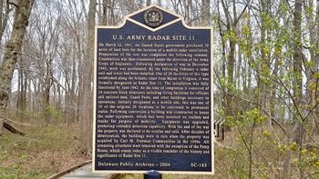
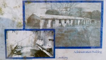
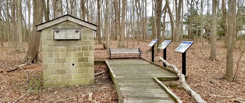
HistoryThis radar site became operational during World War II early in 1942 as a part of a chain of radar stations along the East Coast of the United States and Canada. These secret radar sites were built to provide early warning of approaching enemy aircraft and ships but also served to assist friendly aircraft that were lost or had in-flight emergencies. The U.S. Army purchased the land for Site 11 on l2 Mar 1941 for $1,333. The land survey and site preparations were complete by September 1941, three months before the start of World War II. Engineering and construction of the 14-acre site were conducted by the United States Army Corps of Engineers (USACE). The radar unit and 100-foot tower were installed by February 1942. Site construction continued until June 1942 when the site became operational. Initially built as a mobile site, it was converted to a permanent site on 22 Aug 1942. Cost of construction is listed as $70,322. The capacity of the site was shown as 69 men and 12 officers on 31 Dec 1945. AWS Site 11 initially operated an SCR-270-C radar set with the antenna mounted atop a 100-foot steel tower. This radar set was a search radar capable of detecting aircraft flying at 25 thousand feet at a range of 110 miles. It is likely that this site, because of the proximity to Fort Miles and the Delaware River munitions facilities, would have been upgraded to more modern equipment toward the end of the war. Physical PlantA 1942 map indicates 17 facility structures on the site divided into a cantonment area on the south end and an operations area on the north end. The cantonment area included quarters for officers and enlisted, supply and administration, a Dining hall, recreation facilities, two guard shacks and other support buildings. The operations area included the radar building, the radar tower, and two guard shacks. The two areas were separated by a large area with no buildings except a pump house that is now the only remaining structure. 
DeactivatedDeactivated in 1946 after the end of the war. Bethany Beach Gap Filler AnnexThe site was reactivated in 1957 by the U.S. Air Force as the Bethany Beach Gap Filler Annex, an unmanned gap-filler FPS-14 radar site. The gap filler site closed in 1968. Current StatusA roadside marker and three reader boards now commemorate the World War II Radar Site. The centrally located pump house is the only remaining structure.
See Also: Sources:
Links:
Visited: 17 Apr 2018
| |||||||||||||||||||||||||||||||||||||||||||||||||||||||||||||||||||||||||||||||||||||||||||||||||||||


