Bergstrom Air Force Base
|
Bergstrom Air Force Base (1942-1993) - A United States Air Force base first established in 1942 as Del Valle Army Air Base near Austin, Travis County, Texas. Renamed Bergstrom Army Air Field on 3 Mar 1943 after Captain John A. E. Bergstrom who was killed at the beginning of World War II at Clark Field, Philippine Islands, 8 Dec 1941. Renamed Bergstrom Field on 11 Nov 1943. Renamed Bergstrom Air Force Base in 24 Jun 1948. Deactivated in 1993.
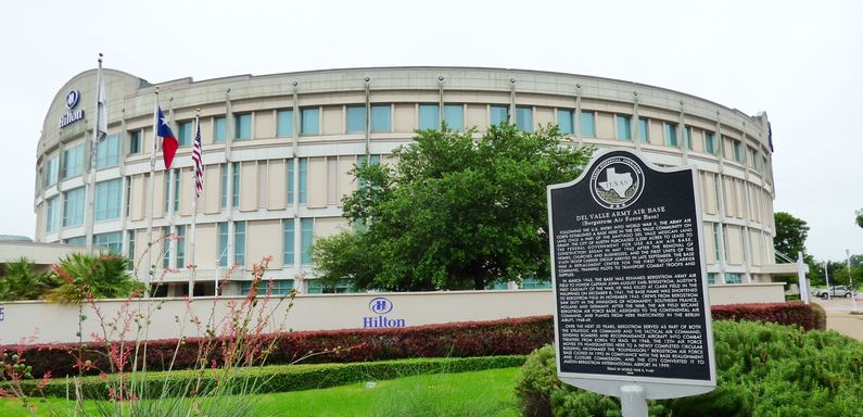
World War IIIn 1942, the city of Austin purchased 3,000 acres of land 11 miles southwest of Austin and leased it to the United States government for a military installation. Established on 19 Sep 1942, Del Valle Army Air Base was initially a troop-carrier training base. The base became Bergstrom Army Air Field on 3 Mar 1943. Post World War IIBergstrom became a permanent base after World War II. After the Air Force became a separate service in 1947 it was assigned to the Strategic Air Command in 1949 and then to the Tactical Air Command in 1966. It was the headquarters for the Twelfth Air Force from 1968 to 1992. Between November 1960 and June 1966 Nike Missile Sites BG-80 and BG-40 were located around Bergstrom to protect the SAC base. Bergstrom was officially closed as an active Air Force base on 30 Sep 1993. Military activity ceased at the base on 30 Sep 1996. Current Status Now Austin-Bergstrom International Airport. Most of the military buildings were destroyed to build the airport and the runways were upgraded to commercial standards. The old circular 12th Air Force Headquarters building has been repurposed into a Hilton Hotel and a marker for the Del Valle Army Air Base/Bergstrom AFB is located to the right of the main entrance. The Texas Army National Guard maintains a presence at the Airport.
See Also: Sources: Links: Visited: 27 May 2015
| ||||||
