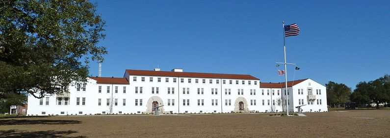
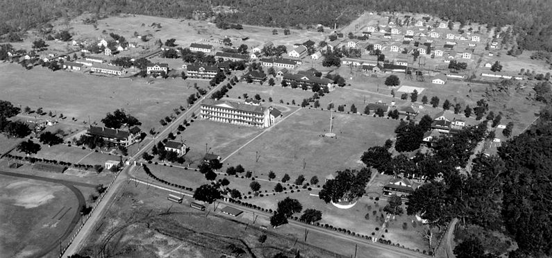
Barrancas Barracks
|
Barrancas Barracks (1820-1947) - First established in 1821 as an American post on the site of earlier Spanish buildings. Popularly known as Barrancas Barracks but also known by Post of Barrancas (1821-1847), Camp Barrancas (1840-1870), Post of Fort Barrancas (1870-18??) and finally as a part of Fort Barrancas (18??-1947). Primarily used to garrison troops for fortifications in the vicinity including Fort Pickens, Fort McRee, Fort Barrancas and the Advanced Redoubt. Deactivated in 1947 and turned over to the U.S. Navy.
HistoryThe post was ceded by Spain to the United States on 24 Oct 1820 and the original Spanish buildings were initially used for quarters for U.S. troops. In 1821 a new large barracks building was started but remained largely unfinished through the 1870s. A new hospital complex was built in the 1830s and the post added new enlisted and officer quarters between 1847-1851. Although popularly known as Barrancas Barracks the post had a number of official names over the years including:
U.S. Civil War (1861-1865)At the beginning of the U.S. Civil War there was only a single company, Company G, 1st U.S. Artillery, in the Pensacola area and they were quartered at Barrancas Barracks under the command of 1st Lieutenant Adam J. Slemmer. The post was originally armed with only four 6-pounder guns, two 12-pounder howitzers, 300 projectiles and 270 cartridge bags. Nearby Fort Barrancas was heavily armed with forty-four sea coast and garrison cannons, 3,152 projectiles and 20,244 pounds of powder. Lt. Slemmer was loyal to the Union and he took measures to secure government property at Barrancas Barracks and Fort Barrancas from a possible takeover by secessionist. On 9 Jan 1861 Lt. Slemmer received orders to prevent the seizure of both Fort Pickens and Fort McRee which were both unmanned. Slemmer determined he had only enough resources to defend one of the forts and he chose Fort Pickens and proceeded to move what he could out to Fort Pickens. Pensacola and the Navy Yard were soon in the hands of secessionist leaving Lt. Slemmer with a total of 81 men at Fort Pickens. Slemmer managed to hang on until sufficient reinforcements arrived and Fort Pickens remained in Union hands for the remainder of the war. Barrancas Barracks remained in Confederate hands until they abandoned Pensacola in May 1861. A description by a visiting surgeon of Barrancas Barracks on 12 Aug 1870 - "Barrancas Barracks is a large three-story fire proof building of brick, unfinished, measuring 196 by 36 feet. The building contains fifteen rooms, 32 by 26 by 16 feet, all well lighted and ventilated, and warmed by open fireplaces." Only seven rooms were occupied and eight rooms are unfinished and vacant. Officers' quarters are five wooden buildings with verandas in front, and raised from one to two feet above the ground. The commanding officers' quarters contains five rooms and an attic; the dimensions are 47 by 36 feet. Mean strength in 1868 was 75.25 men and in 1869 it was 58.75 men. New officer quarters were built during the 1870s. Endicott Period (1890-1910)A new 23 bed hospital was built in 1895. Starting in 1896 and continuing until 1908, eight Endicott Period gun batteries were built in and around Fort Pickens and two more were built at Fort McRee. Neither of these forts had sufficient quarters for either the number of officers or enlisted men required to man the batteries. Most of the time the forts were manned by small detachments or simply caretakers and the majority of the garrisons were quartered at Barrancas Barracks. World War I (1917-1918) In 1938 the old 1822 three story Barracks building was salvaged and a new barracks was built and completed in 1939 on the site of the old barracks. World War II (1941-1945)Current StatusNow located on Naval Air Station Pensacola, Escambia County, Florida.
Sources:
Links: Visited: 2 Jan 2012
| ||||||
