30 RU - Cape Bauld Radar Site
|
30 RU - Cape Bauld Radar Site (1942-1944) - A World War II Royal Canadian Air Force (RCAF) Radar Station established in 1942. Located at Cape Bauld on Quirpon Island, Newfoundland. Initially assigned a Radar Detachment designation of 30 RD later changed to Radar Unit designation of RU. Note that the unit used the detachment designation, 30 RD, until it closed in October 1944.
History Established in October 1942 and became operational later in 1942 as 30 RD Cape Bauld Radar Site manned by RCAF personnel. The site was located on barren Quirpon Island at the northern tip of Newfoundland. Initial equipment included the Chain Home Low early warning radar of British orign. This radar was designed to detect low flying aircraft and could also detect surface vessels under certain conditions. The advance party arrived in September 1942 with the remainder arriving in October. The recorded numerical strength of the unit as of 31 Mar 1943 was 2 Officers and 38 Airmen.
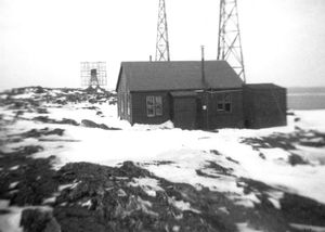
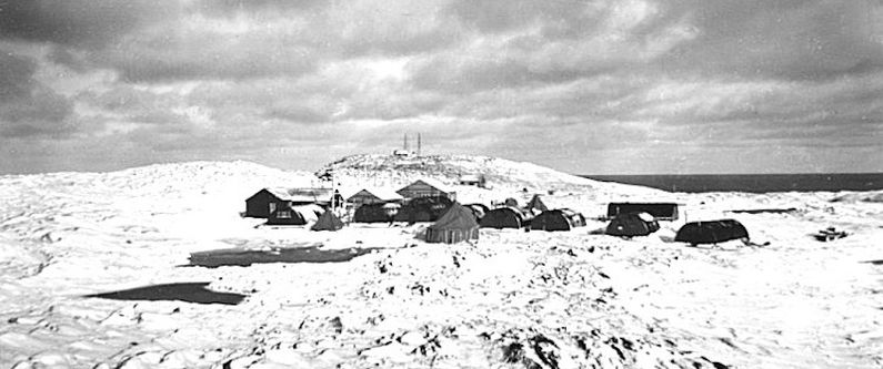
Physical PlantInitial cantonment construction was with Nissen Huts (similar to US Quonset huts) as quarters for the troops. A limited number of frame buildings were added that included the Mess (No 11), officer's quarters (No. 13), power house (No. 17) and equipment buildings (No. 18 & 19). In 1943 two new frame barracks buildings (No. 24 and 25) were constructed and housed the majority of the personnel. Only two Nissen Huts were then being used as quarters(No. 10 and 4). Hut No. 4 was the detachment sick bay and Hut No. 2 served as day sleeping quarters for the night shifts. Sanitary facilities began with a single outhouse and improved to a five holer latrine with one seat separated for the officers. 
During the winter months, drinking water, water used in the Mess and water for personal hygiene was hauled from either Cod Cove or Sealet Ponds by dog team. They hauled about 225 gallons per day. Additional water for washing clothes, etc. was obtained by melting snow. In the summer months, water was obtained for the mess from an elevated pond by siphon and from a well for the barracks. Food and other supplies were brought to the station by supply ships during the summer months. During the short summer season sufficient quantities of food and supplies had to be stockpiled for the remaining year. Foodstuffs included large quantities of tinned meat and dehydrated vegetables. The Mail Service at the site was considered very poor. During the summer the Coastal Boat carried the mail, and it provided a fairly regular service, about every three or four weeks, from late May until late December. During the winter, the Service was much worse. The mail traveled overland by dog team to Deer Lake, a distance of about 300 miles. From Deer Lake it went by railway to Gander and then to Canada (Newfoundland and Labrador were not yet provinces of Canada). In the winter, the average time for a first class letter to get from Cape Bauld to Canada was eight weeks. During the winter, incoming mail was dropped by aircraft every three or four weeks but outgoing mail still went out overland by dog teams. ClosureOfficially deactivated on 31 Oct 1944.
Current StatusLittle remains.
See Also: Sources: Links:
Visited: No
| ||||||||||||||||||||||||||
