File:St. Croix 1613 Map Champlain.jpeg
Jump to navigation
Jump to search
Size of this preview: 783 × 600 pixels. Other resolution: 1,013 × 776 pixels.
Original file (1,013 × 776 pixels, file size: 233 KB, MIME type: image/jpeg)
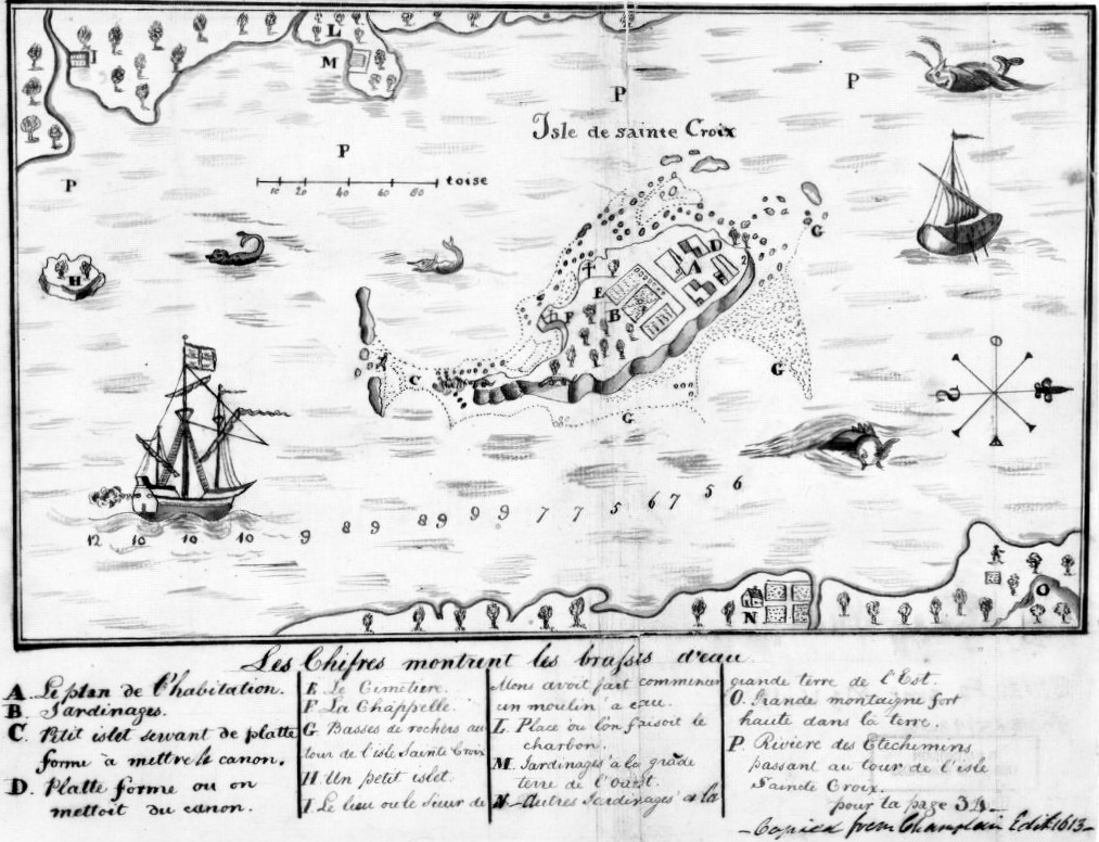
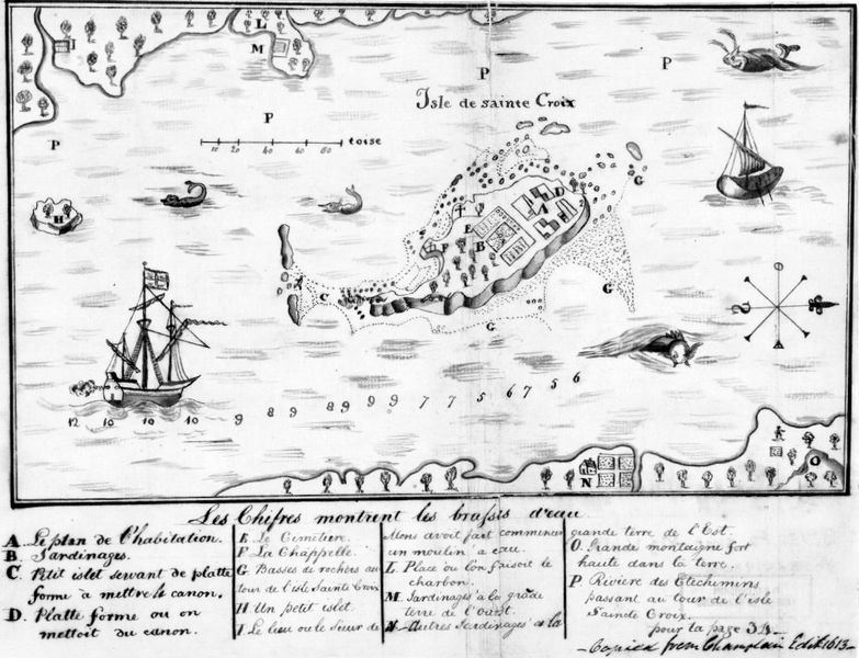
Manuscript maps that were assembled by Egbert Benson and sent in 1802 to Rufus King, United States minister to Great Britain, in order to facilitate negotiations over disputed international boundary between Maine and New Brunswick, This image is available from the United States Library of Congress, Prints and Photographs Division under the digital ID https://lccn.loc.gov/2009579306. No known copyright restrictions.
File history
Click on a date/time to view the file as it appeared at that time.
| Date/Time | Thumbnail | Dimensions | User | Comment | |
|---|---|---|---|---|---|
| current | 15:09, 20 March 2020 | | 1,013 × 776 (233 KB) | John Stanton (talk | contribs) | Manuscript maps that were assembled by Egbert Benson and sent in 1802 to Rufus King, United States minister to Great Britain, in order to facilitate negotiations over disputed international boundary between Maine and New Brunswick, {{LOC|LocID=https://... |
You cannot overwrite this file.
File usage
The following page uses this file: