File:MobileHarborMap 1862.jpg
From FortWiki
Size of this preview: 377 × 599 pixels.
Full resolution (536 × 852 pixels, file size: 152 KB, MIME type: image/jpeg)
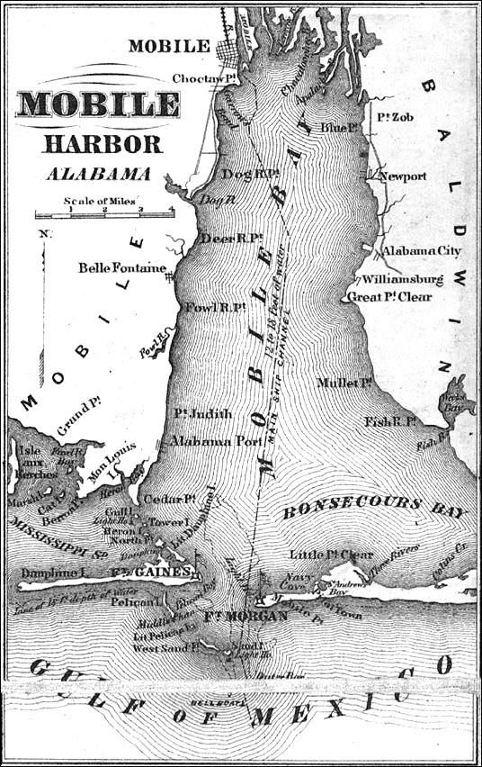
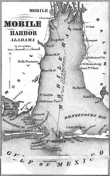
Mobile Harbor Map, 1862. NPS
File history
Click on a date/time to view the file as it appeared at that time.
| Date/Time | Thumbnail | Dimensions | User | Comment | |
|---|---|---|---|---|---|
| current | 23:13, 1 March 2008 | | 536 × 852 (152 KB) | John Stanton (Talk | contribs) | Mobile Harbor Map, 1862. NPS |
- Edit this file using an external application (See the setup instructions for more information)
File usage
The following page links to this file: