Yorktown Surrender Ground: Difference between revisions
m Text replace - "width="500"" to "width="-500" height="-500"" |
Bot: Automated import of articles *** existing text overwritten *** |
||
| (6 intermediate revisions by the same user not shown) | |||
| Line 1: | Line 1: | ||
{{PageHeader}} | {{PageHeader}} | ||
<gallery heights="500px"> | |||
File:Yorktown Surrender 6237385009 24fac93584 o.jpg|The British Surrender at Yorktown | |||
</gallery> | |||
The surrender of the British at Yorktown began when a small drummer boy mounted the rampart of the British Horn Work beating out a parley signal at 10 am on 17 Oct 1781. The drummer boy was followed by an officer waving a white handkerchief. The officer was blindfolded and led to General Washington's tent where a two hour ceasefire was negotiated and four commissioners were select to negotiate the terms of the surrender. The negotiated terms were presented to General Washington who approved ten of the fourteen provisions on the morning of the 19th. The surrender ceremony was to take place that afternoon at two o'clock at a field behind the American lines. | The surrender of the British at Yorktown began when a small drummer boy mounted the rampart of the British Horn Work beating out a parley signal at 10 am on 17 Oct 1781. The drummer boy was followed by an officer waving a white handkerchief. The officer was blindfolded and led to General Washington's tent where a two hour ceasefire was negotiated and four commissioners were select to negotiate the terms of the surrender. The negotiated terms were presented to General Washington who approved ten of the fourteen provisions on the morning of the 19th. The surrender ceremony was to take place that afternoon at two o'clock at a field behind the American lines. | ||
| Line 17: | Line 12: | ||
== Surrender Road == | == Surrender Road == | ||
<gallery heights="500px"> | |||
File:Yorktown Surrender Site - 08.jpg|The Surrender Road and Field Today | |||
</gallery> | |||
The surrender road led from the British fortifications to the field shown in the above photo. Most of this route is now paved highway but the portion in from to the surrender field is still a dirt road as it was in 1781. The total distance from the British fortification to the surrender field is just a mile and a quarter. | The surrender road led from the British fortifications to the field shown in the above photo. Most of this route is now paved highway but the portion in from to the surrender field is still a dirt road as it was in 1781. The total distance from the British fortification to the surrender field is just a mile and a quarter. | ||
== Surrender Field == | == Surrender Field == | ||
== Surrender Pavilion == | == Surrender Pavilion == | ||
<gallery> | |||
File:Yorktown Surrender Site - 17.jpg|Captured British Mortar at the Surrender Pavilion | |||
File:Yorktown Surrender Site - 14.jpg|Capture Cannons on the Lower Level of the Surrender Pavilion | |||
File:Yorktown Surrender Site - 05.jpg|Yorktown Surrender Pavilion | |||
</gallery> | |||
< | |||
{{ | ==Context== | ||
<!-- {{#display_map: | |||
|} | 37.2083755,-76.5053183~ Surrender Display; | ||
37.2092257,-76.5054953~ Surrender Field; | |||
37.2088412,-76.5050715~ Surrender Road}} --> | |||
{{{Location|Yorktown, York County, Virginia|37.2092257|-76.5054953|}} | |||
'''Sources:''' | '''Sources:''' | ||
| Line 66: | Line 40: | ||
* [http://www.nps.gov/york/historyculture/history-of-the-siege.htm NPS - History of the Siege] | * [http://www.nps.gov/york/historyculture/history-of-the-siege.htm NPS - History of the Siege] | ||
[[Category:Virginia Forts]] | [[Category:Virginia Forts]] | ||
[[Category:Yorktown Revolutionary War Battleground]] | [[Category:Yorktown Revolutionary War Battleground]] | ||
[[Category:Revolutionary War - Yorktown Defenses]] | [[Category:Revolutionary War - Yorktown Defenses]] | ||
[[Category: | [[Category:Revolutionary War]] | ||
{{PageFooter}} | |||
Latest revision as of 08:41, 21 August 2026
-
 The British Surrender at Yorktown

The surrender of the British at Yorktown began when a small drummer boy mounted the rampart of the British Horn Work beating out a parley signal at 10 am on 17 Oct 1781. The drummer boy was followed by an officer waving a white handkerchief. The officer was blindfolded and led to General Washington's tent where a two hour ceasefire was negotiated and four commissioners were select to negotiate the terms of the surrender. The negotiated terms were presented to General Washington who approved ten of the fourteen provisions on the morning of the 19th. The surrender ceremony was to take place that afternoon at two o'clock at a field behind the American lines.
The British marched out of Yorktown in a somber column with their colors furled and their muskets reversed. As the column reached the surrender ground it passed between the American Troops on one side of the road and the French troops on the other side. The British band played "The World Turned Upside Down" as the British troops came to the spot where they each laid down their arms. The British enlisted troops were to become prisoners of war and the British officers were to be paroled.
British General Charles O'Hara was selected by Lord Cornwallis to hand over his sword to General Washington. Lord Cornwallis did not attend the ceremony claiming illness. After some confusion Lord Cornwallis's sword was presented to General Washington's second in command, General Benjamin Lincoln, who in turn presented it to General George Washington. Also in attendance were the French heros General Marquis de Lafayette and General Comte de Rochambeau, Admiral de Grasse did not attend.
The famous painting above by John Trumbull depicts General Lincoln at the center mounted on the white horse extending his hand to General O'Hara to receive Lord Cornwallis's sword. George Washington is in the background on the brown horse because Lord Cornwallis chose not to attend. Lafayette is shown on the American side. The French officers are shown on the left.
Surrender Road
-
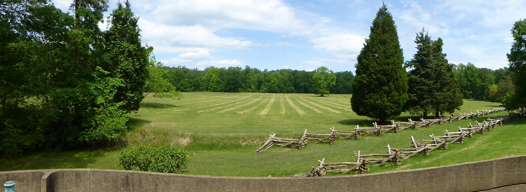 The Surrender Road and Field Today

The surrender road led from the British fortifications to the field shown in the above photo. Most of this route is now paved highway but the portion in from to the surrender field is still a dirt road as it was in 1781. The total distance from the British fortification to the surrender field is just a mile and a quarter.
Surrender Field
Surrender Pavilion
-
 Captured British Mortar at the Surrender Pavilion
 -
 Capture Cannons on the Lower Level of the Surrender Pavilion
 -
 Yorktown Surrender Pavilion


Context
{Location:
Yorktown, York County, Virginia
Lat: 37.209° Long: -76.505°
Bing, Google,
OldMapsOnline,
USGS, OHM
Sources:
- Roberts, Robert B., Encyclopedia of Historic Forts: The Military, Pioneer, and Trading Posts of the United States, Macmillan, New York, 1988, 10th printing, ISBN 0-02-926880-X, page 827
Links:
- North American Forts - Yorktown Battlefield
- Wikipedia - Siege of Yorktown
- NPS - History of the Siege
Related:
Yorktown Revolutionary War Battleground, George Washington,