File:Packwood Ferry Locale 1853.png
Jump to navigation
Jump to search

Size of this preview: 800 × 572 pixels. Other resolution: 1,385 × 991 pixels.
Original file (1,385 × 991 pixels, file size: 2.73 MB, MIME type: image/png)
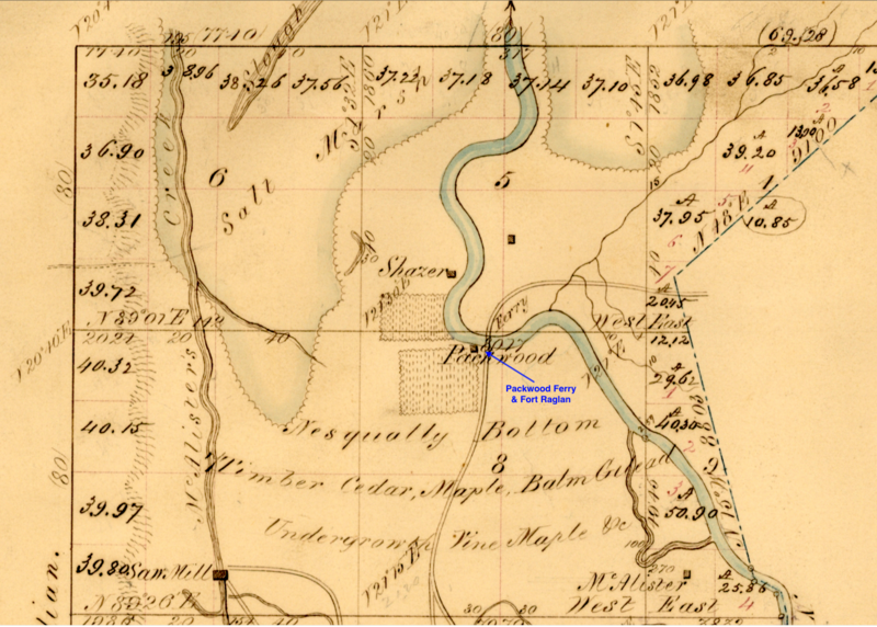
Packwood Ferry Locale from 1853 Department of the Interior Survey Map of the Nisqually River Fort Raglan Area, public domain, provided by Trent Crawford 22 May 2019
File history
Click on a date/time to view the file as it appeared at that time.
| Date/Time | Thumbnail | Dimensions | User | Comment | |
|---|---|---|---|---|---|
| current | 07:15, 23 May 2019 | | 1,385 × 991 (2.73 MB) | John Stanton (talk | contribs) | Packwood Ferry Locale from 1853 Department of the Interior Survey Map of the Nisqually River Fort Raglan Area, public domain |
You cannot overwrite this file.
File usage
The following page uses this file: