File:North Head SCR-296A Radar Site Plan.jpg
Jump to navigation
Jump to search

Size of this preview: 724 × 600 pixels. Other resolution: 939 × 778 pixels.
Original file (939 × 778 pixels, file size: 154 KB, MIME type: image/jpeg)
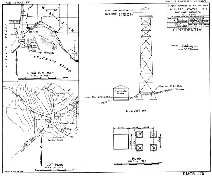
North Head SCR-296A Radar Site Plan, public domain from NARA through CDSG.
File history
Click on a date/time to view the file as it appeared at that time.
| Date/Time | Thumbnail | Dimensions | User | Comment | |
|---|---|---|---|---|---|
| current | 07:17, 22 May 2017 | | 939 × 778 (154 KB) | John Stanton (talk | contribs) | North Head SCR-296A Radar Site Plan, public domain from NARA through CDSG. |
You cannot overwrite this file.
File usage
The following page uses this file: